Situation Summary
Tonga remains a low-threat environment globally (rank #191, composite score 2) with no discrete security incidents recorded in the current monitoring window. No new acute security, crime, civil unrest, political instability, infrastructure failure, or travel-risk events have been confirmed in the last 24–48 hours across regional and open-source channels. The security posture remains stable, though underlying exposure to natural hazards (cyclones, tsunamis) and maritime-regional developments warrant continued baseline awareness.
Key Developments
No location-specific security incidents in Tonga on 15–16 August 2026 have been confirmed. The absence of reported events across conflict, crime, civil unrest, political instability, and infrastructure channels indicates no acute deterioration in the last 24–48 hours.
*Note: Regional context (e.g., SLBM activity in Pacific waters earlier in August) and governance modernization in Tonga (14 August) fall outside the 24–48 hour window and do not constitute current developments.*
Highest-Risk Areas
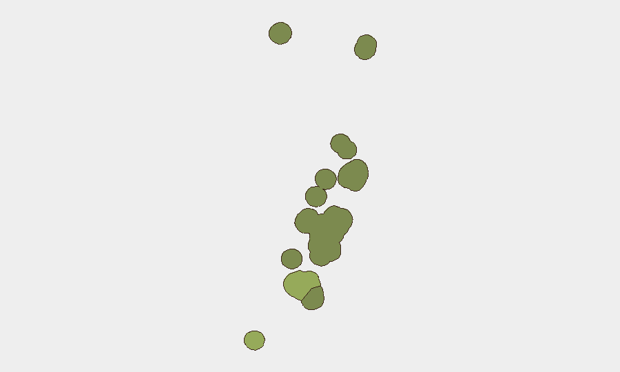
Tongatapu (risk score 45) is the dominant risk driver, reflecting its status as the capital region, seat of government, and hub for population density, commerce, and infrastructure concentration. Vavaʻu (28) and Haʻapai (22) follow, though at substantially lower absolute risk levels. The disparity is consistent with typical centralized governance and economic structures in small island states; secondary island groups present lower transaction frequency and fewer asset/personnel concentrations. Risk scores reflect composite exposure to crime, governance, disaster (especially cyclone and tsunami), and maritime factors rather than acute conflict or unrest.
How GeoBit Would Assist
Intel Sweep (global event feeds, multi-language OSINT, entity extraction) and AOI Monitoring & Early Warning (persistent area-of-interest watch with alerting) are the primary operational tools for continuous baseline surveillance of Tonga and its sub-regions, with automated flagging of emerging incidents in security, crime, civil unrest, and infrastructure domains. Risk & Threat Assessment and Environmental & Health capabilities support forward-looking exposure modeling for natural hazards (cyclones, tsunami) and infrastructure criticality, allowing security teams to pre-position mitigation for people and assets in Tongatapu and outer island operations. Maritime & Aviation tracking and GIS & Spatial Analysis enable real-time route optimization and situational awareness for personnel movement and supply logistics in the inter-island environment.
7-Day Outlook
No acute security deterioration is anticipated in the immediate term. Baseline monitoring for natural-hazard seasonal risk (cyclone season in the South Pacific typically peaks December–February, currently out of season) and routine crime/governance indicators should remain active. Any spike in regional maritime tensions, political statements, or infrastructure disruption would warrant rapid escalation.
RECOMMENDATION: Activate standing GeoBit AOI Monitoring on Tongatapu and Vavaʻu with alerting thresholds set for security, crime, and infrastructure events. Request a baseline Risk & Threat Assessment brief covering natural-hazard exposure and cyclone/tsunami contingency routing for personnel and supply chains across the island group.
Highest-Risk Areas — Ranked
| # | State / Region | Risk |
|---|---|---|
| 1 | Tongatapu | 45 |
| 2 | Vavaʻu | 28 |
| 3 | Haʻapai | 22 |
| 4 | ʻEua | 18 |
| 5 | Ongo Niua | 12 |
Sources
Previous Daily Briefs
A new Tonga brief is written every day — each with its own risk map and downloadable CSV. Here's the last week; use the calendar to go further back.
- August 13, 2026
- August 11, 2026
- August 9, 2026
- August 7, 2026
- August 5, 2026
- August 4, 2026
- August 3, 2026
📅 Browse every day by calendar →
Highlighted days have a brief. Tap a day for that day's map & analysis, or “csv” for that day's dataset ($5).
Atlas — our AI intelligence desk — emails them this snapshot personally. Nothing else, no list.