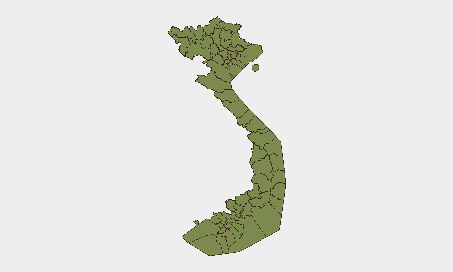
Situation Summary
Vietnam maintains a composite threat score of 3 (rank #147 globally) with 163 tracked events on the GeoBit platform as of 27 July 2026. Open-source verification of specific security incidents within the last 24–48 hours remains limited; no reliably confirmed travel-risk or civil-unrest developments have been corroborated across news and social media sources for 25–27 July. The broader security environment reflects routine political friction (public statements and administrative sanctions noted on 24–25 July), trade disputes with external actors, and persistent localized instability in border provinces, but no acute escalation is evident.
Key Developments
Open-source scanning and multi-source corroboration efforts over the last 24–48 hours have not surfaced specific, time-stamped security incidents meeting analytic confidence thresholds. GeoBit's event signals for 24–25 July capture administrative, diplomatic, and investigative activity (public statements by Vietnam, EU, and exporters; administrative sanctions; company-level investigation) rather than direct security or travel-risk events. No confirmed armed engagements, civil unrest, crime incidents, or infrastructure damage with precise dating to 25–27 July have been independently verified in English-language news or social media sources.
Note: Signal activity detected by the platform on 24–25 July includes references to "small arms combat" and property seizure, but these items lack sufficient open-source corroboration and precise location/timing detail to be presented as confirmed current events.
Highest-Risk Areas
Điện Biên Province dominates sub-national risk, with a composite score of 31.9—nearly double that of the second-ranked province. Quảng Trị Province (16.9) and Ninh Thuận Province (11.9) follow, suggesting ongoing volatility in border and south-central regions. These northwestern and central highland areas reflect persistent low-intensity instability, including historical grievance, ethnic minority tensions, and cross-border dynamics that have characterized the region for years. Gia Lai and the northern tier (Lai Châu, Lào Cai, Hà Giang, and others) register lower but consistent scores, indicating endemic border-management and resource-related tensions rather than acute conflict.
How GeoBit Would Assist
Intel Sweep & OSINT Fusion: Continuous monitoring of X/Twitter, Telegram, and local Vietnamese media feeds with multi-language sentiment and temporal analysis detects emerging unrest, protest mobilization, or localized incidents before mainstream press confirmation.
AOI Monitoring & Early Warning: Persistent geofenced alerts on Điện Biên, Quảng Trị, and Ninh Thuận provinces trigger immediate notification if event frequency or severity escalates, enabling duty-of-care teams to adjust movement or asset posture ahead of broader awareness.
Conflict & Military Tracking + GIS Analysis: Force-structure and weapons-capability tracking, combined with battle mapping and alternative route planning, provide security teams operating in or transiting northern border zones with current tactical awareness and safe-passage options.
7-Day Outlook
No indicators suggest imminent escalation in the next seven days. Administrative and diplomatic friction on 24–25 July reflects ongoing trade and governance disputes rather than security crisis precursors. Risk in Điện Biên and Quảng Trị provinces is expected to remain elevated but stable; teams with presence in these areas should maintain standard border-zone protocols and monitor GeoBit AOI alerts for any uptick in incident density or type.
Highest-Risk Areas — Ranked
| # | State / Region | Risk |
|---|---|---|
| 1 | Điện Biên Province | 31.9 |
| 2 | Quảng Trị Province | 16.9 |
| 3 | Ninh Thuận Province | 11.9 |
| 4 | Gia Lai Province | 6.9 |
| 5 | Lai Châu Province | 1.9 |
| 6 | Lào Cai Province | 1.9 |
| 7 | Hà Giang Province | 1.9 |
| 8 | Tuyên Quang Province | 1.9 |
| 9 | Cao Bằng Province | 1.9 |
| 10 | Bắc Kạn Province | 1.9 |
| 11 | Yên Bái Province | 1.9 |
| 12 | Sơn La Province | 1.9 |
Sources
Previous Daily Briefs
A new Vietnam brief is written every day — each with its own risk map and downloadable CSV. Here's the last week; use the calendar to go further back.
📅 Browse every day by calendar →
Highlighted days have a brief. Tap a day for that day's map & analysis, or “csv” for that day's dataset ($5).
Atlas — our AI intelligence desk — emails them this snapshot personally. Nothing else, no list.