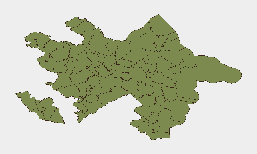
Situation Summary
Azerbaijan faces elevated but moderate composite security risk (rank #105 globally; score 9/100) with acute concentration in Ujar District and Baku City. The past 48 hours have seen a maritime incident involving an Azerbaijan-flagged merchant vessel, signaling potential extension of regional instability into commercial shipping lanes. Diplomatic friction with multiple neighbors (France, Turkey, Israel-Armenia context) and ongoing international investigation activity compound the operating environment, though no nationwide state-level collapse or mass-casualty domestic violence is evident.
Key Developments
- Off Odesa coast / Atlas Bey merchant vessel – 2026-07-16 to 2026-07-17: Azerbaijan-flagged cargo ship struck by drone attack; 10 crew members evacuated; captain's body recovered. Azerbaijan Foreign Ministry issued maritime security alert. Direct attribution and operational context not yet confirmed.
- Baku / Foreign Ministry response – 2026-07-16 to 2026-07-17: Maritime security posture elevated following Atlas Bey incident; search-and-rescue operation conducted; reputational and operational exposure to shipping operators noted.
- International diplomatic friction – 2026-07-15: France signaled reduced diplomatic relations; Turkey issued dual disapproval statements; Israeli rejection of Armenian positions (indirect Azerbaijan relevance); Russian and Chinese public statements on Azerbaijan-related issues. No imminent state-to-state military escalation signaled, but regional alignment stress evident.
- Arrest/detention activity – 2026-07-15: Prison system detained individual(s) on unspecified charges; details sparse and verification pending.
- Odessa investigation – 2026-07-15: Formal investigation activity initiated by Odessa authorities regarding Azerbaijan-linked subject or incident; status and jurisdiction unclear.
Highest-Risk Areas
Ujar District (risk 31.8) and Baku City (risk 27.5) together account for over 59 composite risk points—more than 80% of national tracked threat mass. Ujar's spike likely reflects border proximity, historical tension, and cross-border militia/smuggling activity. Baku's risk reflects capital concentration (population, infrastructure, diplomatic missions, international commerce, aviation hub) and greater event reporting density. Shusha District (4.0) shows residual tension, while remaining eleven regions remain below 2.0 and are operationally low-concern for most corporate asset classes.
How GeoBit Would Assist
Intel Sweep and multi-language OSINT (X/Twitter, Telegram, local news outlets) enable 24–48-hour early warning of maritime incidents, arrest/detention patterns, and diplomatic posture shifts before they reach corporate risk channels. Maritime & Aviation tracking with GIS & Spatial Analysis allows duty-of-care teams to monitor shipping routes around Azerbaijan, track vessel movements in contested waters, and route alternatives for supply chains. AOI Monitoring & Early Warning with persistent watch on Ujar, Baku, and border regions provides real-time alerting when event density or actor movement accelerates, allowing proactive staff or asset relocation before mass-casualty or mass-displacement scenarios emerge.
7-Day Outlook
Maritime insecurity and search-and-rescue operations will likely dominate near-term reporting; further drone strikes on commercial shipping cannot be ruled out pending attribution of Atlas Bey attack. Diplomatic statements are expected to persist but do not yet signal imminent conventional military escalation. Baku and Ujar remain the priority zones for continuous monitoring; no nationwide curfew, border closure, or travel ban is anticipated in the next 7 days unless international incident escalates sharply.
Highest-Risk Areas — Ranked
| # | State / Region | Risk |
|---|---|---|
| 1 | Ujar District | 31.8 |
| 2 | Baku City | 27.5 |
| 3 | Shusha District | 4 |
| 4 | Sadarak District | 1.8 |
| 5 | Qazakh District | 1.8 |
| 6 | Sharur District | 1.8 |
| 7 | Yevlakh District | 1.8 |
| 8 | Kangarli District | 1.8 |
| 9 | Nakhchivan Autonomous Republic | 1.8 |
| 10 | Aghstafa District | 1.8 |
| 11 | Tovuz District | 1.8 |
| 12 | Qakh District | 1.8 |
Previous Daily Briefs
A new Azerbaijan brief is written every day — each with its own risk map and downloadable CSV. Here's the last week; use the calendar to go further back.
📅 Browse every day by calendar →
Highlighted days have a brief. Tap a day for that day's map & analysis, or “csv” for that day's dataset ($5).
Atlas — our AI intelligence desk — emails them this snapshot personally. Nothing else, no list.