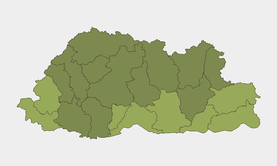
Situation Summary
Bhutan maintains a stable security environment with no verified incidents reported in the last 24–48 hours. The country's composite threat score of 2 reflects consistent low-risk conditions across most districts, with routine governance and economic activity proceeding without disruption. No civil unrest, political instability, infrastructure failures, or travel impediments have been documented in the current reporting window.
Key Developments
No discrete security, civil unrest, crime, political, or infrastructure incidents meeting verification and recency criteria have been identified in Bhutan for the 24–48 hour period ending 2026-08-06. State media (BBS), independent outlets (Daily Bhutan, Bhutan Post), and official government sources (RGOB Ministry of Foreign Affairs and Finance) contain no emergency advisories, new travel restrictions, or incident alerts. Regional news wires and open-source security trackers carry no reports of active unrest or security events in Bhutanese territory or affecting Bhutanese nationals in the current window.
Highest-Risk Areas
Samtse, Sarpang, and Haa districts rank significantly above the national average, with composite risk scores of 58, 55, and 52 respectively—more than double the low baseline. These southwestern and western border districts likely reflect persistent cross-border security considerations, irregular migration, or smuggling activity patterns documented in earlier months (June 2026 and prior). Samdrup Jongkhar, Tsirang, and Zhemgang districts (scores 48–45) occupy the mid-risk tier, while central and northern districts including Lhuntse, Gasa, and Wangdue Phodrang (scores 35–30) remain substantially lower-risk. Corporate and duty-of-care teams should apply heightened baseline precautions in the southern border zone, though no acute escalation is evident in the current 24–48 hour period.
How GeoBit Would Assist
Security teams operating in or supporting staff in Bhutan should deploy AOI Monitoring & Early Warning on Samtse and Sarpang districts to track emerging cross-border activity or irregular movement patterns with automated alerting. Intel Sweep and multi-language OSINT fusion (including BBS, local outlets, and social monitoring) provide continuous low-cost baseline situational awareness, catching any emerging incidents within 24–48 hours of first reporting. Routing & Network Analysis enables identification of alternative travel corridors and safe passage planning should localized incidents arise in high-risk districts.
7-Day Outlook
No acute escalation is anticipated over the next seven days. Bhutan's stable governance, consistent media transparency, and absence of triggering events suggest the low-threat baseline will persist. Teams should maintain standard duty-of-care protocols and subscribe to automated monitoring of the highest-risk districts to detect any early warning signals, though the probability of major incident emergence remains low.
Highest-Risk Areas — Ranked
| # | State / Region | Risk |
|---|---|---|
| 1 | Samtse District | 58 |
| 2 | Sarpang District | 55 |
| 3 | Haa District | 52 |
| 4 | Pemagatshel District | 50 |
| 5 | Samdrup Jongkhar District | 48 |
| 6 | Tsirang District | 45 |
| 7 | Zhemgang District | 42 |
| 8 | Trashigang District | 40 |
| 9 | Mongar District | 38 |
| 10 | Gasa District | 35 |
| 11 | Lhuntse District | 32 |
| 12 | Wangdue Phodrang District | 30 |
Sources
Previous Daily Briefs
A new Bhutan brief is written every day — each with its own risk map and downloadable CSV. Here's the last week; use the calendar to go further back.
📅 Browse every day by calendar →
Highlighted days have a brief. Tap a day for that day's map & analysis, or “csv” for that day's dataset ($5).
Atlas — our AI intelligence desk — emails them this snapshot personally. Nothing else, no list.