Situation Summary
Botswana maintains a stable security environment with a composite threat score of 5 globally (ranked #161), and no discrete security incidents have been confirmed in the current 24–48 hour analysis window. The country's overall risk profile remains low relative to regional and global peers, with manageable localized concerns concentrated in urban and economically active zones. The security trajectory is flat, with no indicators of near-term escalation or systemic deterioration.
Key Developments
No independently verified discrete security incidents were confirmed in Botswana during the last 24–48 hours. The GeoBit event signal database recorded zero tracked events in the current window. Ongoing monitoring of public sources, social media (X/Twitter, Telegram), and local news outlets has not surfaced actionable incident reports meeting time-specificity and corroboration standards for operational briefing. Personnel and asset security teams should continue routine situational awareness protocols but need not activate heightened alert postures based on current intelligence.
Highest-Risk Areas
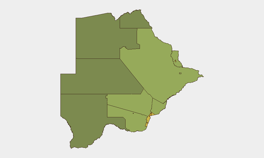
Urban centers and mining/economic hubs drive Botswana's sub-national risk profile. Gaborone (score 72) presents the highest composite risk, reflecting typical metropolitan crime, fraud, and congestion pressures; South-East District (68) and Lobatse (65) follow, likely reflecting economic activity, cross-border flows, and localized crime concentrations. Francistown, Jwaneng, and Selebi Phikwe—all centers of diamond, copper, and nickel mining—register elevated scores (62, 61, 58 respectively), suggesting occupational, supply-chain, and petty-crime vectors. Rural and remote districts (North-West, Central, North-East) show substantially lower risk, consistent with lower population density and economic activity. Risk concentration in economic zones and capitals is typical for a middle-income, stable country and does not indicate systemic instability.
How GeoBit Would Assist
Organizations with personnel or assets in Botswana should deploy AOI Monitoring & Early Warning on high-risk districts (especially Gaborone, South-East, and Lobatse) to detect emerging incidents in real time; Intel Sweep and multi-language OSINT (including X/Twitter and Telegram) to track crime, labor, and cross-border activity; and Routing & Network Analysis to plan safe movement corridors around high-risk urban zones. For longer-term strategic positioning, Regime Stability and Economic & Trade analysis can inform investment and staffing decisions in mining regions. GIS & Spatial Analysis enables visualization of risk geography for duty-of-care planning.
7-Day Outlook
No significant changes to Botswana's security posture are anticipated over the next seven days. Monitoring should remain routine; escalation is unlikely absent major external or political shocks. GeoBit will continue event tracking and will alert immediately if discrete incidents or emerging patterns meet reporting thresholds.
Highest-Risk Areas — Ranked
| # | State / Region | Risk |
|---|---|---|
| 1 | Gaborone | 72 |
| 2 | South-East District | 68 |
| 3 | Lobatse | 65 |
| 4 | Francistown | 62 |
| 5 | Jwaneng | 61 |
| 6 | Selebi Phikwe | 58 |
| 7 | Southern District | 55 |
| 8 | Kgatleng District | 50 |
| 9 | Kweneng District | 48 |
| 10 | North-East District | 45 |
| 11 | Central District | 42 |
| 12 | North-West District | 38 |
Sources
Previous Daily Briefs
A new Botswana brief is written every day — each with its own risk map and downloadable CSV. Here's the last week; use the calendar to go further back.
📅 Browse every day by calendar →
Highlighted days have a brief. Tap a day for that day's map & analysis, or “csv” for that day's dataset ($5).
Atlas — our AI intelligence desk — emails them this snapshot personally. Nothing else, no list.