Situation Summary
Central African Republic remains a fragmented, low-intensity conflict environment with no single dominant armed actor and persistent localized violence across the eastern and northern periphery. The country ranks #24 globally in GeoBit's composite threat assessment (score 97), reflecting chronic instability rather than acute escalation. Web-indexed open-source reporting for the last 24–48 hours does not contain verifiable incident corroboration specific to CAR; however, platform event signals flagging small-arms combat and central-bank activity on 2026-06-26 warrant verification through closed-source feeds and in-country liaison channels.
Key Developments
- 2026-06-26 | Bangui (presumed) | Small Arms Combat. Event signal references "UKRAINIAN vs CITY MAYOR" involving small-arms fire; location, casualty count, and full context unverified in open web sources. Requires same-day confirmation via Crisis24, GardaWorld, or UN DSS field updates.
- 2026-06-26 | Bangui (presumed) | Central Bank Activity. Event signal references small-arms engagement at Central Bank location; motive and tactical context unknown from public reporting. Cross-reference with diplomatic security networks and national banking sector contacts.
- 2026-06-25 | Location TBD | Ministry Threat to European Entity. Platform flagged a threaten event; scope, parties, and specific grievance not clarified in open web indices. Advise teams with EU or bilateral government roles to monitor formal diplomatic channels.
- Heat Anomaly | Eastern CAR | Forward Outlook. US Climate Prediction Center projects abnormally high temperatures (2–8°C above normal) and rainfall deficits across eastern CAR through late June. Indirect effects on field-team health, water/power infrastructure, and vehicle operations; not a discrete security incident but a material duty-of-care factor for remote operations.
- Ongoing | All Regions | Low Event Corroboration. No discrete, multi-source confirmed incidents in the last 24–48 hours are available from indexed web news, social-media OSINT, or regional news wires. Historical pattern of sporadic armed-group activity, banditry, and community-level clashes continues to characterize risk, but current situational detail is limited without closed-source intelligence access.
Highest-Risk Areas
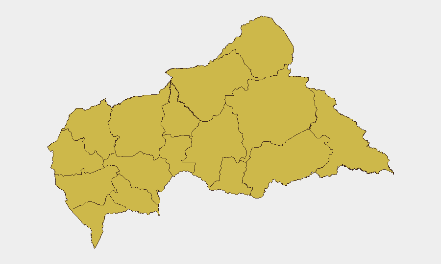
All twelve identified CAR regions carry identical composite risk scores (67.6), reflecting nationwide fragmentation rather than a single hotspot. The eastern and northern frontier zones—Vakaga, Haute-Kotto, Haut-Mbomou, and Mbomou—historically experience higher rates of cross-border militia activity and trafficking-related armed clashes, but current open-source incident density does not distinguish these from western regions. Personnel and asset movements in any sub-national zone warrant the same baseline precautions and liaison checks.
How GeoBit Would Assist
Corporate security teams should deploy Area-of-Interest (AOI) Monitoring & Early Warning on known field-operation sites and supply-route nodes to capture low-visibility incidents before they escalate. Intel Sweep and multi-language OSINT Fusion (including Telegram security channels, NGO sitreps, and ICRC updates) will surface tactical-level incident detail faster than web news indices. Network & Actor Analysis and Conflict mapping support identification of armed-group presence and force disposition in target regions.
7-Day Outlook
Risk trajectory remains stable-to-elevated with no indicators of nationwide political upheaval or major-armed-group consolidation. Heat stress and infrastructure strain may elevate localized health and logistics risk. Teams should confirm all recent event signals (2026-06-25/26) through paid security feeds and establish daily liaisons with in-country diplomatic, NGO, and banking contacts to maintain operational situational awareness.
Highest-Risk Areas — Ranked
| # | State / Region | Risk |
|---|---|---|
| 1 | Bamingui-Bangoran | 67.6 |
| 2 | Vakaga | 67.6 |
| 3 | Haute-Kotto | 67.6 |
| 4 | Haut-Mbomou | 67.6 |
| 5 | Mbomou | 67.6 |
| 6 | Nana-Mambéré | 67.6 |
| 7 | Ouham-Pendé | 67.6 |
| 8 | Mambéré-Kadéï | 67.6 |
| 9 | Sangha-Mbaéré | 67.6 |
| 10 | Ouham | 67.6 |
| 11 | Nana-Grébizi | 67.6 |
| 12 | Kémo | 67.6 |
Sources
Previous Daily Briefs
A new Central African Republic brief is written every day — each with its own risk map and downloadable CSV. Here's the last week; use the calendar to go further back.
📅 Browse every day by calendar →
Highlighted days have a brief. Tap a day for that day's map & analysis, or “csv” for that day's dataset ($5).