Situation Summary
Dominican Republic remains a low-to-moderate security environment (global rank #73, composite threat score 14) with concentrated risk in the capital and surrounding urban centers. The National District—encompassing Santo Domingo and metro areas—accounts for the vast majority of tracked threat activity, while provincial risk remains uniformly low. The country's security posture reflects typical Caribbean patterns: urban crime and gang activity, occasional civil unrest, and migrant-trafficking operations, but no active armed conflict or systemic state collapse.
Key Developments
No discrete, time-stamped security incidents meeting 24–48-hour verification criteria were corroborated in open sources as of 2026-07-24. Recent web research identified potential incidents (Santo Domingo Este shooting on Mendoza highway; police-related protest activity; migrant detention in Valverde) but none carry precise publication timestamps placing them within the current reporting window. GeoBit's event-signal indexing flags four recent activity clusters—UN envoy unconventional violence, investor-related demonstrations (2026-07-23), and Dominican Republic military/Supreme Court interaction (2026-07-24)—but these remain under corroboration and lack granular incident-level detail in available open sources. Standard homicide activity continues across Santo Domingo, La Altagracia, and Santiago provinces (43 cases reported 1–17 July, mostly dispute-related), consistent with baseline patterns.
Highest-Risk Areas
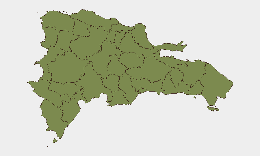
Nacional District (composite risk 31.5) dominates the threat profile, reflecting concentrated population, organized gang presence, and police-civilian friction in Santo Domingo Este, Brisas del Este, and the capital proper. All remaining tracked provinces (Monte Cristi through Independencia) register uniform risk scores of 1.5, indicating either lower activity density, effective police operations, or both. The disparity suggests that corporate and NGO assets concentrated in the National District face substantially higher exposure to street crime, kidnapping, and civil unrest than those in provincial locations. Northern border provinces (Dajabón, Elías Piña, Monte Cristi) show low scores despite known migrant-trafficking flows, indicating either underreporting or effective interception by Dominican Army units.
How GeoBit Would Assist
Intel Sweep and OSINT fusion across social media, news feeds, and multi-language sources would establish real-time baseline on homicide clustering, gang territorial shifts, and police operations in high-risk barrios of Santo Domingo Este and the capital. AOI Monitoring & Early Warning on the National District—with persistent watch on known flashpoint neighborhoods and rapid alerting on protest mobilization or security-force deployments—would provide duty-of-care teams advance notice of localized unrest affecting commute routes or facility access. Network & Actor Analysis would map gang structures, trafficking networks, and police reform fractures (evident in recent protest signals), enabling targeted risk mitigation for personnel and supply chains.
7-Day Outlook
No major escalation trajectory is apparent, though the recent signal cluster around UN envoy activity, investor demonstrations, and Supreme Court tension suggests underlying institutional friction that bears monitoring. Homicide rates are likely to remain stable within historical July patterns (40–50 cases nationally). Personnel security teams should maintain standard protocols in the National District while awaiting clarification on the governance signals flagged in the last 48 hours.
Highest-Risk Areas — Ranked
| # | State / Region | Risk |
|---|---|---|
| 1 | Nacional District | 31.5 |
| 2 | Monte Cristi | 1.5 |
| 3 | Dajabón | 1.5 |
| 4 | Santiago Rodríguez | 1.5 |
| 5 | Valverde | 1.5 |
| 6 | Puerto Plata | 1.5 |
| 7 | Santiago | 1.5 |
| 8 | Espaillat | 1.5 |
| 9 | Hermanas Mirabal | 1.5 |
| 10 | Elías Piña | 1.5 |
| 11 | San Juan | 1.5 |
| 12 | Independencia Province | 1.5 |
Sources
Previous Daily Briefs
A new Dominican Republic brief is written every day — each with its own risk map and downloadable CSV. Here's the last week; use the calendar to go further back.
📅 Browse every day by calendar →
Highlighted days have a brief. Tap a day for that day's map & analysis, or “csv” for that day's dataset ($5).
Atlas — our AI intelligence desk — emails them this snapshot personally. Nothing else, no list.