Situation Summary
DR Congo remains at composite threat rank #13 globally, driven primarily by active civil conflict and insurgency across eastern provinces. The past 48 hours have witnessed a significant acceleration of health and displacement crises overlaying persistent armed-group activity: a sharp spike in confirmed Ebola cases in Ituri, cross-border travel restrictions imposed by Uganda, and renewed fighting in North Kivu forcing mass displacement. Major urban centers including Kinshasa remain at baseline security posture, but eastern provinces continue to present acute and compounding risks to movement, humanitarian operations, and personnel safety.
Key Developments
- Bunia & Mambasa, Ituri Province (18–19 June 2026): WHO reported approximately 50 new confirmed Ebola cases (Bundibugyo strain) within two days, marking a sharp acceleration of the ongoing outbreak. Movement restrictions and road screening intensified across the region.
- Kasindi/Mpondwe border axis, Ituri–North Kivu–Uganda frontier (20–21 June 2026): Ugandan authorities suspended all DRC flights within 48 hours and reinforced border security patrols in response to the worsening Ebola situation, significantly disrupting cross-border transit and screening.
- Walikale & Masisi territories, North Kivu Province (20–21 June 2026): UN reporting confirmed recent fighting that displaced hundreds of families. Secondary road networks are now elevated-risk environments for ambush and banditry.
- Rwampara area, Ituri Province (within 48 hours prior to 20 June 2026): Local residents breached and disrupted an Ebola treatment facility, reflecting resistance to health measures and heightening operational risk for medical and NGO personnel in the field.
- Eastern provinces overall (18–19 June 2026): Armed-group presence and secondary-route banditry remain at baseline but persistent levels. No major new clashes independently verified in the last 48 hours, though road security risks persist.
- National posture (18–19 June 2026): Kinshasa and major urban centers show high but stable security conditions with no nationwide mass civil unrest. Authorities maintain heightened alert following earlier political activity and Ebola-response measures.
Highest-Risk Areas
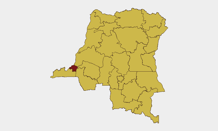
Kinshasa dominates the national sub-national ranking at 95.8, reflecting its role as the political and administrative center where tensions around governance and public-health measures concentrate. The second tier—Maniema, Sud-Ubangi, Équateur, Nord-Ubangi, and others at 65.8—comprises predominantly rural, remote provinces with weak state presence, active armed groups, and now acute disease-outbreak dynamics. Eastern provinces (Ituri, North Kivu, Tshopo, Lower Uele, Upper Uele) are concurrent hotspots for both insurgent activity and health emergency, creating compounded risk for overland travel and staff deployment. The 50-case Ebola surge and Uganda border restrictions have elevated operational friction across the eastern corridor.
How GeoBit Would Assist
Security and duty-of-care teams should employ AOI Monitoring & Early Warning on Ituri, North Kivu, and border zones to track Ebola-case clusters, displacement events, and armed-group movement in real time. Routing & Network Analysis capabilities enable identification of alternative supply and personnel-transit corridors avoiding both active conflict zones and Ebola-screening checkpoints. Conflict & Military battle mapping and OSINT fusion (X/Telegram, local news, humanitarian feeds) provide daily corroboration of armed-group positions and road-block activity to inform duty-of-care decisions on field-staff mobility.
7-Day Outlook
The Ebola outbreak and Uganda flight suspension are likely to persist or worsen over the next week, further restricting eastern-corridor movement and heightening screening delays at checkpoints. Armed-group activity in North Kivu and Ituri should remain at elevated but not dramatically escalating levels unless major clashes emerge. Kinshasa and western provinces are expected to sustain baseline security conditions, though contingency planning for rapid deterioration in response to health-emergency messaging or political friction remains prudent.
Highest-Risk Areas — Ranked
| # | State / Region | Risk |
|---|---|---|
| 1 | Kinshasa | 95.8 |
| 2 | Maniema | 65.8 |
| 3 | Sud-Ubangi | 65.8 |
| 4 | Équateur | 65.8 |
| 5 | Nord-Ubangi | 65.8 |
| 6 | Mongala | 65.8 |
| 7 | Lower Uele | 65.8 |
| 8 | Tshopo | 65.8 |
| 9 | Tshuapa | 65.8 |
| 10 | Upper Uele | 65.8 |
| 11 | Ituri | 65.8 |
| 12 | North Kivu | 65.8 |
Sources
Previous Daily Briefs
A new DR Congo brief is written every day — each with its own risk map and downloadable CSV. Here's the last week; use the calendar to go further back.
📅 Browse every day by calendar →
Highlighted days have a brief. Tap a day for that day's map & analysis, or “csv” for that day's dataset ($5).