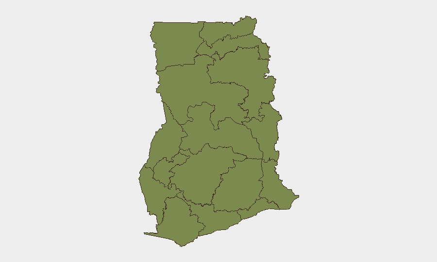
Situation Summary
Ghana faces a fragmented but elevated security environment marked by localized armed violence in the north, political tensions linked to vigilante-group concerns, and acute external risks from anti-migrant violence affecting Ghanaian nationals in South Africa. The national threat composite score of 7 (rank #115 globally) masks severe sub-national concentration: Bono East Region carries a risk score nearly five times the national average. The trajectory suggests sustained clan/communal conflict in border zones and heightened political vigilance ahead of election cycles, with secondary ripple effects from regional instability.
Key Developments
- Odomi, Nkwanta South Municipality, Oti Region (2026-07-08/09, breaking): Armed attackers killed three civilians and wounded nine in a direct assault on the community. Residents have escalated calls for curfew review, signaling ongoing insecurity despite existing restrictions and police presence.
- Nkwanta South Municipality, Oti Region (concurrent): Public demand for curfew revision reflects residents' assessment that current containment measures are insufficient to deter organized armed incursions, indicating either capability or intelligence gaps in local security response.
- Dome-Kwabenya, Greater Accra (2026-07-10, breaking): Ghana Police arrested six private security guards following a shooting incident at or near former MP Sarah Adwoa Safo's residence, raising questions about firearm discipline and political-security boundary violations in the capital.
- Accra – NPP Russia Branch statement (last 48h): The chairman publicly denied that the "Lions of NPP" constitutes a vigilante outfit, a reactive posture suggesting rising public concern about politically aligned informal security groups and election-violence risk.
- National level – Ghana/South Africa bilateral talks postponed (2026-07-09/10): Ghana's government announced postponement of next-month talks with South Africa, citing anti-migrant violence surge and repatriation of hundreds of Ghanaian nationals ahead of a hostile deadline. Foreign Affairs Minister Felix Kwakye Ofosu indicated Ghana is considering legal action against South Africa.
- National political sphere – external duty-of-care escalation: The South Africa migration crisis has elevated travel risk for Ghanaian nationals and framed a regional security concern that now influences high-level diplomatic scheduling, indicating government-level perception of acute external threat.
- Greater Accra Region – Ga Mantse statement (2026-07-09, Ghana Investment and Trade Week): Traditional authority calls for coordinated security and infrastructure planning to sustain the 24-hour economy programme, implying current operational constraints.
Highest-Risk Areas
Bono East Region (score 33.5) is the dominant driver of Ghana's overall threat profile, carrying risk nearly equivalent to all other regions combined and signaling either a sustained conflict hotspot, high criminal activity, or armed group presence. Volta Region (6.6) and Greater Accra (5.5) are secondary concern nodes; Volta likely reflects cross-border instability while Greater Accra signals political tensions and urban crime. The remaining ten regions cluster at 3.5–4.0, indicating distributed low-to-moderate risk rather than concentrated secondary theaters.
How GeoBit Would Assist
Duty-of-care teams should employ AOI Monitoring & Early Warning on Bono East, Oti, and Volta Regions to establish persistent watch for armed-group movement or attack precursors. Network & Actor Analysis and Intel Sweep (X/Telegram OSINT) capabilities enable identification of political vigilante groups and their operational intent signals ahead of announced incidents. Routing & Network Analysis supports real-time alternative-route planning for staff in high-risk zones and can flag travel corridors through Nkwanta South or border areas where curfew enforcement creates operational friction.
7-Day Outlook
Armed incidents in Oti and Bono East regions are likely to persist absent significant security-force redeployment or intelligence breakthroughs. Political vigilante rhetoric will remain elevated through the medium term given election-cycle proximity. External risk to Ghanaian nationals in South Africa will likely sustain government diplomatic escalation and travel advisories.
Highest-Risk Areas — Ranked
| # | State / Region | Risk |
|---|---|---|
| 1 | Bono East Region | 33.5 |
| 2 | Volta Region | 6.6 |
| 3 | Greater Accra Region | 5.5 |
| 4 | Upper East Region | 4 |
| 5 | Upper West Region | 3.5 |
| 6 | Savannah Region | 3.5 |
| 7 | North East Region | 3.5 |
| 8 | Northern Region | 3.5 |
| 9 | Eastern Region | 3.5 |
| 10 | Oti Region | 3.5 |
| 11 | Bono Region | 3.5 |
| 12 | Ahafo Region | 3.5 |
Sources
Previous Daily Briefs
A new Ghana brief is written every day — each with its own risk map and downloadable CSV. Here's the last week; use the calendar to go further back.
📅 Browse every day by calendar →
Highlighted days have a brief. Tap a day for that day's map & analysis, or “csv” for that day's dataset ($5).
Atlas — our AI intelligence desk — emails them this snapshot personally. Nothing else, no list.