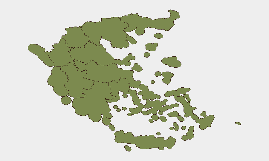
Situation Summary
Greece faces a mixed but fragmented threat landscape dominated by wildfire risk, petty-to-moderate crime against tourists, and isolated violence in urban centers. Central Greece is driving the national composite risk score (31.3) primarily through active wildfire and arson-negligence incidents; Attica (7.9) reflects Athens-area crime patterns including the 21 July stabbing near the Acropolis and ongoing transport safety concerns. Maritime security concerns have surfaced with four attacks on Greek-owned tankers in the Black Sea and Gulf of Oman within 48 hours, though crews remain safe. Overall risk trajectory is volatile but localized, with no indication of coordinated or systemic instability.
Key Developments
- Athens – Acropolis, 21 July 2026: A 60-year-old assailant stabbed two Greek-American tourists (ages 73 and 78) near the Acropolis Museum entrance; both sustained non-life-threatening injuries and the attacker was arrested on scene with a noted psychiatric history and criminal record.
- Central Greece – wildfire campaign, 19–21 July 2026: Hellenic Fire Service arrested 13 individuals over two days for arson and criminal negligence linked to wildfire outbreaks—a record rate—amid ongoing firefighting operations in Epidaurus (Argolis region) requiring six aerial assets.
- Piraeus Central Port (Attica), 20–21 July 2026: Counter-narcotics units arrested a 47-year-old Greek national and seized 26+ kg of cannabis in a maritime drug-trafficking interdiction.
- Black Sea and Gulf of Oman – international waters, 20–21 July 2026: Four Greek-owned oil/product tankers sustained damage in separate attack incidents; all seven Greek seafarers aboard reported safe, prompting reassessment of voyage security protocols for Greek-flagged vessels.
- Halkidiki (Northern Greece) – coastal beaches, 20–21 July 2026: Police arrested two men suspected of a pattern of vehicle break-ins targeting beachgoers and tourists, stealing cash and valuables.
- Samos Island, 20–21 July 2026: Two taxi drivers detained for overcharging passengers beyond legal tariff in ongoing enforcement operations spanning Athens, Lavrio, and island transport services.
- Central Athens – Panepistimio Street, reported 20–21 July (incident 17 July): A bus–trolleybus collision near Panepistimio metro station resulted in four minor injuries, underscoring recurrent urban transport safety issues.
Highest-Risk Areas
Central Greece dominates the risk profile (31.3) due to active wildfire/arson activity concentrated in the Peloponnese and surrounding agricultural zones. Attica (7.9) reflects crime concentration in and around Athens, driven by tourist-focused property crime, violent street incidents, and port-based trafficking operations. The remaining eight regions score below 2.7 and pose minimal corporate risk. Duty-of-care considerations should prioritize wildfire exposure in Central Greece and street crime/transport safety in the greater Athens metropolitan area.
How GeoBit Would Assist
GeoBit's AOI Monitoring & Early Warning capability enables persistent surveillance of Central Greece wildfire zones and Attica urban crime hotspots with automated alerting on new incidents. Intel Sweep and OSINT fusion (X/Twitter, local news feeds, port authority channels) provide 24-hour detection of maritime threats, transport accidents, and arrest patterns affecting foreign nationals. GIS & Spatial Analysis and Routing & Network Analysis allow security teams to model safe transit corridors in Athens, avoid high-risk beach areas, and plan alternative transport routes around fire-affected zones.
7-Day Outlook
Wildfire risk will remain elevated through late July given high ambient temperatures and ongoing arson/negligence arrests; expect continued Hellenic Fire Service operations in Central Greece and Peloponnese. Street crime in Athens and tourist-area thefts are endemic and unlikely to escalate sharply. Maritime risk for Greek-owned vessels in contested waters (Black Sea, Gulf of Oman) warrants continued voyage-security review but does not indicate a new regional threat.
Highest-Risk Areas — Ranked
| # | State / Region | Risk |
|---|---|---|
| 1 | Central Greece | 31.3 |
| 2 | Attica | 7.9 |
| 3 | Peloponnese Region | 5.2 |
| 4 | South Aegean | 2.6 |
| 5 | Eastern Macedonia and Thrace | 1.7 |
| 6 | Western Greece | 1.7 |
| 7 | Western Macedonia | 1.3 |
| 8 | Central Macedonia | 1.3 |
| 9 | Thessaly | 1.3 |
| 10 | Autonomous Monastic State of the Holy Mountain | 1.3 |
| 11 | Northern Aegean | 1.3 |
| 12 | Crete | 1.3 |
Sources
Previous Daily Briefs
A new Greece brief is written every day — each with its own risk map and downloadable CSV. Here's the last week; use the calendar to go further back.
📅 Browse every day by calendar →
Highlighted days have a brief. Tap a day for that day's map & analysis, or “csv” for that day's dataset ($5).
Atlas — our AI intelligence desk — emails them this snapshot personally. Nothing else, no list.