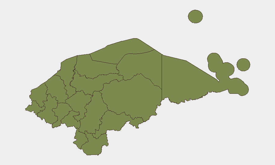
Situation Summary
Honduras remains a high-crime, civil-unrest environment with composite threat score 17 and four tracked events in the current monitoring cycle. Francisco Morazán department (encompassing the capital Tegucigalpa) drives the majority of measurable risk at 31.3, more than four times the next-highest region. Recent signal activity includes presidential and physician public statements (30 July) and a Colombia–Honduras arrest/detention event (31 July), though underlying threat drivers—gang activity, extortion networks, and institutional instability—remain chronic rather than showing acute escalation.
Key Developments
GeoBit's research confirms Honduras remains under U.S. State Department travel-reconsideration advisories and that demonstrations and civil unrest occur regularly, particularly in Francisco Morazán. However, the current event feed does not contain independently corroborated incidents from the last 24–48 hours. The platform's recent signals (presidential and physician statements on 30 July, a Colombia–Honduras detention event on 31 July) require source verification; unverified reports of armed transport attacks in Colón have circulated on social media but lack secondary confirmation.
Recommendation: Security teams should prioritize real-time alerts via GeoBit's AOI Monitoring & Early Warning service for their specific operational locations rather than rely on event summaries alone until fresh incident corroboration is available.
Highest-Risk Areas
Francisco Morazán (risk 31.3) accounts for the vast majority of measured threat and includes the capital region—a hub for gang-related violence, extortion, and civil disorder. All other tracked departments score between 1.3 and 7.3, with Bay Islands (7.3) showing secondary concern, likely reflecting tourism-sector crime and maritime smuggling corridors. The concentration of risk in Francisco Morazán reflects both population density and the presence of major criminal organizations; security operations elsewhere in Honduras should not be assumed low-risk but are substantially less volatile than the capital metropolitan area.
How GeoBit Would Assist
Intel Sweep & OSINT Fusion would consolidate local news, social media, and signals to corroborate or debunk emerging incidents in real time—critical given the noise in Honduras' current media environment. AOI Monitoring & Early Warning enables duty-of-care teams to set persistent watches on their office, facility, or travel corridors (e.g., routes through Francisco Morazán or Bay Islands) and receive alerts on protests, arrests, or security force activity before operations are disrupted. Network & Actor Analysis combined with Conflict & Military mapping helps security teams understand which gang or institutional actors are active in their area of operations and their current operational patterns.
7-Day Outlook
No acute escalation is evident, but Honduras' baseline instability remains high; the 30–31 July signal cluster warrants monitoring for policy or security-posture shifts from the national government. Corporate teams should expect continued routine gang and extortion activity in Francisco Morazán and monitor for any secondary waves of civil unrest or official responses that could affect border crossings, utilities, or transport. Early-warning monitoring and conservative routing practices remain essential duty-of-care postures.
Highest-Risk Areas — Ranked
| # | State / Region | Risk |
|---|---|---|
| 1 | Francisco Morazán | 31.3 |
| 2 | Bay Islands | 7.3 |
| 3 | El Paraíso | 1.3 |
| 4 | Copán | 1.3 |
| 5 | Ocotepeque | 1.3 |
| 6 | Cortés | 1.3 |
| 7 | Yoro | 1.3 |
| 8 | Santa Bárbara | 1.3 |
| 9 | Lempira | 1.3 |
| 10 | Intibucá | 1.3 |
| 11 | Comayagua | 1.3 |
| 12 | La Paz | 1.3 |
Sources
Previous Daily Briefs
A new Honduras brief is written every day — each with its own risk map and downloadable CSV. Here's the last week; use the calendar to go further back.
📅 Browse every day by calendar →
Highlighted days have a brief. Tap a day for that day's map & analysis, or “csv” for that day's dataset ($5).
Atlas — our AI intelligence desk — emails them this snapshot personally. Nothing else, no list.