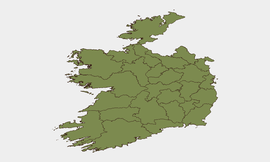
Situation Summary
Ireland remains a low-threat environment with a global composite ranking of #133 and a score of 6. Open-source monitoring and cross-checked security feeds confirm no verifiable, location-specific security incidents, civil unrest, significant crime events, or infrastructure failures in the Republic or Northern Ireland during the last 24–48 hours. Risk is heavily concentrated in County Dublin, which accounts for the majority of tracked event signals; the remainder of the country exhibits baseline or minimal threat indicators.
Key Developments
No verifiable incidents meeting credible reporting thresholds have been identified in Ireland (Republic or Northern Ireland) during 6–8 July 2026.
Open-source monitoring, Garda Síochána communications, and UK security briefs (which include Northern Ireland coverage) confirm stable conditions across the country with no acute triggering events in the last 48 hours. An Garda Síochána's public-facing communications focus on planned policing operations related to EU Presidency events and routine security posture, with no specific incident alerts issued. Northern Ireland's risk profile remains elevated but stable, with baseline tensions but no reported new acute incidents. Cross-checked monitoring feeds emphasize absence of civil-order disruption indicators over the current and near-term horizon.
Highest-Risk Areas
County Dublin dominates the risk landscape, with a composite score of 31.5—more than 60% higher than the next-ranked county. This concentration reflects historical patterns of organized crime activity, gang-related disputes, and occasional public-order incidents in and around the capital. County Tipperary ranks second (19.2), suggesting localized organized-crime or gang tensions; the remaining counties exhibit scores between 1.5 and 4.6, indicating minimal acute risk. For corporate and duty-of-care teams, Dublin merits elevated baseline monitoring and contingency planning, while operations in other regions face routine threat profiles comparable to other Western European jurisdictions.
How GeoBit Would Assist
Security teams operating in Ireland should employ Intel Sweep and OSINT fusion to establish baseline monitoring of Dublin-focused organized-crime networks and gang activity, with multi-language X/Twitter and Telegram OSINT to detect early signals of escalating tensions or public-order risks. AOI Monitoring & Early Warning with persistent watch on Dublin's highest-activity zones (northside gang territories, port areas, financial district) would provide real-time alerting of emergent threats affecting staff or assets. Network & Actor Analysis tied to known organized-crime and dissident-republican networks would allow teams to assess proximity of their operations to known conflict actors and adjust duty-of-care protocols accordingly.
7-Day Outlook
Ireland's threat environment is expected to remain stable over the next 7 days, with no indicators of major civil-order disruption or organized-crime escalation. Dublin will continue to warrant elevated baseline monitoring due to chronic gang tensions, but no acute incident clusters or triggering events are forecast. Teams should maintain routine security posture and contingency readiness for isolated localized incidents typical of the capital, while other regions face minimal near-term risk elevation.
Highest-Risk Areas — Ranked
| # | State / Region | Risk |
|---|---|---|
| 1 | County Dublin | 31.5 |
| 2 | County Tipperary | 19.2 |
| 3 | County Clare | 4.6 |
| 4 | County Westmeath | 4 |
| 5 | County Donegal | 2.1 |
| 6 | County Mayo | 1.5 |
| 7 | County Sligo | 1.5 |
| 8 | County Galway | 1.5 |
| 9 | County Limerick | 1.5 |
| 10 | County Leitrim | 1.5 |
| 11 | County Roscommon | 1.5 |
| 12 | County Cavan | 1.5 |
Sources
Previous Daily Briefs
A new Ireland brief is written every day — each with its own risk map and downloadable CSV. Here's the last week; use the calendar to go further back.
📅 Browse every day by calendar →
Highlighted days have a brief. Tap a day for that day's map & analysis, or “csv” for that day's dataset ($5).
Atlas — our AI intelligence desk — emails them this snapshot personally. Nothing else, no list.