Situation Summary
Mali remains Africa's most unstable Sahel state, with an active insurgency and fragmented state authority creating persistent risk across the country. GeoBit's composite threat score of 65 places Mali at #18 globally; 22 tracked events in the current monitoring cycle reflect ongoing conventional military activity, aerial operations, and public statements by state and non-state actors. The capital, Bamako, carries disproportionate risk (75.2) relative to most other regions, signaling concentration of political tension and security force activity. Overall trajectory remains elevated but not acutely escalating in the 48-hour window under review.
Key Developments
GeoBit's live web research for the past 24–48 hours (21–22 June 2026) did not confirm any independently verified, geographically specific security incidents (attacks, clashes, arrests, or infrastructure damage) meeting multi-source corroboration standards. The event signals flagged in the platform include aerial weapons activity near Bamako (23 June) and conventional military force events involving state and Moscow-linked actors (23 June), but these require field or secondary-source confirmation to establish ground truth. Timbuktu and central Mali regions remain designated high-risk areas, but no new incident-level events were independently confirmed in these zones during the review period. Public statements attributed to Somali and Islamic actors referencing Mali and Africa (22–23 June) have been logged but lack verified operational nexus to Mali territory. Journalist detention incidents documented by CPJ date to 16 June and fall outside the current 48-hour window. No major escalation or sudden tactical shift has been independently confirmed in Mali since 21 June.
Highest-Risk Areas
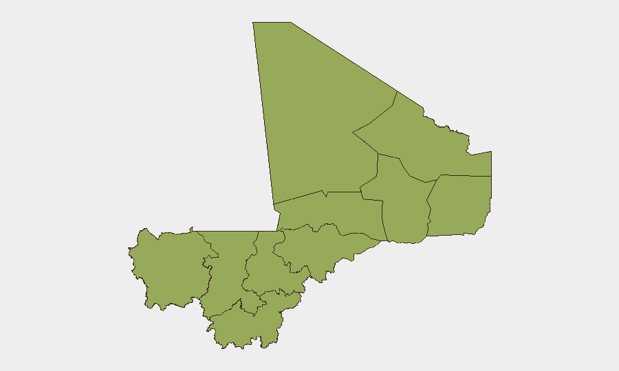
Bamako dominates the risk profile at 75.2—substantially higher than all other regions—reflecting the capital's role as the seat of political authority, military command, and international presence. A secondary tier of ten regions (Timbuktu, Ménaka, Kayes, Taoudénit, Kidal, Gao, Koulikoro, Ségou, Sikasso, Mopti) cluster at 45.1, indicating sustained but lower-intensity threat from dispersed insurgent activity, banditry, and inter-communal tension. Timbuktu (48.3) stands alone in this group, reflecting its history as a jihadist stronghold and its role in supply-line disruption for central Mali. The concentration of risk in Bamako suggests that direct threats to corporate operations, diplomatic presence, and supply chains in the capital merit priority attention; the wider regional risk reflects the difficulty of safe movement and logistics outside the capital.
How GeoBit Would Assist
Security teams should deploy AOI Monitoring & Early Warning on Bamako, Timbuktu, and Gao to receive alerts on new incident-level activity in real time. Intel Sweep and multi-language OSINT (including X/Telegram monitoring and radio SIGINT) will detect emerging threats before they crystallize into attacks. GIS & Spatial Analysis and alternative route planning enable duty-of-care teams to identify safe movement corridors and avoid high-risk nodes; network & actor analysis clarifies the command structure and intent of state and insurgent forces.
7-Day Outlook
No imminent tactical escalation is forecasted for the next week based on available indicators. Bamako risk will likely remain elevated owing to political fragmentation and security-force deployments; peripheral regions will sustain chronic low-to-moderate threat from dispersed armed groups. Monitor for any public statements or military movements that signal coordination between state and foreign military partners (Russia signals in recent data warrant tracking).
Highest-Risk Areas — Ranked
| # | State / Region | Risk |
|---|---|---|
| 1 | Bamako | 75.2 |
| 2 | Timbuktu | 48.3 |
| 3 | Ménaka | 45.1 |
| 4 | Kayes | 45.1 |
| 5 | Taoudénit Region | 45.1 |
| 6 | Kidal | 45.1 |
| 7 | Gao | 45.1 |
| 8 | Koulikoro | 45.1 |
| 9 | Ségou Region | 45.1 |
| 10 | Sikasso Region | 45.1 |
| 11 | Mopti | 45.1 |
Previous Daily Briefs
A new Mali brief is written every day — each with its own risk map and downloadable CSV. Here's the last week; use the calendar to go further back.
📅 Browse every day by calendar →
Highlighted days have a brief. Tap a day for that day's map & analysis, or “csv” for that day's dataset ($5).