Situation Summary
Palau remains in a stable security environment with no confirmed incidents reported in the last 24–48 hours. The nation's composite threat score of 2 reflects a historically low-risk profile, and current open-source monitoring and security feeds show no active civil unrest, crime surges, conflict, or infrastructure disruptions. The overall trajectory is neutral and routine, with security posture appropriate to a Pacific island state with minimal reported transnational threats or internal instability.
Key Developments
No discrete security, conflict, civil unrest, crime, political instability, infrastructure, or travel-risk incidents have been verified for Palau within the current 24–48-hour window. Open-source and near-real-time security briefs confirm a quiet operational environment across all states and municipalities.
*Note: Recent non-incident activity (mid-July 2026, outside the 24–48-hour window) included routine Pacific Islands Forum security readiness exercises in Koror, reflecting scheduled preparedness planning rather than a disruptive event.*
Highest-Risk Areas
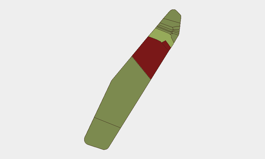
Peleliu and Angaur account for the nation's highest sub-national risk scores (92 and 88, respectively), though these reflect historical context—primarily uninhabited or lightly populated status, limited infrastructure, and legacy WWII-era ordnance concerns—rather than active current incidents. Koror, the commercial and administrative hub, carries a mid-range risk score (45) proportional to its population density and economic activity. Melekeok and Airai round out the secondary risk tier. Risk concentration in outer islands reflects vulnerability to environmental hazards, limited emergency services, and geographic isolation rather than security threats per se; corporate and NGO personnel in Koror face routine urban-environment baseline risks (petty crime, traffic, health access) typical of small Pacific capitals.
How GeoBit Would Assist
Teams with personnel or assets in Palau would employ GeoBit's AOI Monitoring & Early Warning for persistent watch on Koror and other high-traffic zones, coupled with Intel Sweep and multi-language OSINT fusion to capture emerging signals across social media, local news, and regional forums. Maritime & Aviation tracking would provide situational awareness for shipping and air-transport dependencies critical to supply chain and personnel movement in an island context. GIS & Spatial Analysis and alternative route/journey planning would support duty-of-care contingency planning should regional disruptions (weather, political events, or maritime incidents in neighboring states) require evacuation or re-routing protocols.
7-Day Outlook
No indicators suggest imminent security degradation in Palau over the next seven days. The near-term trajectory remains stable, contingent on continued absence of major regional contagion (unrest in neighboring Pacific nations, transnational maritime incidents, or climate-driven emergency). Routine operations in Koror and outer-state commerce are expected to continue without material disruption. Standard corporate duty-of-care and travel protocols remain appropriate and sufficient.
Highest-Risk Areas — Ranked
| # | State / Region | Risk |
|---|---|---|
| 1 | Peleliu | 92 |
| 2 | Angaur | 88 |
| 3 | Koror | 45 |
| 4 | Melekeok | 35 |
| 5 | Airai | 32 |
| 6 | Ngatpang | 28 |
| 7 | Ngeremlengui | 26 |
| 8 | Ngaraard | 25 |
| 9 | Ngardmau | 24 |
| 10 | Aimeliik | 23 |
| 11 | Ngiwal | 22 |
| 12 | Ngchesar | 21 |
Sources
Previous Daily Briefs
A new Palau brief is written every day — each with its own risk map and downloadable CSV. Here's the last week; use the calendar to go further back.
📅 Browse every day by calendar →
Highlighted days have a brief. Tap a day for that day's map & analysis, or “csv” for that day's dataset ($5).
Atlas — our AI intelligence desk — emails them this snapshot personally. Nothing else, no list.