Situation Summary
Papua New Guinea's overall security profile remains stable at composite threat rank #88 globally, with 416 tracked events. The National Capital District (Port Moresby) dominates risk exposure at 3.5× the national average, driven by persistent urban crime, civil tensions, and rejection incidents. Immediate operational focus is an active maritime search-and-rescue operation in East New Britain Province, with all other recent signals (seismic activity, wildfire, polio surveillance) presenting non-security risks.
Key Developments
- East New Britain Province – Maritime Search Operation (ongoing, incident date 18 July): Royal Papua New Guinea Constabulary and provincial authorities are conducting a large-scale search for 27 people missing at sea (14 adults, 11 children, 2 other males) from two boats in waters near Pigeon Island to Kokopo. An overturned vessel has been sighted from the air. Search operations, now entering their fourth–fifth day as of 23–24 July, remain active with marine police units, emergency vessels, and helicopter support deployed. No indication of foul play; operational risk to inter-island and coastal transit remains elevated in the area.
- Port Moresby – Reject/Traveller Incidents (22 July): Two distinct rejection or traveller-related security signals logged in Port Moresby on 22 July. No detailed public reporting available; incidents appear lower-scale or resolved. Consistent with baseline urban security friction in the National Capital District.
- Military/Police Activity (23 July): A military or police power demonstration was recorded on 23 July. No location or operational detail available; no escalation indicated.
- Environmental & Health Signals (recent, non-security): A magnitude 4.7 earthquake was recorded 89 km northwest of Finschhafen (Morobe Province); active wildfire detected; circulating vaccine-derived poliovirus type 2 (cVDPV2) remains under public-health surveillance. None represent acute security threats.
Highest-Risk Areas
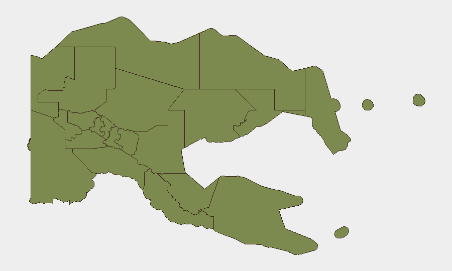
National Capital District (Port Moresby, risk score 31.5) is the dominant risk node—roughly 20× higher than any other province—and accounts for the majority of rejection incidents, traveller-related crime, and urban armed violence tracked by GeoBit. All remaining provinces cluster at risk score 1.5, reflecting a highly concentrated threat environment: Port Moresby's informal settlements, market areas, and nightlife districts pose persistent robbery, assault, and carjacking hazards, particularly after dark. Eastern Highlands, Gulf, and Madang provinces show minimal indexed risk but warrant monitoring for tribal conflict and remote-area instability. Maritime routes in coastal provinces (East New Britain, Manus, Milne Bay) carry inherent navigation and rescue risks, as the current East New Britain incident underscores.
How GeoBit Would Assist
Security teams protecting personnel or assets in Papua New Guinea would deploy AOI Monitoring & Early Warning on Port Moresby and key provincial capitals to detect emerging protests, riots, or armed incidents in real time. OSINT Fusion & Corroboration (X/Twitter, local news, radio SIGINT) provides early signal of tribal disputes, maritime emergencies, or police operations before mainstream reporting. Routing & Network Analysis enables duty-of-care teams to plan secure transit routes around high-risk zones in Port Moresby and recommend maritime alternatives for inter-island travel when sea conditions or search operations close normal corridors.
7-Day Outlook
The East New Britain maritime search operation will likely conclude or transition to salvage/recovery mode within 48–72 hours if no survivors are located. Port Moresby's baseline crime and civil-friction risk will persist; no escalation is forecast unless tribal or election-related tensions spike unexpectedly. Environmental risks (wildfire, seismic aftershocks, disease surveillance) remain non-security drivers and do not materially alter the threat ranking.
Highest-Risk Areas — Ranked
| # | State / Region | Risk |
|---|---|---|
| 1 | National Capital District | 31.5 |
| 2 | Eastern Highlands | 1.5 |
| 3 | Gulf | 1.5 |
| 4 | Madang | 1.5 |
| 5 | Manus | 1.5 |
| 6 | West New Britain | 1.5 |
| 7 | New Ireland | 1.5 |
| 8 | East New Britain | 1.5 |
| 9 | Morobe | 1.5 |
| 10 | Central | 1.5 |
| 11 | Oro | 1.5 |
| 12 | Milne Bay | 1.5 |
Sources
Previous Daily Briefs
A new Papua New Guinea brief is written every day — each with its own risk map and downloadable CSV. Here's the last week; use the calendar to go further back.
📅 Browse every day by calendar →
Highlighted days have a brief. Tap a day for that day's map & analysis, or “csv” for that day's dataset ($5).
Atlas — our AI intelligence desk — emails them this snapshot personally. Nothing else, no list.