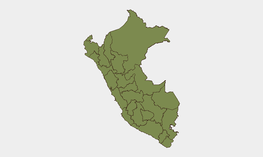
Situation Summary
Peru remains at global threat rank #60 with a composite threat score of 22 across 379 tracked events. No major, cross-verified security incidents, armed violence, or civil unrest have been confirmed in the last 24–48 hours; the current threat environment reflects standing conditions—ongoing states of emergency, baseline urban violent crime, and elevated risk in specific conflict-affected regions—rather than acute new developments. Political tensions are evident in recent signal activity (presidential investigations, company disapprovals, and demands directed at government), but these have not yet translated into documented street-level disruptions. Overall trajectory remains stable at elevated baseline rather than escalating.
Key Developments
- 2026-07-19, National: Presidential and government investigations launched; multiple disapproval and public-statement signals from state actors and media indicate ongoing political scrutiny, though no street-level unrest has been confirmed as of this brief.
- 2026-07-19, Prison System: Arrest/detain event recorded; details limited in available open-source data, but signals suggest law-enforcement activity related to broader investigative cycle.
- 2026-07-17–19, Diplomatic: Reduction in international relations noted alongside ambassador disapproval statements; geopolitical posturing continues but does not yet indicate imminent destabilization.
- No new major criminal or armed incidents confirmed in Lima–Callao, VRAEM, or northern border regions (Tumbes, Piura, Loreto, Cajamarca, Amazonas) in the last 48 hours; chronic violent crime in Lima districts (Carabayllo, San Juan de Miraflores, Puente Piedra) persists at historical baseline.
- Standing state-of-emergency status remains in place in Lima–Callao and Trujillo–Virú (La Libertad); no new emergency declarations or rescissions in the last 24–48 hours.
Highest-Risk Areas
Huánuco dominates the regional threat landscape with a composite risk score of 31.8—more than double the second-ranked region—driven by ongoing organized-crime activity, narcotics trafficking, and armed-group presence in coca-growing areas. Lima (15.8) remains the second-highest-risk region, reflecting concentrated urban violent crime, gang activity, and port-related trafficking; as Peru's capital and economic hub, Lima also concentrates political instability signals. Lambayeque (13.8) and Ancash (10.8) follow, with Lambayeque linked to trafficking and organized crime in the north, and Ancash to extraction-zone violence and gang disputes. Together, these four regions account for the plurality of Peru's tracked threat events. Mid-tier regions (Junín, Cajamarca, Ayacucho, Apurímac) maintain lower but measurable risk from coca cultivation, illegal mining, and legacy conflict-zone instability.
How GeoBit Would Assist
A corporate security or duty-of-care team with personnel or assets in Peru should employ Intel Sweep and OSINT Fusion to track ongoing political investigations and diplomatic signals in real time, distinguishing signal noise from actionable escalation. AOI Monitoring & Early Warning configured for Huánuco, Lima, Lambayeque, and northern border zones (Tumbes, Piura, Loreto) will provide persistent watch on organized-crime activity, gang violence, and trafficking movements with alert thresholds tuned to corporate risk tolerance. Routing & Network Analysis is critical for journey planning and alternative-route identification in high-risk regions, particularly Lima and the VRAEM corridor; linked with GIS & Spatial Analysis to map safe corridors and avoid active gang territories or state-of-emergency zones.
7-Day Outlook
Near-term trajectory suggests continued political investigation activity and rhetorical posturing without acute escalation to street-level unrest, though public sentiment and protest potential remain elevated in Lima. Huánuco and northern trafficking routes are likely to sustain chronic cartel and gang activity; no major tactical shift is anticipated. Corporate teams should maintain heightened situational awareness in Lima, avoid travel to VRAEM and high-risk northern regions absent critical business need, and ensure real-time monitoring feeds are active.
Highest-Risk Areas — Ranked
| # | State / Region | Risk |
|---|---|---|
| 1 | Huánuco | 31.8 |
| 2 | Lima | 15.8 |
| 3 | Lambayeque | 13.8 |
| 4 | Ancash | 10.8 |
| 5 | Junín | 6.8 |
| 6 | Cajamarca | 3.8 |
| 7 | Ayacucho | 3.8 |
| 8 | Piura | 2.8 |
| 9 | Apurímac | 2.8 |
| 10 | Arequipa | 2.8 |
| 11 | Tacna | 2.8 |
| 12 | Loreto | 1.8 |
Sources
Previous Daily Briefs
A new Peru brief is written every day — each with its own risk map and downloadable CSV. Here's the last week; use the calendar to go further back.
📅 Browse every day by calendar →
Highlighted days have a brief. Tap a day for that day's map & analysis, or “csv” for that day's dataset ($5).
Atlas — our AI intelligence desk — emails them this snapshot personally. Nothing else, no list.