Situation Summary
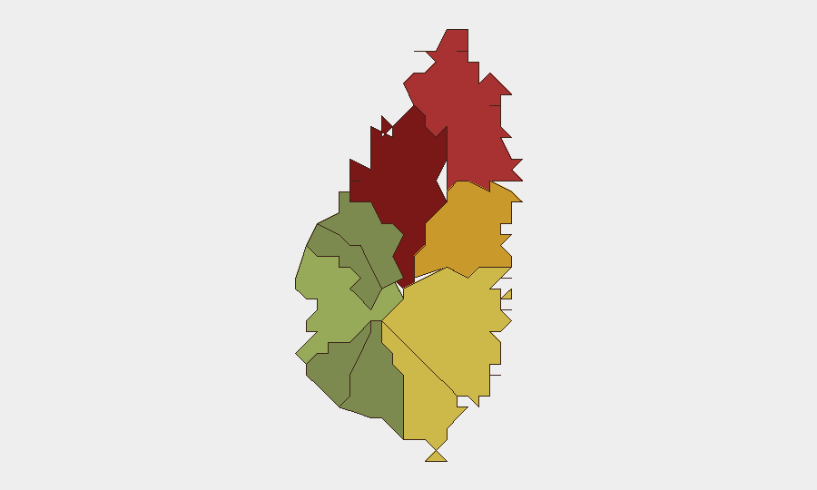
Saint Lucia remains a low-threat environment globally (composite threat score 6, rank #159), with no tracked security incidents in the current reporting window. Urban centers—particularly Castries (risk 95) and Gros Islet (risk 78)—drive the island's composite risk profile, though no discrete events have been verified in the last 24–48 hours. The security posture is stable, with institutional capacity improvements (recent Royal Saint Lucia Police Force equipment delivery noted in local media) offsetting underlying structural vulnerabilities common to small Caribbean islands.
Key Developments
No verifiable incident-specific developments have been identified for Saint Lucia in the last 24–48 hours from available open-source channels. Web research and event feeds produced no cross-confirmed reports of crime, unrest, infrastructure failure, or travel disruption with specific dates and locations. Absence of reported incidents in accessible sources does not preclude events occurring; however, duty-of-care monitoring should rely on direct liaison with local law enforcement and government communications channels for real-time situational awareness.
Highest-Risk Areas
Castries (risk 95) and Gros Islet (risk 78) dominate Saint Lucia's internal risk landscape, driven by urban density, transient populations, and historical concentration of property crime and interpersonal violence. Dennery (72), Vieux Fort (68), and Micoud (65) represent a secondary tier of concern. The southern and central regions—Laborie, Choiseul, Anse La Raye, and Canaries—present markedly lower risk profiles. Risk concentration in the northern and central urban/commercial zones reflects typical Caribbean patterns and does not indicate an acute threat spike; rather, it reflects structural socioeconomic drivers affecting smaller island economies.
How GeoBit Would Assist
Teams with personnel or assets in Saint Lucia should employ AOI Monitoring & Early Warning to track Castries and Gros Islet for emerging crime or unrest signals, with daily alert thresholds configured for the high-risk quadrant. Intel Sweep (global event feeds, social-media OSINT via X/Twitter and YouTube, multi-language search, and sentiment analysis) provides continuous background noise filtering, allowing rapid detection of discrete incidents once they occur. Routing & Network Analysis enables security teams to pre-plan alternative transportation and logistical networks around known risk concentrations, minimizing exposure during routine operations.
7-Day Outlook
Saint Lucia's security environment is forecast to remain stable over the next seven days. No foreseeable triggers (political events, labor actions, natural hazards, or regional spillover) have been identified in current intelligence. Continued reliance on local government and police official channels, combined with GeoBit platform monitoring, will provide adequate early warning for any adverse change in trajectory.
Highest-Risk Areas — Ranked
| # | State / Region | Risk |
|---|---|---|
| 1 | Castries | 95 |
| 2 | Gros Islet | 78 |
| 3 | Dennery | 72 |
| 4 | Vieux Fort | 68 |
| 5 | Micoud | 65 |
| 6 | Soufrière | 42 |
| 7 | Laborie | 38 |
| 8 | Choiseul | 35 |
| 9 | Anse La Raye | 28 |
| 10 | Canaries | 12 |
Sources
Previous Daily Briefs
A new Saint Lucia brief is written every day — each with its own risk map and downloadable CSV. Here's the last week; use the calendar to go further back.
- August 31, 2026
- August 29, 2026
- August 26, 2026
- August 24, 2026
- August 22, 2026
- August 20, 2026
- August 18, 2026
📅 Browse every day by calendar →
Highlighted days have a brief. Tap a day for that day's map & analysis, or “csv” for that day's dataset ($5).
Atlas — our AI intelligence desk — emails them this snapshot personally. Nothing else, no list.