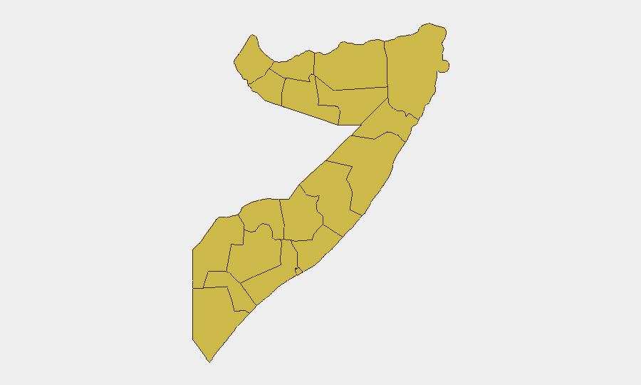
Situation Summary
Somalia remains at composite threat rank #8 globally, driven primarily by ongoing civil war fragmentation and the persistent operational presence of al-Shabaab across multiple regions. No major kinetic incidents were verified in the last 24–48 hours; however, the baseline threat environment remains severe and static rather than recently escalating or de-escalating. All twelve tracked sub-national regions carry identical composite risk scores (66.8), reflecting endemic instability across the country rather than localized hotspots. The security picture is characterized by chronic rather than acute deterioration.
Key Developments
- No verified major conflict or security incidents were corroborated by multiple independent sources in Somalia during the 24–48 hour window ending 22 July 2026.
- Recent reporting mentions clashes in Hafun, Puntland and Laag (near Boosaaso, Puntland), but these lack multi-source confirmation and precise dating within the requested window.
- A Ministry of Defence statement reported al-Shabaab casualties in Sablale, Lower Shabelle on 13 July (outside the 24–48 hour window); no follow-on incidents from that location were confirmed in recent hours.
- Unconfirmed reports of airstrikes in Middle Shabelle and Hiiraan/Suullaay regions reference militant casualties but remain outside the current reporting window and lack independent corroboration.
- Overall event signal velocity appears low; open-source monitoring has not detected escalation in either al-Shabaab operations or clan-based conflict in the past two days.
Highest-Risk Areas
All twelve tracked regions—including Awdal, Woqooyi Galbeed, Gedo, Bakool, Bay, Middle Juba, Lower Shabelle, Sahil, Togdheer, Hiiraan, Middle Shebelle, and Lower Juba—carry identical composite risk scores. This uniformity indicates pervasive state fragility, clan competition, and al-Shabaab penetration nationwide rather than concentration in one or two zones. Puntland and South West State have appeared in recent unconfirmed reporting; however, the absence of regional differentiation in risk scores suggests that corporate and duty-of-care teams must apply equivalent caution across all administrative divisions. Risk is diffuse and structural.
How GeoBit Would Assist
Organizations with personnel or assets in Somalia should employ Area-of-Interest (AOI) Monitoring & Early Warning on key operational locations (bases, supply routes, staff residences) to detect kinetic activity or security cordon movements before they escalate. OSINT Fusion & Corroboration (X/Twitter, Telegram, local news, Ministry statements, and radio SIGINT) enables multi-source validation of incident reports, reducing false alerts and sharpening situational awareness during communication blackouts. Routing & Network Analysis and GIS & Spatial Analysis support contingency planning—identifying safe corridors, alternate supply routes, and displacement vectors in the event of localized conflict or al-Shabaab advance.
7-Day Outlook
No imminent escalation is indicated by current event signals; however, the chronic absence of major reported incidents does not signal improvement. The baseline threat trajectory remains flat and elevated. Security teams should assume no near-term change to threat posture and maintain existing protocols; GeoBit monitoring will provide 24–72 hour early warning of significant kinetic activity, al-Shabaab operations, or clan-driven clashes affecting priority areas.
Highest-Risk Areas — Ranked
| # | State / Region | Risk |
|---|---|---|
| 1 | Awdal | 66.8 |
| 2 | Woqooyi Galbeed | 66.8 |
| 3 | Gedo | 66.8 |
| 4 | Bakool | 66.8 |
| 5 | Bay | 66.8 |
| 6 | Middle Juba | 66.8 |
| 7 | Lower Shabelle | 66.8 |
| 8 | Sahil | 66.8 |
| 9 | Togdheer | 66.8 |
| 10 | Hiiraan | 66.8 |
| 11 | Middle Shebelle | 66.8 |
| 12 | Lower Juba | 66.8 |
Sources
Previous Daily Briefs
A new Somalia brief is written every day — each with its own risk map and downloadable CSV. Here's the last week; use the calendar to go further back.
📅 Browse every day by calendar →
Highlighted days have a brief. Tap a day for that day's map & analysis, or “csv” for that day's dataset ($5).
Atlas — our AI intelligence desk — emails them this snapshot personally. Nothing else, no list.