Situation Summary
The United Kingdom faces a cluster of acute incidents spanning transport, maritime, civil safety and national security within the last 48 hours, against a baseline composite threat score of 3 (rank #149 globally). England dominates sub-national risk with a score of 31.4—approximately 9× higher than Scotland—driven by multiple concurrent safety and infrastructure failures. The trajectory suggests elevated operational strain on emergency services and transport networks, compounded by sustained heatwave conditions that constrain response capacity and elevate secondary risks such as wildfires.
Key Developments
- Liverpool, Merseyside – 30 July 2026: Vehicle struck parade crowds, injuring 109 people with several in serious condition. Investigation ongoing; event-security posture in city centres affected.
- South of Bedford, Bedfordshire – 30 July 2026: Two-train collision on major north–south rail corridor caused one fatality and dozens of injuries (multiple "very seriously" and "seriously" hurt). Significant disruption to rail infrastructure and travel networks.
- Off Isle of Wight, English Channel – 30 July 2026: Russian military vessel fired warning shots at UK-linked yacht; UK PM described incident as "deeply concerning." Ministry of Defence investigating. Represents elevated maritime security risk in adjacent waters and geopolitical tension.
- South West England – 30 July 2026: Authorities issued "extremely high" wildfire risk warning amid prolonged heatwave. Risk to infrastructure, road/rail corridors and utilities in heathland and forested areas.
- North-West London – 30 July 2026: Counter-terrorism officers conducted National Security Act investigation searches at two residential addresses, indicating active intelligence-led counter-espionage operations in the capital.
- England (nationwide) – 30 July 2026: Amber and yellow heat-health alerts active; NHS reporting sustained pressure on critical services. Indirect impact on emergency-response capacity.
- English Channel – 28–30 July 2026: Royal Navy intercepted and boarded Russian "ghost fleet" tanker involved in sanctions-evasion operations, part of broader pattern of Russian naval activity near UK waters affecting commercial maritime traffic risk.
Highest-Risk Areas
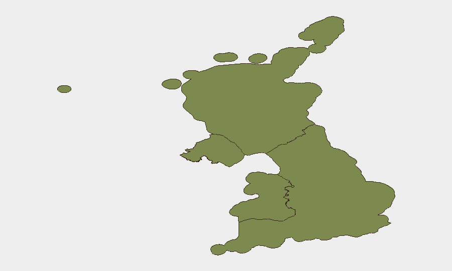
England accounts for the overwhelming majority of tracked risk (score 31.4 of 53.9 total UK score), reflecting its larger population, critical infrastructure concentration and current incident cluster. Scotland (3.6), Northern Ireland (1.5) and Wales (1.4) collectively represent 6.5% of UK risk. The England spike is driven by the convergence of transport failures (rail collision, vehicle-into-crowd incident), environmental hazard (wildfire risk), infrastructure strain (NHS under heatwave pressure) and active security investigations. Risk is geographically dispersed across the English corridor (Liverpool, Bedford, London, South West) rather than localized, suggesting systemic rather than site-specific vulnerability.
How GeoBit Would Assist
Security teams would deploy AOI Monitoring & Early Warning on high-footfall locations (transport hubs, city centres, coastal areas) to detect emerging crowd, traffic or infrastructure risks; GIS & Spatial Analysis to map wildfire progression, rail corridor disruptions and maritime incident zones; and Risk & Threat Assessment to model cascading effects of heatwave-driven NHS strain on emergency-response capacity for concurrent incidents. Maritime & Aviation tracking would provide real-time positioning of vessels in the English Channel to inform risk exposure for corporate shipping or leisure activity.
7-Day Outlook
The heatwave is forecast to persist through early August, sustaining wildfire risk and NHS pressure. Emergency services remain operationally stretched across multiple concurrent incidents (rail, road safety, counter-terrorism operations), reducing surge capacity for new events. Further Russian naval activity near UK waters and continuation of national security investigations should be anticipated.
Highest-Risk Areas — Ranked
| # | State / Region | Risk |
|---|---|---|
| 1 | England | 31.4 |
| 2 | Scotland | 3.6 |
| 3 | Northern Ireland | 1.5 |
| 4 | Wales | 1.4 |
Sources
- news.met.police.uk
- bbc.co.uk
- nationalcrimeagency.gov.uk
- cityoflondon.police.uk
- norfolk.police.uk
- bbc.com
- news.met.police.uk
- standard.co.uk
- securityweek.com
- lemonde.fr
- counterterrorism.police.uk
- economictimes.indiatimes.com
- standard.co.uk
- standard.co.uk
- thetimes.com
- en.wikipedia.org
- krebsonsecurity.com
- cybersecuritynews.com
Previous Daily Briefs
A new United Kingdom brief is written every day — each with its own risk map and downloadable CSV. Here's the last week; use the calendar to go further back.
📅 Browse every day by calendar →
Highlighted days have a brief. Tap a day for that day's map & analysis, or “csv” for that day's dataset ($5).
Atlas — our AI intelligence desk — emails them this snapshot personally. Nothing else, no list.