Situation Summary
Burkina Faso remains rated #16 globally in composite threat, driven primarily by active insurgency and armed-group operations across multiple regions. Open-source reporting confirms no independently verified kinetic incidents or major civil unrest in the 24–48 hours preceding this brief (20–22 July 2026), though persistent terrorism, kidnapping, and cross-border instability risks remain operationally significant. Diplomatic rupture with the EU (consular closure, expelled diplomats mid-July) has reduced foreign diplomatic presence and consular support capacity. France's formal travel-advisory status discouraging all travel remains in effect, reflecting sustained threat assessment.
Key Developments
- Ghana–Burkina Faso border tension (19–20 July 2026): Regional military-tension signals involving both nations recorded around 19 July; diplomatic friction remains live and may affect border-zone mobility and cross-border trade logistics.
- EU consular services closure (mid-July 2026, ongoing): Expulsion of EU diplomats and 72-hour departure order resulted in closure of EU and French consular operations in Ouagadougou; foreign nationals have materially reduced access to consular assistance and emergency support.
- Counter-terrorism operations (early–mid-July 2026): State-reported security-force (FDS) operations in Cascades, Centre‑Nord, and Est regions claimed elimination of armed militants and recovery of logistics; timing beyond early July is imprecise in available open sources, and independent verification remains limited.
- No confirmed new attacks in last 48 hours: Multi-source open-source review yields no reliably corroborated reports of new kinetic incidents, bombings, or direct combat specifically dated 20–22 July 2026.
- Curfews, checkpoints, and movement restrictions remain active: French and international briefs cite ongoing restrictions on civilian movement, particularly in high-risk regions and around military operations; exact locations and scope vary by region and are subject to rapid change.
Highest-Risk Areas
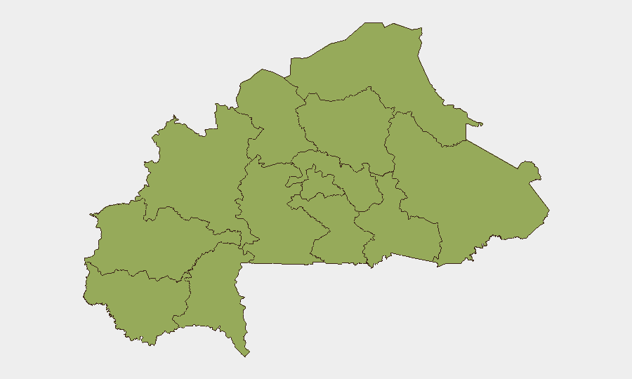
All twelve tracked sub-national regions carry identical composite risk scores (53.5), reflecting nationwide threat saturation rather than concentrated geographic hotspots. Upper-Basins, Boucle du Mouhoun, Central regions (West, South, East, North), Waterfalls, Southwest, Sahel, East, and North all share equal risk weighting, indicating that terrorism, armed-group activity, and kidnapping risks are broadly distributed rather than localized. This pattern underscores that corporate assets and personnel in any region face comparable baseline threat exposure, with specific incident risk varying by proximity to reported operations, border zones, and military activity corridors.
How GeoBit Would Assist
Security teams would employ AOI Monitoring & Early Warning on high-value sites and personnel locations across priority regions, with real-time alerting for incident signals and military activity. Conflict & Military tracking, OSINT fusion, and multi-language social-media intelligence (X/Telegram, local broadcast media) would enable early detection of emerging armed-group movements, checkpoint activity, and curfew changes before they disrupt operations. Routing & Network Analysis would support dynamic alternative-route planning and cross-border mobility contingency for supply chains and staff movement, accounting for live border-tension and checkpoint data.
7-Day Outlook
Near-term trajectory remains high-plateau threat with continued counter-terrorism operations expected across Centre‑Nord, Est, and Cascades regions; no imminent major escalation is signaled, but operational tempo and kinetic risk remain sustained. Ghana–Burkina Faso border dynamics warrant close watch; any flare-up could rapidly constrain cross-border movement and consular support options. Diplomatic isolation and consular-service gaps will persist, increasing corporate duty-of-care dependencies on private-security and real-time intelligence channels.
Highest-Risk Areas — Ranked
| # | State / Region | Risk |
|---|---|---|
| 1 | Upper-Basins | 53.5 |
| 2 | Boucle du Mouhoun | 53.5 |
| 3 | Central-West | 53.5 |
| 4 | Central-South | 53.5 |
| 5 | Central-East | 53.5 |
| 6 | Waterfalls | 53.5 |
| 7 | Southwest | 53.5 |
| 8 | Sahel | 53.5 |
| 9 | Central-North | 53.5 |
| 10 | East | 53.5 |
| 11 | North | 53.5 |
| 12 | Centre | 53.5 |
Sources
Previous Daily Briefs
A new Burkina Faso brief is written every day — each with its own risk map and downloadable CSV. Here's the last week; use the calendar to go further back.
📅 Browse every day by calendar →
Highlighted days have a brief. Tap a day for that day's map & analysis, or “csv” for that day's dataset ($5).
Atlas — our AI intelligence desk — emails them this snapshot personally. Nothing else, no list.