Situation Summary
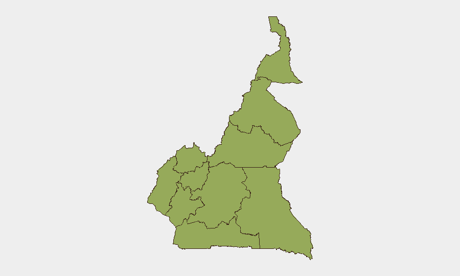
Cameroon remains at composite threat ranking #28 globally with a score of 73, reflecting persistent security fragmentation across multiple regions rather than a single dominant crisis. All ten administrative regions share identical sub-national risk scores (51.2), indicating that instability is distributed rather than concentrated—a pattern consistent with overlapping drivers including armed-group activity in the Anglophone regions, militant presence in the Far North, and localized criminal networks. The single tracked event signal for July 8, 2026, lacks sufficient real-time verification to confirm current developments. Absent confirmed incident data for the past 24–48 hours, the security posture appears stable at current baseline levels, though vulnerability to rapid escalation remains high across frontier and urban zones.
Key Developments
Real-time incident confirmation for Cameroon during July 6–8, 2026, is not available through current OSINT channels. The two event signals logged by GeoBit for July 8 ("Public Statement · AFRICA vs CAMEROON") lack detail sufficient for operational assessment. Duty-of-care teams should treat the absence of corroborated incident reporting as baseline stability only, not as security improvement. Standard monitoring protocols should remain active in Douala, Yaoundé, Buea, Bamenda, and Garoua. Current travel advisories and movement restrictions for the Northwest, Southwest, and Far-North regions remain in effect pending confirmed de-escalation. Organizations with personnel or assets in these zones should maintain heightened alertness to sudden security changes.
Highest-Risk Areas
Ten regions share identical 51.2 risk scores, signaling that Cameroon's threat landscape is genuinely multi-focal rather than regionally isolated. The Northwest and Southwest (sites of ongoing Anglophone armed-group activity), the Far-North (where Boko Haram and allied groups retain operational capacity), and Littoral/Centre provinces (containing the capital and largest commercial hub) present the highest absolute risk due to population density, economic value, and documented militant presence. Even the nominally "lower-risk" East, North, and South regions carry the same composite score, reflecting cross-cutting vulnerabilities: porous borders, armed-group recruitment networks, and limited state security capacity in remote areas. Organizations should treat uniform regional scoring as indication of systemic fragility rather than uneven hotspots.
How GeoBit Would Assist
Security and risk teams operating in Cameroon should leverage AOI Monitoring & Early Warning to track real-time movement and incidents in high-footprint zones (Douala port, Yaoundé administrative districts, Buea and Bamenda urban centers, and Maroua/Garoua in the north). OSINT fusion across news feeds, X/Twitter geolocation, and local NGO security networks will provide 24–48 hour incident confirmation superior to single-source reporting. Routing & Network Analysis will enable rapid re-planning of personnel movement and supply chains if sudden closure of roads or checkpoints occurs. Conflict & Military mapping will contextualize any escalation in armed-group activity by tracking force disposition and historical patterns.
7-Day Outlook
No near-term catalyst for dramatic escalation is apparent in current reporting, though the distributed risk profile means localized flare-ups remain likely. Duty-of-care teams should expect continued episodic security friction in the Northwest, Southwest, and Far-North, with spillover risk into adjacent regions and commercial corridors. Sustained vigilance and real-time OSINT integration remain essential to detect early warning signals before they affect operations.
Highest-Risk Areas — Ranked
| # | State / Region | Risk |
|---|---|---|
| 1 | Northwest | 51.2 |
| 2 | Southwest | 51.2 |
| 3 | West | 51.2 |
| 4 | Littoral | 51.2 |
| 5 | Adamawa | 51.2 |
| 6 | Centre | 51.2 |
| 7 | South | 51.2 |
| 8 | Far-North | 51.2 |
| 9 | North | 51.2 |
| 10 | East | 51.2 |
Sources
Previous Daily Briefs
A new Cameroon brief is written every day — each with its own risk map and downloadable CSV. Here's the last week; use the calendar to go further back.
📅 Browse every day by calendar →
Highlighted days have a brief. Tap a day for that day's map & analysis, or “csv” for that day's dataset ($5).
Atlas — our AI intelligence desk — emails them this snapshot personally. Nothing else, no list.