Situation Summary
Canada's composite threat score of 4 places it at #166 globally, reflecting a manageable but non-trivial security environment. Recent event signals indicate a cluster of incidents across the 24–48-hour window, including small-arms engagements in Montreal and Toronto, police arrests involving gunmen, and criminal threats directed at state and industry. Ontario drives the national risk profile significantly (composite 32), with secondary concern in Nunavut and British Columbia, though the geographic distribution of recent tactical incidents suggests distributed rather than concentrated vulnerability.
Key Developments
- Toronto, ON – 04 Jul 2026 · Armed engagement between hired gunmen and Toronto-area personnel; police response and arrest/detain operations underway. Specific casualty and operational status pending confirmation.
- Montreal, QC – 02 Jul 2026 · Small-arms combat incident reported; investigation active. Scale and parties involved require further corroboration.
- National – 04 Jul 2026 · Administrative sanctions imposed on tanker (maritime/supply-chain implications); criminal entities issued threats against Canada and associated critical infrastructure.
- National – 02–04 Jul 2026 · Government public statement regarding banking sector; Canadian industrial sector responding to security concerns via public statement. Suggests potential financial system or trade-related tension.
- National – 03 Jul 2026 · Conventional military force deployment or readiness action noted; context (drill, border response, or other) unclear from available signals.
*Note: Limited detail available on most events. Specific casualty counts, operational scope, travel/infrastructure impacts, and suspect/motive information remain unconfirmed from current reporting. Corporate teams should confirm status through official Canadian law enforcement (RCMP, provincial/municipal services) and relevant operators.*
Highest-Risk Areas
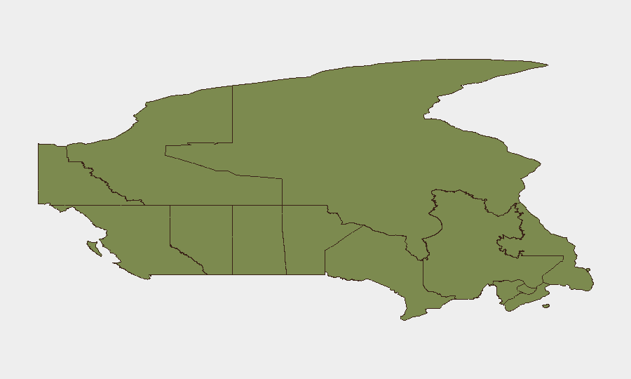
Ontario's risk score (32) is more than 1.5× the next-ranked region (Nunavut, 21.2), reflecting both population density and concentration of financial, transportation, and federal infrastructure in the Greater Toronto Area and Ottawa corridor. Recent tactical incidents in Toronto and Montreal align with this ranking and suggest active criminal or security-related activity in the country's largest metropolitan centers. Nunavut and British Columbia's elevated scores likely reflect isolation (northern logistics vulnerabilities, remote communities) and maritime/border exposure, respectively. Organizations with personnel, assets, or supply-chain dependencies in Ontario—particularly Greater Toronto Area—should elevate monitoring and contingency protocols.
How GeoBit Would Assist
Intel Sweep & OSINT Fusion would systematically correlate Toronto and Montreal small-arms incidents, tanker sanctions, and criminal threats across news, government, and social feeds to establish timeline, actor identity, and broader context. AOI Monitoring & Early Warning configured on Ontario, Toronto, Montreal, and key transportation corridors (airports, ports, rail) would deliver near-real-time alerting on police/military activity, infrastructure disruption, and emerging actor statements. Network & Actor Analysis would map relationships between the "gunmen," "hired gun," and "criminal" entities flagged in event signals to assess organizational scope and risk escalation probability. Routing & Network Analysis supports continuity planning by identifying alternative supply-chain and personnel movement routes away from affected areas.
7-Day Outlook
The cluster of armed incidents and criminal threats in a 48-hour window warrants close observation for escalation or secondary incidents. Military-force signals combined with police arrests suggest state security response is active; escalation risk depends on motive clarity (criminal opportunism vs. organized/ideological activity) and whether initial incidents are contained. Corporate teams should maintain enhanced reporting posture through early July and confirm status of operations in Ontario and Quebec by end of business 04 Jul.
Highest-Risk Areas — Ranked
| # | State / Region | Risk |
|---|---|---|
| 1 | Ontario | 32 |
| 2 | Nunavut | 21.2 |
| 3 | British Columbia | 15.4 |
| 4 | Alberta | 11.2 |
| 5 | Quebec | 9.9 |
| 6 | Yukon | 5.1 |
| 7 | Saskatchewan | 4.7 |
| 8 | Northwest Territories | 4.3 |
| 9 | Manitoba | 4.1 |
| 10 | New Brunswick | 3.9 |
| 11 | Newfoundland and Labrador | 2.3 |
| 12 | Nova Scotia | 2.1 |
Sources
Previous Daily Briefs
A new Canada brief is written every day — each with its own risk map and downloadable CSV. Here's the last week; use the calendar to go further back.
📅 Browse every day by calendar →
Highlighted days have a brief. Tap a day for that day's map & analysis, or “csv” for that day's dataset ($5).
Atlas — our AI intelligence desk — emails them this snapshot personally. Nothing else, no list.