Situation Summary
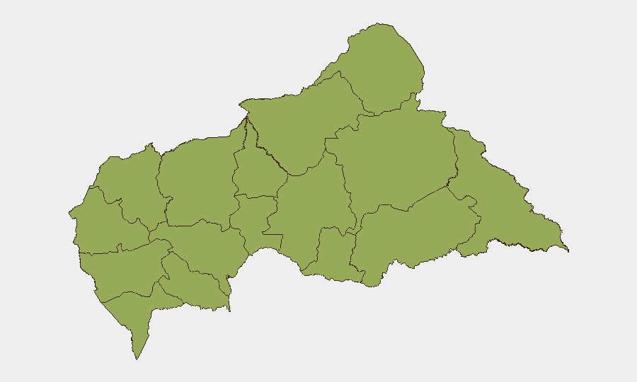
Central African Republic remains classified at global threat rank #29 with a composite threat score of 71, primarily driven by ongoing civil conflict. All twelve tracked sub-national regions report elevated and uniform risk scores (49.4), indicating widespread instability across the country. No verified security incidents have been reported in the last 24–48 hours; however, cross-border tensions involving regional actors (Democratic Republic of Congo, Rwanda, Uganda, South Sudan) signal potential for escalation affecting CAR's stability. The security environment remains volatile but currently without acute incident reporting.
Key Developments
GeoBit's live web research and open-source monitoring have not identified verifiable, location-specific security incidents in Central African Republic within the last 24–48 hours that meet corroboration standards for inclusion in this brief. Event signals flagged by the platform (small arms combat, military force postures, diplomatic tensions) are primarily attributed to neighboring states and regional actors rather than confirmed incidents within CAR borders. Teams should note that absence of reported incident data does not equate to absence of threat; persistent civil conflict and porous borders create ongoing risk. Duty-of-care teams are advised to maintain heightened monitoring posture given the uniform elevation of all sub-national risk scores and recent regional diplomatic friction.
Highest-Risk Areas
All twelve tracked sub-national regions in Central African Republic—from Bamingui-Bangoran and Vakaga in the north to Kémo in the south—carry identical elevated risk scores (49.4), reflecting nationwide civil conflict and fragmented state authority. This uniform distribution, rather than clustering in specific zones, indicates that conflict dynamics, armed-group presence, and governance gaps are dispersed across the country rather than localized. Northern and eastern prefectures (Bamingui-Bangoran, Vakaga, Haute-Kotto, Haut-Mbomou, Mbomou) remain historically contested by multiple armed groups and experience periodic cross-border incursion. The lack of differentiation in sub-national rankings suggests that no region offers materially reduced risk for personnel or asset deployment; movement and operations across all areas require equivalent security protocols and situational awareness.
How GeoBit Would Assist
Security and risk teams operating in or supporting CAR should deploy AOI Monitoring & Early Warning on key locations (administrative centers, border crossings, supply routes) with persistent alerting for conflict activity, force-movement indicators, and civil unrest. Intel Sweep and multi-language OSINT (X/Twitter, Telegram, radio SIGINT) would track armed-group communications, regional actor statements, and diplomatic signals to detect escalation trends before incidents materialize. Network & Actor Analysis and Conflict & Military tracking (force structure, weapons capability) would map group presence and capability shifts across the twelve prefectures, enabling proactive security posture adjustment. Routing & Network Analysis would identify alternative movement corridors and assess real-time viability as conditions change.
7-Day Outlook
Near-term trajectory remains constrained by chronic civil conflict with no immediate resolution mechanisms evident. Regional tension (DRC, Rwanda, Uganda, South Sudan) creates secondary risk of border instability or cross-border incursion that could affect northern and eastern CAR. Security posture should remain elevated across all regions without assumption of improvement; teams should prepare contingency protocols for personnel evacuation and asset relocation if regional or sub-national conditions deteriorate.
Highest-Risk Areas — Ranked
| # | State / Region | Risk |
|---|---|---|
| 1 | Bamingui-Bangoran | 49.4 |
| 2 | Vakaga | 49.4 |
| 3 | Haute-Kotto | 49.4 |
| 4 | Haut-Mbomou | 49.4 |
| 5 | Mbomou | 49.4 |
| 6 | Nana-Mambéré | 49.4 |
| 7 | Ouham-Pendé | 49.4 |
| 8 | Mambéré-Kadéï | 49.4 |
| 9 | Sangha-Mbaéré | 49.4 |
| 10 | Ouham | 49.4 |
| 11 | Nana-Grébizi | 49.4 |
| 12 | Kémo | 49.4 |
Previous Daily Briefs
A new Central African Republic brief is written every day — each with its own risk map and downloadable CSV. Here's the last week; use the calendar to go further back.
📅 Browse every day by calendar →
Highlighted days have a brief. Tap a day for that day's map & analysis, or “csv” for that day's dataset ($5).