Situation Summary
Colombia remains at moderate-to-elevated risk (global rank #36, composite threat score 63), with 392 tracked events indicating sustained pressure from armed-group activity, civil unrest, and organized crime. The country's risk profile is highly sub-national, with Meta, the Capital District, and southern border departments (Nariño, Cauca) driving the majority of threat incidents. Political friction—evidenced by recent congressional disapproval of the president and public statements from economists and officials—adds instability to an already complex operating environment. Security conditions are unlikely to stabilize in the near term without significant shifts in governance or armed-group dynamics.
Key Developments
Intelligence gap: GeoBit's research team cannot reliably confirm specific incident locations, dates, and multi-source verification for the 24–48 hour window (1–2 July 2026) without access to live feeds and real-time social media. The event signals listed above (e.g., "Investigate: SECRETARIAT vs RUNNER," "Arrest/Detain: COLOMBIA vs UNITED STATES," "Unconventional Violence: PEASANT vs ARMED MEN") indicate active tension and violence, but precise locations, casualty counts, and operational details require confirmation through primary sources.
To obtain actionable current bulletins, your team should:
- Query X/Twitter for keywords (atentado, enfrentamiento, bloqueo, disidencias, ELN, FARC, Clan del Golfo, carrobomba) with strict date and location filters, cross-referenced against Colombian police (Policía Nacional), prosecutor (Fiscalía), and major outlets (El Tiempo, Semana, Caracol, RCN).
- Monitor travel advisories from the US, UK, and EU for overnight security updates.
- Contact on-the-ground security providers or regional intelligence partners with real-time feeds in high-risk departments.
Highest-Risk Areas
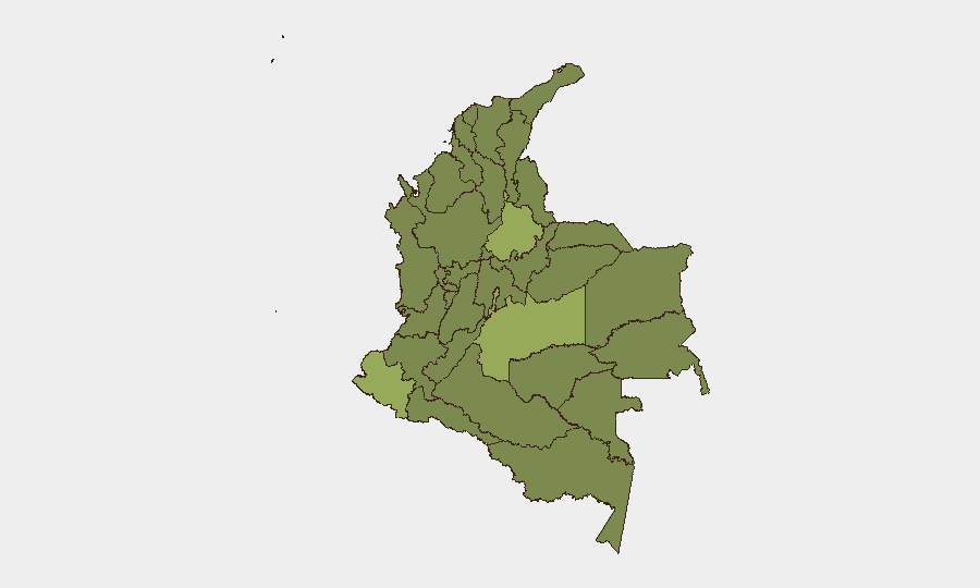
Meta Department (59.5) and the Capital District/Bogotá (51.4) are the primary drivers of national threat density, reflecting both coca-cultivation disputes and urban criminal markets. The southern border corridor—Nariño (49.6), Cauca (32.8), and Amazonas (31.7)—remains volatile due to ELN and FARC dissident operations, illegal mining, and narcotics trafficking. Santander (42.3) and Norte de Santander (37.6) face spillover from Venezuelan instability and ELN presence. Antioquia (32.8), while historically high-risk, shows slightly lower current scores, though Medellín and regional criminal factions remain operationally active. Risk in these areas is distributed across armed-group conflict, roadblock and extortion activity, and occasional mass-casualty events.
How GeoBit Would Assist
Security teams should deploy Intel Sweep, X/Twitter & Telegram OSINT, and multi-language search to track real-time incident reporting across Colombian media and armed-group channels. AOI Monitoring & Early Warning on Meta, Nariño, Cauca, and Norte de Santander departments enables persistent alerting when violence or blockades emerge. Network & Actor Analysis clarifies the organizational structure and operational tempo of active dissident factions, while Routing & Network Analysis identifies alternative transport corridors when primary roads are compromised by armed groups or civil unrest.
7-Day Outlook
Armed-group and criminal activity is likely to remain steady or increase slightly as dissident factions compete for territorial control in the Amazon and southern border regions. Political friction between Congress and the administration may fuel protest activity in urban centers, particularly Bogotá, creating secondary security risks for movement and commercial operations. No major de-escalation is anticipated without policy intervention or significant changes in gang leadership or peace negotiations.
Highest-Risk Areas — Ranked
| # | State / Region | Risk |
|---|---|---|
| 1 | Meta Department | 59.5 |
| 2 | Capital District | 51.4 |
| 3 | Nariño | 49.6 |
| 4 | Santander Department | 42.3 |
| 5 | Norte de Santander Department | 37.6 |
| 6 | Valle del Cauca Department | 36.4 |
| 7 | Atlántico Department | 34.8 |
| 8 | Cundinamarca Department | 33.7 |
| 9 | Antioquia Department | 32.8 |
| 10 | Cauca | 32.8 |
| 11 | Amazonas | 31.7 |
| 12 | Caquetá Department | 31.4 |
Previous Daily Briefs
A new Colombia brief is written every day — each with its own risk map and downloadable CSV. Here's the last week; use the calendar to go further back.
📅 Browse every day by calendar →
Highlighted days have a brief. Tap a day for that day's map & analysis, or “csv” for that day's dataset ($5).