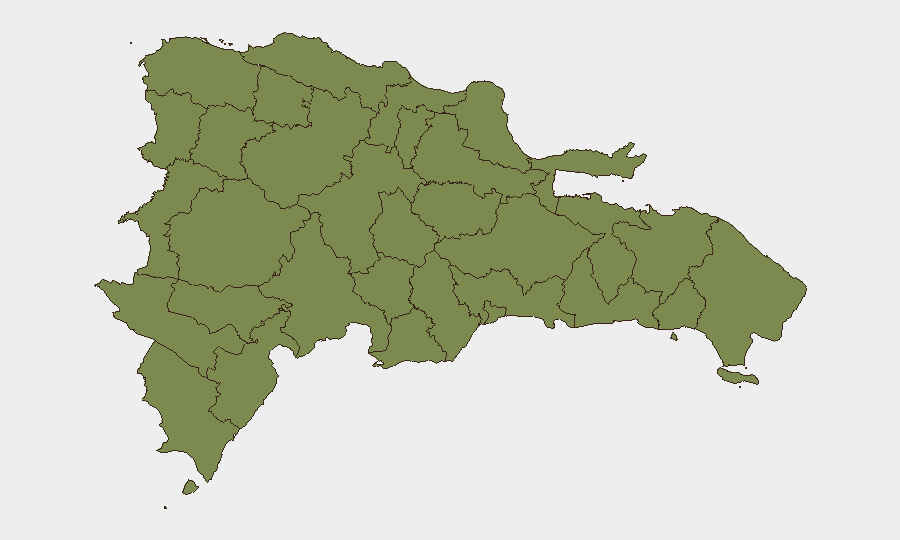
Situation Summary
Dominican Republic remains a low-ranked global threat environment (composite score 13) but exhibits acute localized risk concentration in the Nacional District (Santo Domingo metropolitan area), where institutional tension, violent crime, and cross-border migration control operations are converging. Security incidents over the past week—including armed confrontations, large-scale migrant detention/deportation operations, and homicides linked to interpersonal conflict—reflect ongoing strain on law enforcement and border management. The trajectory shows sustained rather than escalating national risk, with vulnerability primarily concentrated in urban centers and northern border corridors.
Key Developments
- Santo Domingo Este (Mendoza highway, La Grúa sector) – mid-July 2026: A fatal shooting left one male (age 21) dead and another injured; National Police secured the scene and investigations were ongoing with no motive disclosed at time of reporting. This represents recent lethal violence in a major urban transit corridor.
- National border enforcement – July 22, 2026: DGM and security forces detained 1,263 foreigners for irregular status nationwide, deporting 1,013 via Elías Piña (503), Dajabón (324), Jimaní (132), and Pedernales (54). This large-scale operation signals heightened border controls that may impact cross-border movement and checkpoint wait times.
- Constanza, La Vega province – July 22, 2026: Army and DGM intercepted a green vehicle transporting six undocumented Haitians; driver Marcos Yeilin Caraballo Rondón was detained on migrant-smuggling charges, reflecting ongoing irregular migration activity in rural northern areas.
- Nagua, María Trinidad Sánchez province – July 22, 2026: National Police and DGM detained 25 individuals in irregular migratory status (at least 13 male) and transferred them to the Migratory Processing Center of Haina, part of coordinated nationwide migration enforcement.
- Valverde province – mid-July 2026: The Army detained a truck driver allegedly transporting undocumented Haitians, continuing a pattern of military-led migration-security operations in the northwest corridor.
- Nationwide homicide trend – July 1–17, 2026: Police recorded 43 homicides, with 33 (76.7%) linked to social/interpersonal conflicts. Santo Domingo province accounted for 11 cases; La Altagracia and Santiago de los Caballeros each recorded 6. Most violence occurs during night hours (midnight–6 a.m.).
Highest-Risk Areas
Nacional District dominates the risk landscape (31.3 composite score), driven by homicides in Santo Domingo metropolitan area, institutional strain evidenced by recent military-judicial confrontation signals, and investor/ministry protest activity. All other provinces rank at or near 1.3, indicating risk is geographically compressed rather than dispersed. Northern border provinces (Dajabón, Elías Piña, Monte Cristi, Puerto Plata) show elevated migrant-trafficking activity and military checkpoint presence but do not rank as elevated threats; instead, they represent operational friction points for corporate travel and supply-chain routing.
How GeoBit Would Assist
Security teams should employ AOI Monitoring & Early Warning on Nacional District (Santo Domingo Este particularly) to detect emerging violence clusters and institutional instability signaling. Routing & Network Analysis capabilities help identify alternative land-transport corridors avoiding high-checkpoint northern border zones during peak enforcement periods. Multi-language X/Twitter and news OSINT paired with entity extraction would disambiguate the institutional and investor-protest signals flagged in event data, clarifying whether escalation is imminent.
7-Day Outlook
National-level threat trajectory remains stable with low probability of sudden escalation. Near-term risk concentration will persist in Santo Domingo metropolitan area (homicide, institutional tension) and northern border corridors (migrant operations). Regulatory delays in tourism infrastructure (Punta Cana) pose medium-term investment/compliance friction but do not constitute immediate operational risk.
Highest-Risk Areas — Ranked
| # | State / Region | Risk |
|---|---|---|
| 1 | Nacional District | 31.3 |
| 2 | Monte Cristi | 1.3 |
| 3 | Dajabón | 1.3 |
| 4 | Santiago Rodríguez | 1.3 |
| 5 | Valverde | 1.3 |
| 6 | Puerto Plata | 1.3 |
| 7 | Santiago | 1.3 |
| 8 | Espaillat | 1.3 |
| 9 | Hermanas Mirabal | 1.3 |
| 10 | Elías Piña | 1.3 |
| 11 | San Juan | 1.3 |
| 12 | Independencia Province | 1.3 |
Sources
Previous Daily Briefs
A new Dominican Republic brief is written every day — each with its own risk map and downloadable CSV. Here's the last week; use the calendar to go further back.
📅 Browse every day by calendar →
Highlighted days have a brief. Tap a day for that day's map & analysis, or “csv” for that day's dataset ($5).
Atlas — our AI intelligence desk — emails them this snapshot personally. Nothing else, no list.