Situation Summary
DR Congo remains the 31st-highest-threat country globally (composite score 59), with 2,319 tracked events. Security conditions are heavily concentrated in the capital Kinshasa and eastern provinces (Ituri, Tshopo, North Kivu, Maniema), where armed group activity, displacement, and disease-related movement restrictions persist. As of 20–21 June, Ebola-related travel controls were active in eastern DRC and border zones, and renewed fighting in North Kivu (Walikale, Masisi) generated civilian displacement. The overall trajectory remains volatile but regionally fragmented: capital-zone and eastern-corridor risks diverge sharply.
Key Developments
Note: Fresh 24–48-hour event data is not available in current research. The most recent verified developments are 3–6 days old (18–21 June). The following are the latest confirmed signals:
- Ebola-related movement restrictions (20–21 June): Travel controls implemented in eastern DRC provinces and along the DRC–Uganda border, affecting logistics and personnel deployment in Ituri and Upper Uele regions.
- Renewed North Kivu fighting (20–21 June): Active clashes and displacement reported in Walikale and Masisi territories, North Kivu, adding to ongoing humanitarian and operational risk.
- Eastern provinces remain unstable (as of 20 June): Persistent insecurity reported across North Kivu, Ituri, Maniema, and Upper Uele corridor; Kinshasa comparatively stable.
- Regional diplomatic activity (23 June): Public statements and disapproval signals exchanged among MEDINA, Chad, and United States regarding unspecified bilateral tensions—potential spillover implications for DRC's regional positioning unclear.
*For 24–48-hour granular updates, current web/X OSINT sweep strongly recommended.*
Highest-Risk Areas
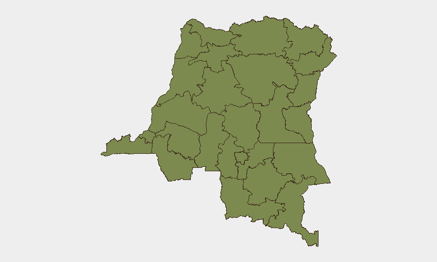
Kinshasa dominates the risk profile (34.2 composite score)—nearly 2.2× the second-ranked province—driven by dense urban population, government/diplomatic concentration, and criminal activity. Eastern provinces form a secondary but volatile tier: Ituri (15.4) and Tshopo (11.7) remain active conflict zones with armed-group presence, while North Kivu (4.2, lower-ranked but operationally significant) hosts ongoing clashes and displacement. All other provinces cluster at 4.2, indicating either lower activity or data sparseness. The capital's outsized risk score reflects its strategic and population density; eastern risk is qualitatively distinct—militia activity, transnational weapons flows, and humanitarian emergencies—making regional presence substantially higher-friction than Kinshasa operations.
How GeoBit Would Assist
Corporate security and duty-of-care teams should deploy AOI Monitoring & Early Warning on Kinshasa (capital operations), Ituri, and North Kivu to detect displacement spikes, armed-group movement, or border crossing anomalies in real time. Intel Sweep with X/Telegram & multi-language OSINT would provide early signals of conflict escalation, health/travel restrictions, or regional diplomatic shifts affecting supply chains and personnel safety. Routing & Network Analysis combined with conflict & military mapping enable secure journey planning and dynamic rerouting around active clashes (Walikale/Masisi) and disease-control zones.
7-Day Outlook
Eastern instability (Ituri, North Kivu) is expected to persist; no deescalation signals present. Ebola restrictions may tighten or ease depending on epidemiological trends—monitor Uganda border closely. Kinshasa likely remains operationally stable but exposed to upstream spillover if regional tensions (Chad/US/MEDINA signals) escalate into proxy activity. Recommend continuous monitoring of health alerts and armed-group repositioning in the Upper Uele–Maniema corridor.
Highest-Risk Areas — Ranked
| # | State / Region | Risk |
|---|---|---|
| 1 | Kinshasa | 34.2 |
| 2 | Ituri | 15.4 |
| 3 | Tshopo | 11.7 |
| 4 | Maniema | 4.2 |
| 5 | Sud-Ubangi | 4.2 |
| 6 | Équateur | 4.2 |
| 7 | Nord-Ubangi | 4.2 |
| 8 | Mongala | 4.2 |
| 9 | Lower Uele | 4.2 |
| 10 | Tshuapa | 4.2 |
| 11 | Upper Uele | 4.2 |
| 12 | North Kivu | 4.2 |
Sources
Previous Daily Briefs
A new DR Congo brief is written every day — each with its own risk map and downloadable CSV. Here's the last week; use the calendar to go further back.
📅 Browse every day by calendar →
Highlighted days have a brief. Tap a day for that day's map & analysis, or “csv” for that day's dataset ($5).