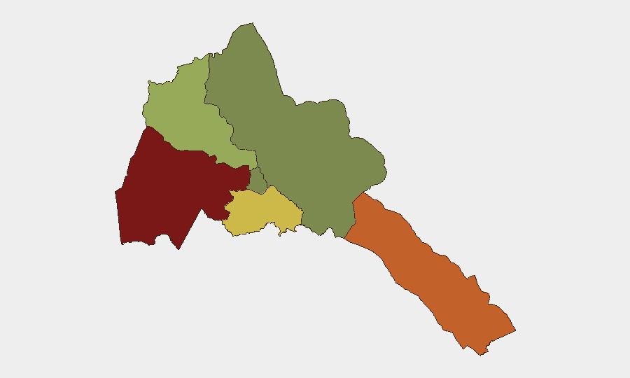
Situation Summary
Eritrea itself remains calm and stable, with no recorded internal security incidents in the current monitoring window. However, regional conflict dynamics—specifically renewed heavy fighting in adjacent Western Tigray Zone (Ethiopia) on 1–3 August—have elevated cross-border spillover risk and underscore ongoing Eritrean military involvement in the broader Ethiopia–Tigray conflict. Unconfirmed reporting suggests Eritrean military personnel were present in Tigray on 2 August. Australian official travel advisories now recommend reconsidering all travel to Eritrea due to potential conflict with neighboring states.
Key Developments
- Shererina area (Western Tigray Zone / Sudan border, ~50–80 km south of Eritrea) – 1–3 August 2026: Heavy clashes between Ethiopian federal forces and TPLF-linked units erupted early Friday 1 August and continued for approximately 23 hours. Artillery and drone strikes were reported. This contested region is adjacent to historical Eritrean military operational areas, raising direct spillover risk for Eritrea-border travel and operations.
- Tigray authorities statement – 1–2 August 2026: Tigray regional officials publicly characterized fighting around Shererina as an "open war" and attributed the offensive to the Ethiopian federal government, citing a Friday-morning start time. This escalatory language signals entrenchment of military positions and reduced near-term de-escalation likelihood in the adjacent border zone.
- Unconfirmed Eritrean military presence in Tigray – 2 August 2026: A single social-media report claimed Eritrean regime military commanders entered Tigray and were "warmly welcomed" by TPLF-affiliated networks on 2 August. No mainstream confirmation has been obtained; treat as unverified but operationally relevant if corroborated.
- Alleged Eritrean support to TPLF – late July–early August 2026: Recent Ethiopian government and analysis commentary assert that a "belligerent faction" within the TPLF has been "directly supported" by the Eritrean government in recruitment, training, and arms provision. While not a discrete incident, these statements confirm ongoing Eritrean security alignment with anti-federal actors in the region.
- Heavy weapons movement toward Tigray southern border – early August 2026: Open-source reporting notes military equipment being repositioned toward the southern flank of Tigray operations, consistent with a broader military build-up in northern Ethiopia where Eritrean involvement has been documented historically and alleged recently.
Highest-Risk Areas
Gash-Barka Region (risk 92) and Southern Red Sea Region (risk 75) carry the highest sub-national threat profiles, reflecting direct adjacency to the active Tigray conflict zone and Sudan border instability. Debub Region (risk 68) faces secondary risk from potential spillover and military movement corridors. Maekel Region, containing the capital Asmara, and the Northern Red Sea Region show significantly lower risk profiles. The elevation in Gash-Barka and Southern Red Sea reflects not internal Eritrean instability but cross-border military activity and potential for rapid escalation if fighting in Tigray expands westward or northward toward the Eritrea–Ethiopia border.
How GeoBit Would Assist
Security teams should deploy AOI Monitoring & Early Warning on the Gash-Barka border corridor and Southern Red Sea Region to detect military movement, force staging, and cross-border activity in real time. Conflict & Military intelligence (force structure, weapons tracking, battle mapping) and Satellite & Imagery analysis would provide continuous assessment of military build-ups and operational readiness. Multi-language OSINT Fusion (social media, regional media, signals) enables rapid corroboration of unconfirmed reports like the 2 August Eritrean military presence claim and early detection of escalation signals.
7-Day Outlook
Heavy fighting in Western Tigray is likely to persist or cycle for at least one week given the stated military commitment by both sides and the absence of active mediation. Eritrean military involvement in supporting anti-federal actors will remain covert or ambiguous unless major cross-border operations commence. Risk of rapid escalation into Eritrean territory remains low but non-negligible; organizations with personnel in Gash-Barka and Southern Red Sea regions should maintain heightened situational awareness and contingency protocols.
Highest-Risk Areas — Ranked
| # | State / Region | Risk |
|---|---|---|
| 1 | Gash-Barka | 92 |
| 2 | Southern Red Sea Region | 75 |
| 3 | Debub Region | 68 |
| 4 | Anseba | 55 |
| 5 | Maekel Region | 18 |
| 6 | Northen Red Sea Region | 0 |
Sources
Previous Daily Briefs
A new Eritrea brief is written every day — each with its own risk map and downloadable CSV. Here's the last week; use the calendar to go further back.
📅 Browse every day by calendar →
Highlighted days have a brief. Tap a day for that day's map & analysis, or “csv” for that day's dataset ($5).
Atlas — our AI intelligence desk — emails them this snapshot personally. Nothing else, no list.