Situation Summary
Gabon remains a low-threat environment globally (#99 composite threat score) with no credible reports of large-scale violence, armed clashes, or civil unrest in the last 24–48 hours. However, authorities have imposed a nationwide social media shutdown as of 14 July, citing security concerns and risks of misinformation-driven instability—a significant indicator that the government perceives elevated risk of information-driven unrest. Scattered incidents of domestic violence, traffic accidents, and police investigations in provincial cities do not constitute systemic security breakdown, but reflect ongoing law-enforcement activity and localized safety concerns.
Key Developments
- 14 July, Libreville (nationwide) – Gabon's High Authority for Communication ordered telecom operators to block WhatsApp, Facebook, Instagram, and TikTok "until further notice," citing threats to national security, social cohesion, and the spread of conflict-related misinformation and hateful speech. This is the only confirmed national-level security measure announced in the reporting window and signals heightened official sensitivity to destabilizing information flows.
- 13 July, Franceville–Okondja road, Haut‑Ogooué (PK 30) – A serious traffic accident occurred around 10:00 on the inter-provincial corridor linking Haut‑Ogooué to Ogooué‑Lolo, highlighting overland transit risks on regional routes.
- 12 July, Franceville, Haut‑Ogooué (La Caisse neighborhood) – A 42-year-old woman died suddenly at home; provincial police have opened an investigation into the circumstances, indicating ongoing law-enforcement activity in the province.
- Recent (date imprecise), Franceville, Haut‑Ogooué (Awai neighborhood) – A domestic violence incident required active intervention by security forces and emergency services near the Sino‑Gabonese public school, reflecting localized household-level violence and emergency-response capacity demands.
- 6 July, Moanda, Haut‑Ogooué – The body of a 57-year-old woman was discovered in the Cité Ekayi neighborhood, triggering police investigation and ongoing public-safety concern in the municipality.
- 8 July, Libreville – Former tourism minister Pascal Ogowe Siffon was released from the national penitentiary; a politically relevant justice development with potential bearing on regime-stability commentary.
Highest-Risk Areas
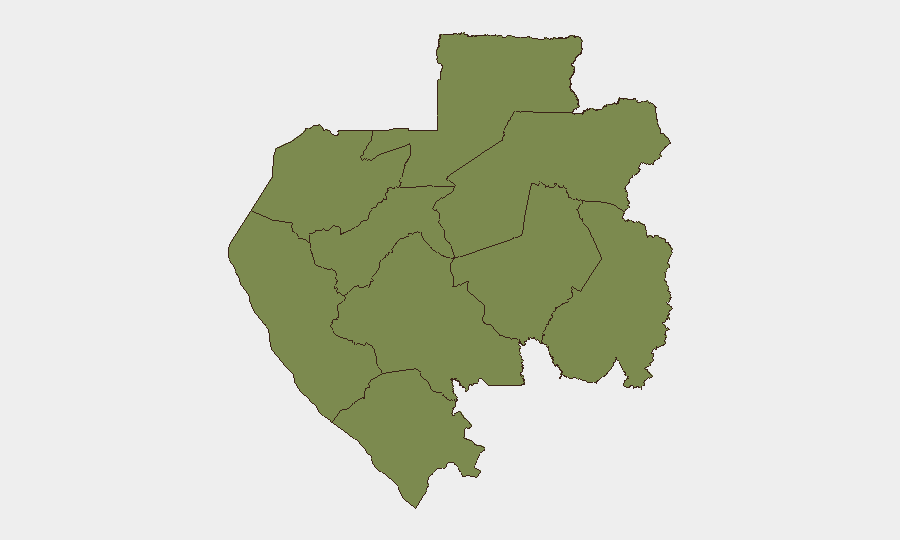
Ogooué‑Lolo Province dominates the sub-national risk ranking at 32.2—substantially higher than all others—driven by military mobilization and conventional military force events recorded on 12–13 July. Estuaire Province (7.2), which includes the capital and primary economic hub Libreville, carries the second-highest risk, likely reflecting the social media shutdown and associated information-control measures. The remaining provinces cluster at 2.2 or lower, indicating no distributed high-risk zones; risk is geographically concentrated in the southeast (Ogooué‑Lolo) and coastal northwest (Estuaire), with provincial incidents in Haut‑Ogooué reflecting routine law-enforcement activity rather than systemic instability.
How GeoBit Would Assist
Corporate teams managing personnel or assets in Gabon should deploy AOI Monitoring & Early Warning to track Ogooué‑Lolo and Estuaire provinces for evolving military activity and information-control escalation, with X/Twitter OSINT and multi-language search to monitor local and diaspora commentary on the social media shutdown and its duration. Routing & Network Analysis can identify secure inter-provincial travel corridors and real-time hazard avoidance on roads like the Franceville–Okondja axis. Conflict & Military force-structure tracking will clarify the nature and scale of the military mobilization events reported on 12–13 July.
7-Day Outlook
The social media shutdown is likely to persist for at least several days pending government review of unrest risk or political conditions. No credible intelligence indicates imminent escalation to large-scale civil unrest, but the information blackout itself may complicate real-time situational awareness for international operators. Continued monitoring of Ogooué‑Lolo military activity and official statements on the shutdown duration is essential.
Highest-Risk Areas — Ranked
| # | State / Region | Risk |
|---|---|---|
| 1 | Ogooué-Lolo Province | 32.2 |
| 2 | Estuaire Province | 7.2 |
| 3 | Ogooué-Ivindo | 2.2 |
| 4 | Moyen-Ogooué Province | 2.2 |
| 5 | Ngounié Province | 2.2 |
| 6 | Nyanga Province | 2.2 |
| 7 | Haut-Ogooué Province | 2.2 |
| 8 | Woleu-Ntem | 2.2 |
| 9 | Ogooué-Maritime Province | 2.2 |
Sources
Previous Daily Briefs
A new Gabon brief is written every day — each with its own risk map and downloadable CSV. Here's the last week; use the calendar to go further back.
📅 Browse every day by calendar →
Highlighted days have a brief. Tap a day for that day's map & analysis, or “csv” for that day's dataset ($5).
Atlas — our AI intelligence desk — emails them this snapshot personally. Nothing else, no list.