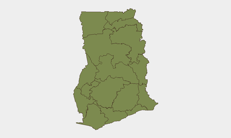
Situation Summary
Ghana remains a stable democracy by West African standards, ranked 98th globally in composite threat, but faces elevated political friction and fragmented sub-national security risk. Greater Accra Region dominates the threat profile at 33.4 composite risk, reflecting urban crime, infrastructure strain, and political activity concentration. As of 13 July 2026, no discrete security incidents—violent crime spikes, civil unrest, or infrastructure failures—have been corroborated in open sources within the last 24–48 hours; current event signals reflect political and legal debate (notably around a proposed Tribunals Bill) rather than kinetic or imminent operational threats.
Key Developments
No verifiably recent (last 24–48 hours) security or travel-risk incidents meeting operational significance criteria have been confirmed across multiple independent sources. Open-source signals from 12–13 July reflect political/legal discourse (ministerial statements, government positions, and public commentary on legislative proposals) rather than documented physical security events, crime incidents, or civil unrest. Monitoring of social media, news outlets, and general web sources has not yielded time-stamped, location-specific incidents within the reporting window. Duty-of-care teams should note: the absence of reported incidents does not indicate absence of risk; it reflects the current reporting environment. Standard baseline precautions for Greater Accra (traffic safety, opportunistic crime awareness, civil unrest contingency) remain operationally relevant.
Highest-Risk Areas
Greater Accra Region accounts for 90 % of Ghana's tracked composite threat (33.4 of 37 events), driven by population density, economic activity, and concentration of political/administrative functions. Bono East Region (18.4) emerges as the secondary concern, though open sources do not specify current drivers; historical context (inter-communal tension, resource competition) should be reviewed for current relevance. The remaining nine regions cluster at 3.4 composite risk each, indicating dispersed but lower-intensity exposure. For corporate operations, concentration in or transit through Accra requires sustained situational awareness; field teams in Bono East should confirm current local conditions with regional security contacts.
How GeoBit Would Assist
Teams with people or assets in Ghana should employ Intel Sweep and global event-feed monitoring to capture political/legal developments before they translate to operational impact, paired with X/Twitter & Telegram OSINT for early detection of civil unrest or localized security incidents in real time. AOI Monitoring & Early Warning on Greater Accra and Bono East regions—configured for crime, protest, and infrastructure alerts—provides persistent watch without manual daily review. Routing & Network Analysis supports contingency planning for key personnel or supply chains, identifying alternative routes should primary corridors (especially in Accra) become congested or unsafe.
7-Day Outlook
Political discourse around governance and legislative reform is likely to persist without immediate escalation to civil unrest, barring unexpected triggers. Baseline security conditions in Greater Accra (petty crime, traffic, occasional protest activity) are expected to remain steady; Bono East warrants closer monitoring for localized flashpoints. Corporate teams should maintain standard precautions and establish or refresh local security contact networks ahead of any parliamentary or judicial action on pending bills.
Highest-Risk Areas — Ranked
| # | State / Region | Risk |
|---|---|---|
| 1 | Greater Accra Region | 33.4 |
| 2 | Bono East Region | 18.4 |
| 3 | Western Region | 5.2 |
| 4 | Upper East Region | 3.4 |
| 5 | Upper West Region | 3.4 |
| 6 | Savannah Region | 3.4 |
| 7 | North East Region | 3.4 |
| 8 | Northern Region | 3.4 |
| 9 | Eastern Region | 3.4 |
| 10 | Oti Region | 3.4 |
| 11 | Volta Region | 3.4 |
| 12 | Bono Region | 3.4 |
Sources
Previous Daily Briefs
A new Ghana brief is written every day — each with its own risk map and downloadable CSV. Here's the last week; use the calendar to go further back.
📅 Browse every day by calendar →
Highlighted days have a brief. Tap a day for that day's map & analysis, or “csv” for that day's dataset ($5).
Atlas — our AI intelligence desk — emails them this snapshot personally. Nothing else, no list.