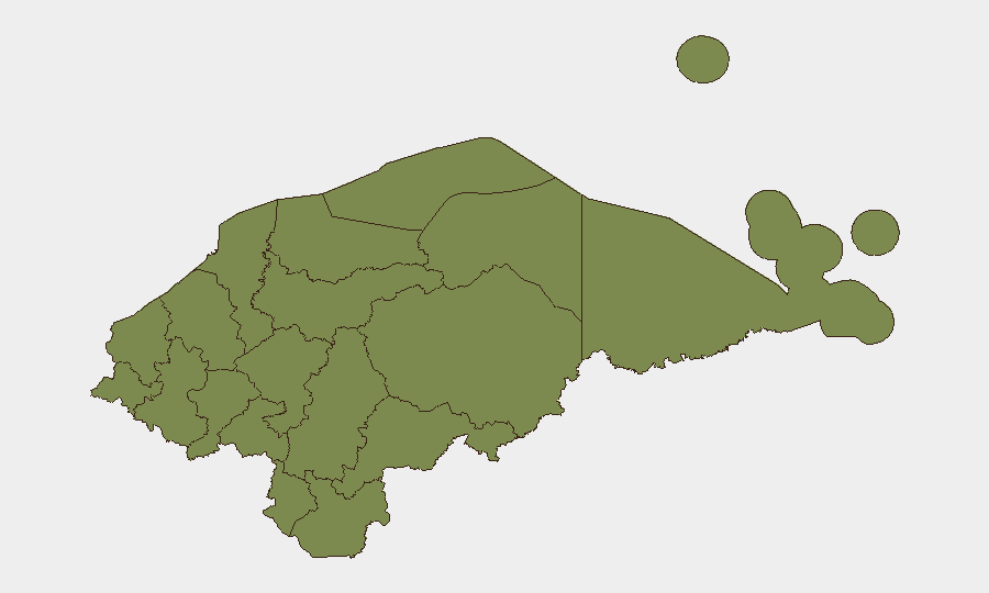
Situation Summary
Honduras remains under a state-of-exception framework with composite national threat score of 18, driven by persistent violent crime, organized extortion targeting transport and commerce, and localized gang activity. The past 48 hours show a pattern of reactive public protest against insecurity, targeted homicides in secondary cities, and police enforcement operations, with no indication of immediate destabilization but sustained operational risk across urban corridors. Travel-risk guidance for northern departments and coastal zones remains at elevated levels due to drug-trafficking violence and land disputes.
Key Developments
- 31 July, Tegucigalpa – Transport workers staged a partial service stoppage and protest following the assassination of a bus driver on the Mateo–Tapias route; extortion and violent attacks on drivers remain a recurring flashpoint for labor unrest in the capital.
- 31 July, Tegucigalpa (southern exit) – Public protest held under the "Honduras sin seguridad" banner by local activist Dr. Floridalia Aguilar, drawing media attention to citizen frustration over persistent insecurity and inadequate state protection.
- 30–31 July, Choluteca city (Las Colinas neighborhood) – Two women fatally shot in what local media characterized as a targeted multi-gunman attack, reinforcing official warnings about elevated violent-crime levels in the department.
- 31 July–1 August, multiple urban areas – National Police reported arrests linked to armed robbery, extortion, and gang activity as part of state-of-exception enforcement; specific street-level details limited in available reporting.
- 31 July–1 August, Tegucigalpa and San Pedro Sula corridors – Short-lived protest roadblocks and burning debris reported on main highway approaches; no major clashes but temporary traffic disruption noted.
- 31 July–1 August, Gracias a Dios, Colón, Olancho, Yoro – Updated foreign-government advisories reiterated "Do Not Travel" warnings citing recent drug-smuggling and land-dispute violence, with roadblocks and armed incidents in rural areas including Aguán valley near Trujillo.
- Last 48 hours, La Ceiba – Armed robberies and homicides reported in coastal urban zones; travel guidance reinforces use of secure lodging and avoidance of nighttime movement outside resort areas.
Highest-Risk Areas
Bay Islands (31.3), Atlántida (23.8), and Francisco Morazán (23.8) carry the highest composite risk scores. Bay Islands faces maritime trafficking and organized crime; Atlántida includes La Ceiba and coastal zones with elevated armed-robbery and homicide risk; Francisco Morazán encompasses Tegucigalpa and its metropolitan transport corridors, where extortion, gang activity, and public unrest create operational friction. All remaining departments score 1.3, indicating a stark concentration of mapped risk in three coastal/capital regions.
How GeoBit Would Assist
GeoBit's Intel Sweep and X/Twitter OSINT capabilities provide real-time monitoring of protest activity, police operations, and emerging crime signals across Tegucigalpa, San Pedro Sula, and coastal hubs. AOI Monitoring with persistent area-of-interest watch on Francisco Morazán, Atlántida, and Gracias a Dios enables early warning of roadblocks, transport disruptions, or armed incidents affecting staff and asset movement. Routing & Network Analysis generates alternative journey planning around high-risk corridors and protest zones, supporting duty-of-care compliance for personnel in transit.
7-Day Outlook
Protest activity and police enforcement are likely to continue at current levels through early August as labor and civil-society groups voice insecurity concerns. Northern departments and maritime routes remain vulnerable to trafficking-related violence and roadblock incidents; capital and secondary-city routes should be monitored for intermittent transport disruption. No immediate escalation to armed conflict or regime instability is apparent, but operational friction and crime-driven closure of certain routes will persist.
Highest-Risk Areas — Ranked
| # | State / Region | Risk |
|---|---|---|
| 1 | Bay Islands | 31.3 |
| 2 | Atlántida | 23.8 |
| 3 | Francisco Morazán | 23.8 |
| 4 | El Paraíso | 1.3 |
| 5 | Copán | 1.3 |
| 6 | Ocotepeque | 1.3 |
| 7 | Cortés | 1.3 |
| 8 | Yoro | 1.3 |
| 9 | Santa Bárbara | 1.3 |
| 10 | Lempira | 1.3 |
| 11 | Intibucá | 1.3 |
| 12 | Comayagua | 1.3 |
Sources
Previous Daily Briefs
A new Honduras brief is written every day — each with its own risk map and downloadable CSV. Here's the last week; use the calendar to go further back.
📅 Browse every day by calendar →
Highlighted days have a brief. Tap a day for that day's map & analysis, or “csv” for that day's dataset ($5).
Atlas — our AI intelligence desk — emails them this snapshot personally. Nothing else, no list.