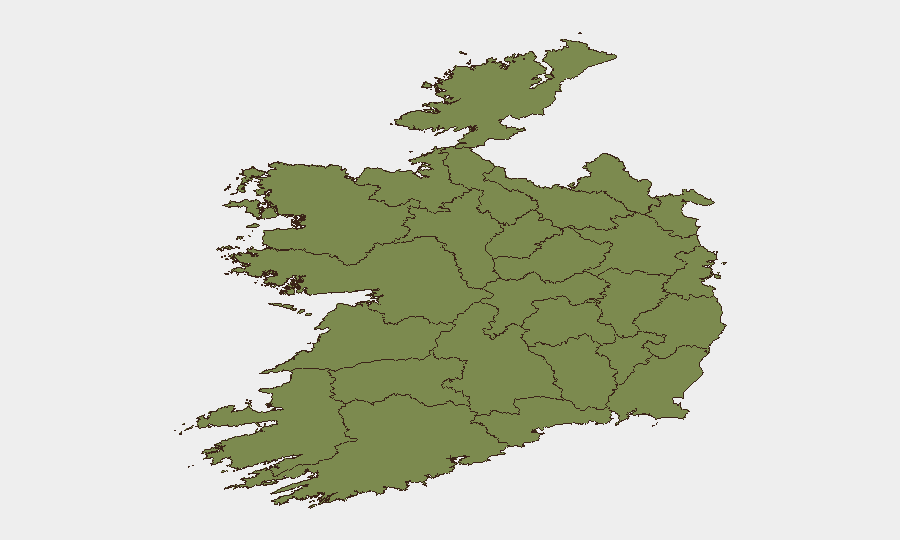
Situation Summary
Ireland's overall security environment remains stable, with a composite threat score of 6 (global rank #135) and no acute, multi-source security crises reported in the past 24–48 hours. County Tipperary significantly elevates the national risk profile (composite score 31.5), while Dublin and smaller clusters in Clare and Westmeath present localized concern. The security posture is routine, characterized by standard police activity, political-institutional developments, and maritime rescue operations, with no verified civil unrest, major crime, or infrastructure disruption at national scale.
Key Developments
- Moygashel, County Tyrone (Northern Ireland) – 7–9 July: Police Service of Northern Ireland (PSNI) conducting sustained high-visibility patrolling and surveillance around a bonfire site and residential estates ahead of Twelfth-related events. No confirmed violent incidents or disorder in the same window, but elevated police presence signals preventive posture in an area with historical tension around race-hate displays.
- National political messaging – 8 July: Ireland announced its Presidency priorities for the Council of the European Union, emphasizing "competitiveness, values and security." This is institutional signaling rather than a response to acute crisis; it reflects ongoing security policy emphasis.
- Coastal rescue operations – 8–9 July: Royal National Lifeboat Institution (RNLI) reports multiple lifeboat callouts across Irish coasts in the past 24 hours. Routine maritime-safety activity; localized impact on small-craft and coastal-zone travel risk.
- Republic of Ireland – 7–9 July: No confirmed major crime, civil unrest, or infrastructure disruption reported. Baseline security environment stable at routine levels.
- Northern Ireland baseline – through 9 July: No verified new physical-security incidents, attacks, or major disorder in the past 24–48 hours. Preventive policing (as noted in Moygashel) reflects management of existing tensions rather than escalation.
Highest-Risk Areas
County Tipperary drives national risk disproportionately (score 31.5 versus Ireland's composite 6), indicating concentrated criminal, civil-order, or organized-activity concerns in that region. Dublin's secondary risk (9.8) reflects its scale, density, and baseline criminality. Clare, Westmeath, Kilkenny, and Louth follow at lower but measurable scores. Northern Ireland's Moygashel operation and the broader Tyrone area remain subject to sectarian-tension baselines and preventive security operations, particularly around sensitive dates (Twelfth period). Teams with personnel or assets in Tipperary should apply elevated due diligence; Dublin remains a major city with standard metropolitan crime and policing activity.
How GeoBit Would Assist
Security teams should deploy AOI (Area of Interest) Monitoring & Early Warning on Tipperary, Dublin, and Moygashel to capture emerging incidents, police activity, and social-media indicators of tension before they escalate. OSINT fusion (X/Twitter, Telegram, YouTube, multi-language search) provides real-time detection of local activism, community statements, and organized-group coordination in high-risk counties. Risk & Threat Assessment and Conflict & Military modules contextualize policing posture, sectarian calendars (Twelfth events), and organized-crime patterns to refine travel routing and duty-of-care protocols for staff in Tipperary and Northern Ireland.
7-Day Outlook
Twelfth-period policing and commemoration events in Northern Ireland will sustain elevated PSNI visibility through mid-July; no major escalation is currently forecast, but preventive operations may create localized congestion and access restrictions. Tipperary's elevated baseline risk is expected to persist; no imminent major incident is signaled by current OSINT, but routine crime and organized-activity monitoring should remain active. Overall trajectory is stable, absent external economic, political, or cross-border shocks.
Highest-Risk Areas — Ranked
| # | State / Region | Risk |
|---|---|---|
| 1 | County Tipperary | 31.5 |
| 2 | County Dublin | 9.8 |
| 3 | County Clare | 3.7 |
| 4 | County Westmeath | 3.2 |
| 5 | County Kilkenny | 2 |
| 6 | County Louth | 2 |
| 7 | County Mayo | 1.5 |
| 8 | County Sligo | 1.5 |
| 9 | County Galway | 1.5 |
| 10 | County Limerick | 1.5 |
| 11 | County Donegal | 1.5 |
| 12 | County Leitrim | 1.5 |
Sources
Previous Daily Briefs
A new Ireland brief is written every day — each with its own risk map and downloadable CSV. Here's the last week; use the calendar to go further back.
📅 Browse every day by calendar →
Highlighted days have a brief. Tap a day for that day's map & analysis, or “csv” for that day's dataset ($5).
Atlas — our AI intelligence desk — emails them this snapshot personally. Nothing else, no list.