Situation Summary
Mauritius remains a low-threat jurisdiction globally (composite threat score 3) with no tracked security events in the current reporting window. However, sub-national risk concentration in Port Louis and surrounding districts reflects underlying vulnerabilities in urban crime, undocumented migration, and organized activity. The security picture is stable but localized, with risk heavily skewed toward the capital and northern commercial zones.
Key Developments
Note: GeoBit's live research did not corroborate discrete incidents within the last 24–48 hours (as of 2026-08-03). The most recent verifiable reporting dates to 2026-07-27–28 and falls outside the current brief window.
Background context (July 2026): Northern Mauritius police operations resulted in 69 arrests including 23 undocumented foreign nationals; southern operations (Operation Colombo) yielded 27 arrests of undocumented migrants. A violent altercation and police search in Résidence Tôle, Mahébourg (2026-07-27) resulted in Rs 167,575 seized. These incidents underline persistent challenges with irregular migration and street-level crime in Port Louis, Grand Port, and Black River districts, but do not constitute developments in the current 48-hour window.
Highest-Risk Areas
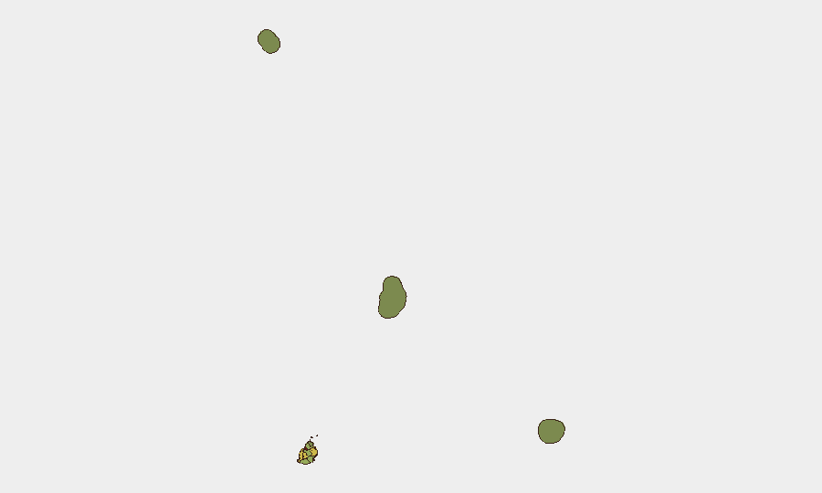
Port Louis dominates the risk profile (score 92), driven by volume of commercial activity, migrant populations, and law-enforcement response intensity. Plaines Wilhems (68) and Black River (65) follow, reflecting secondary urban centers and informal settlement concentrations. Flacq and Grand Port (62, 58) show moderate elevation linked to port operations, maritime trade, and transient populations. Risk tapers sharply beyond the six northern and central districts, with Rodrigues and offshore territories (Saint Brandon, Agaléga) presenting minimal threat signatures. Corporate assets and personnel should assume heightened exposure in Port Louis commercial and harbor zones.
How GeoBit Would Assist
AOI Monitoring & Early Warning would establish persistent watch over Port Louis commercial districts, port facilities, and identified migrant-concentration areas, with real-time alerting on police operations, street incidents, or supply-chain disruptions. OSINT fusion (Twitter, Telegram, local news aggregation, sentiment analysis) would flag emerging crime clusters, labor unrest, or organized activity before they escalate to headline incidents. GIS & Spatial Analysis would map hazard concentrations by district and refine duty-of-care routing for personnel, identifying safer transit corridors and time-windows in high-risk zones.
7-Day Outlook
No imminent security escalation is forecast. Mauritius is expected to remain below global and regional threat baselines, with risk containment to localized urban crime and irregular-migration management. Seasonal patterns and regional stability in the Indian Ocean suggest the security environment will persist at current levels absent external geopolitical or economic shock. Corporate teams should maintain routine monitoring protocols and situational awareness in Port Louis, but heightened alert posture is not warranted.
Highest-Risk Areas — Ranked
| # | State / Region | Risk |
|---|---|---|
| 1 | Port Louis | 92 |
| 2 | Plaines Wilhems | 68 |
| 3 | Black River | 65 |
| 4 | Flacq | 62 |
| 5 | Grand Port | 58 |
| 6 | Moka | 52 |
| 7 | Savanne | 48 |
| 8 | Pamplemousses | 45 |
| 9 | Rivière du Rempart District | 38 |
| 10 | Rodrigues | 22 |
| 11 | Saint Brandon | 8 |
| 12 | Agaléga | 5 |
Sources
Previous Daily Briefs
A new Mauritius brief is written every day — each with its own risk map and downloadable CSV. Here's the last week; use the calendar to go further back.
📅 Browse every day by calendar →
Highlighted days have a brief. Tap a day for that day's map & analysis, or “csv” for that day's dataset ($5).
Atlas — our AI intelligence desk — emails them this snapshot personally. Nothing else, no list.