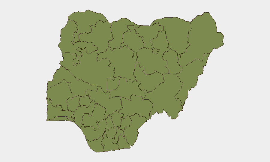
Situation Summary
Nigeria's security environment remains volatile across multiple threat vectors—kidnapping, banditry, and suspected insurgent activity—with incident frequency rising and geographic dispersion widening. The recent Senate approval of a state police bill has triggered institutional debate that may alter policing capacity and governance incentives in unpredictable ways, creating near-term uncertainty around security effectiveness. Road corridors, particularly in the South-South and North-West zones, remain high-risk for abduction; urban centers face crowd-related and politically-linked risks. The overall national threat ranking (#30 globally, composite score 63) reflects persistent, distributed rather than acute centralized crisis.
Key Developments
- Benin–Auchi Road, Edo State – June 27: Police rescued 11 kidnap victims following a tracked operation against bandit camps; ongoing patrols and forest clearances indicate sustained gang activity on this corridor.
- Kwara State – June 27: Video evidence circulated of suspected terrorists arrested by security agencies, prompting civil society concern over terror-cell spread into traditionally lower-risk regions and accountability gaps.
- National – June 27: Senate approval of a state police bill has triggered expert warnings that decentralized policing may be exploited by powerful governors and could intensify politically-motivated violence amid existing insecurity.
- National – June 27: Human rights organization *Nigerians Unite Against Terror* issued a public alert that insurgent groups are actively attempting to inflame ethnic and religious divisions, urging nationwide reporting of suspicious activity.
- Multiple States – June 27: Security commentators reported a spike in kidnapping, banditry, and insurgent attacks across multiple states, criticizing lack of intelligence-led operations and warning of worsening travel and investment risk in affected areas.
Highest-Risk Areas
Lagos and Kaduna States dominate the sub-national risk ranking (33.2 and 33, respectively), driven by population density, economic activity, and road-network vulnerability in Lagos, and by North-West banditry and kidnapping in Kaduna. Oyo State (30.4) faces a similar mix of urban insecurity and corridor-based banditry. Anambra State (17.7) reflects South-East criminal activity and kidnapping-for-ransom patterns. Borno State (12.7), despite its history of insurgency, currently ranks lower—likely due to reduced open conflict intensity, though the presence of non-state armed groups remains persistent. The Benin–Auchi corridor (Edo State) and routes connecting North-West military installations show elevated current incident density.
How GeoBit Would Assist
A corporate security team operating in Nigeria would employ AOI Monitoring & Early Warning on high-risk corridors (Lagos–Ibadan, Abuja–Kaduna, Benin–Auchi) to detect kidnapping patterns and roadblock activity in near-real-time. Routing & Network Analysis would support duty-of-care teams in identifying safer alternative routes and timing guidance for essential travel. OSINT fusion (X/Twitter, Telegram, local broadcast sources, radio SIGINT) would provide continuous sentiment analysis and emerging threat signals from civil society, security commentators, and actor networks—particularly around the state police bill implementation and ethnic/religious flashpoints flagged by human rights groups. Combined with conflict mapping and entity/actor network analysis, this would enable predictive alerting on governance-driven violence risks.
7-Day Outlook
The state police bill will likely drive continued political debate and local mobilization, creating secondary protest and crowd-risk events in state capitals and Abuja through early July. Kidnapping and banditry on road corridors are expected to persist at current or slightly elevated levels pending the outcome of ongoing security force operations in Edo and Kwara. Sentiment among civil society and media remains skeptical of federal security effectiveness, which may accelerate local vigilante activity and complicate operational environment predictability in rural zones.
Highest-Risk Areas — Ranked
| # | State / Region | Risk |
|---|---|---|
| 1 | Lagos State | 33.2 |
| 2 | Kaduna State | 33 |
| 3 | Oyo State | 30.4 |
| 4 | Anambra State | 17.7 |
| 5 | Federal Capital Territory | 15.8 |
| 6 | Sokoto State | 14.8 |
| 7 | Kano State | 13.7 |
| 8 | Borno State | 12.7 |
| 9 | Kogi State | 12.3 |
| 10 | Delta State | 9.1 |
| 11 | Ogun State | 9 |
| 12 | Rivers State | 7.6 |
Sources
Previous Daily Briefs
A new Nigeria brief is written every day — each with its own risk map and downloadable CSV. Here's the last week; use the calendar to go further back.
📅 Browse every day by calendar →
Highlighted days have a brief. Tap a day for that day's map & analysis, or “csv” for that day's dataset ($5).