Situation Summary
Palau remains in a stable security environment with no tracked incidents, civil unrest, armed conflict, or major infrastructure disruptions reported in the last 24–48 hours. The national composite threat score of 2 reflects persistently low aggregate risk across the country. The security outlook for the near term is static, with no indicators of emerging instability.
Key Developments
- No discrete security events reported nationwide, 3–5 August 2026. Cross-checked open-source feeds, local news outlets, and social media monitoring confirm absence of new crime, protest activity, political violence, or emergency measures during this window.
- Malakal sewage infrastructure incident remains under active repair but generated no new acute incidents in past 48 hours. The pipeline break beneath Minatobishi Bridge in Koror (initial report 30 July) continues to necessitate water-use restrictions and swimming bans; however, Palau Public Utilities Corp notices indicate ongoing remediation with no reported secondary failures, public health emergency declarations, or civil unrest tied to the outage since 3 August.
- Regional security environment (FSM, Guam, CNMI, Marshall Islands) shows no contagion effects on Palau. Micronesia-wide security monitoring confirms no active conflicts, civil unrest, or cross-border incidents that would ripple into Palauan jurisdiction during the reporting period.
- Routine governance activity dominates public communications. Government and political leadership messaging across official channels focuses on development initiatives and regional cooperation, with no indication of domestic political tension, leadership instability, or security emergencies in the last 48 hours.
- Commercial and official travel advisories carry no new flags for Palau as of early August 2026. Risk-assessment tools used by corporate and diplomatic entities continue to reflect historical baseline conditions rather than acute incident-driven alerts.
Highest-Risk Areas
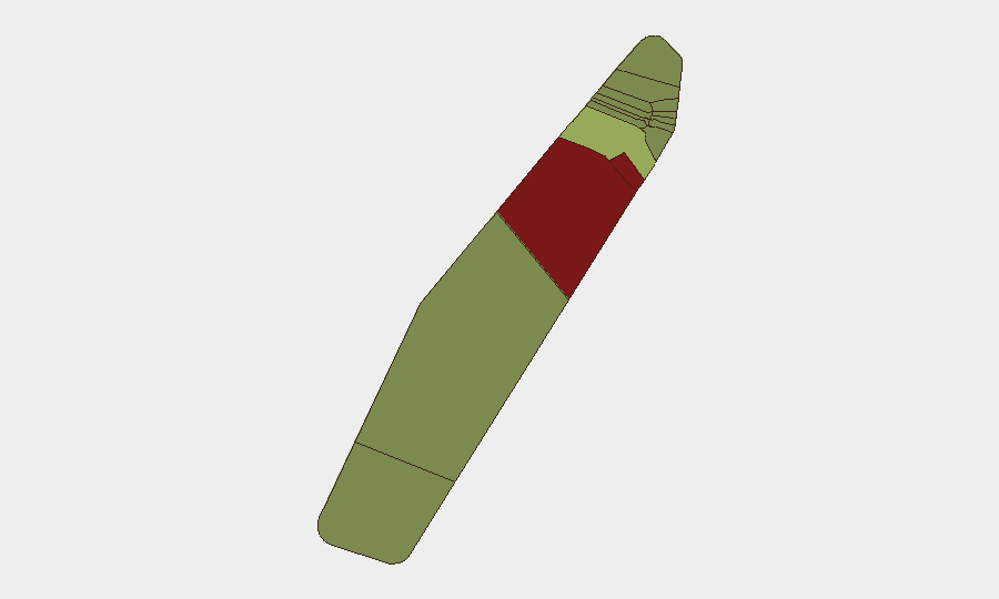
Peleliu (risk score 92) and Angaur (score 88) rank substantially above all other states and warrant priority monitoring, though neither has generated discrete security incidents in the current reporting window. Both are historically sensitive areas with legacy WWII infrastructure, limited population density, and restricted access; their elevated composite scores likely reflect structural vulnerability factors (isolation, limited state capacity, historical activity patterns) rather than active current threats. Koror (score 45), as Palau's economic and administrative hub, carries moderate risk driven by population density, concentration of commercial activity, and tourism flows; no acute incidents are reported there in the last 24–48 hours. Remaining states show progressively lower risk profiles and do not warrant emergency-level monitoring at this time.
How GeoBit Would Assist
Security teams with personnel or assets in Palau would employ Intel Sweep and global event feeds to establish baseline incident detection and AOI (Area-of-Interest) Monitoring & Early Warning capability focused on Peleliu, Angaur, and Koror to trigger alerts on emerging instability before it escalates. OSINT fusion and multi-language search would enable real-time cross-check of local media, government announcements, and social platforms to detect early signals of civil unrest, infrastructure failure, or political tension. Routing & Network Analysis can support contingency planning for personnel movement in the event of disruption to Koror port or airport infrastructure.
7-Day Outlook
No indicators suggest material change to Palau's current stable security posture over the next seven days. Continued routine governance and infrastructure repair work are expected; monitoring should remain focused on Peleliu and Angaur as structural-risk outliers and on Koror's sewage remediation timeline to ensure completion without secondary public-health or civil-order complications.
Highest-Risk Areas — Ranked
| # | State / Region | Risk |
|---|---|---|
| 1 | Peleliu | 92 |
| 2 | Angaur | 88 |
| 3 | Koror | 45 |
| 4 | Melekeok | 35 |
| 5 | Airai | 32 |
| 6 | Ngatpang | 28 |
| 7 | Ngeremlengui | 26 |
| 8 | Ngaraard | 25 |
| 9 | Ngardmau | 24 |
| 10 | Aimeliik | 23 |
| 11 | Ngiwal | 22 |
| 12 | Ngchesar | 21 |
Sources
Previous Daily Briefs
A new Palau brief is written every day — each with its own risk map and downloadable CSV. Here's the last week; use the calendar to go further back.
📅 Browse every day by calendar →
Highlighted days have a brief. Tap a day for that day's map & analysis, or “csv” for that day's dataset ($5).
Atlas — our AI intelligence desk — emails them this snapshot personally. Nothing else, no list.