Situation Summary
Papua New Guinea remains a composite-threat environment characterised by concentrated urban crime, maritime-transit risks, and emerging diplomatic tension. The National Capital District (Port Moresby) accounts for the majority of recorded security incidents, while outer provinces face acute hazards linked to inter-island travel, weather, and limited emergency response. Current trajectory shows elevated diplomatic rhetoric alongside persistent operational risk in transportation and urban centres, with no indication of rapid deterioration or improvement over the near term.
Key Developments
- East New Britain Province, Duke of York to Kokopo route – maritime disaster ongoing (18–26 July 2026). Two small boats capsized near Pigeon Island on 18 July, leaving 27 people (14 adults, 11 children, 2 unspecified) missing. Two skippers survived and are in police custody at Kokopo Police Station. Search operations by air and sea remain active; one vessel was later located capsized and drifting off Namatanai, New Ireland, with no survivors sighted. Bad weather has hampered recovery efforts.
- East New Britain authorities issue maritime safety advisory (24–26 July). Provincial Governor and disaster officials have publicly urged Duke of York and island communities to enforce weather checks, vessel-capability standards, and communication protocols on inter-island routes, citing persistent risk from rough seas, overloading, and limited search-and-rescue capacity.
- National Capital District / Diplomatic incident (25 July 2026). Multiple public statements on 25 July signal tension between Port Moresby, Beijing, Taipei, and Washington, including statements attributed to Papua New Guinea government vs. ambassadors, US vs. Port Moresby, and Beijing vs. ambassador. Taiwan reported a "reduce relations" statement. Exact substance remains unclear from open-source signals, but rhetoric intensity is elevated.
- Poliovirus alert ongoing. Circulating vaccine-derived poliovirus type 2 (cVDPV2) remains active in PNG; health authorities continue monitoring and response, though no discrete incident in the last 24–48 hours is reported.
- Military/Police power show (23 July 2026). RPNGC/military activity noted; no specific incident details available in current open sources, but linked to broader security posture in Port Moresby area.
Highest-Risk Areas
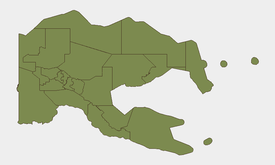
The National Capital District (Port Moresby) dominates the risk profile at 31.3, driven by persistent armed robbery, carjacking, violent assault, and gang activity in urban centres. Bougainville (11.3) retains elevated hazard linked to post-conflict instability and limited state authority. All other provinces cluster at 1.3, indicating low baseline recorded incident density, though East New Britain's current maritime crisis and weather-related transit hazards demonstrate that outer-province risks remain operationally significant despite low historical event counts. Port Moresby and Lae remain the primary focus for corporate security and duty-of-care protocols.
How GeoBit Would Assist
AOI Monitoring & Early Warning on Port Moresby, East New Britain, and Bougainville would detect emerging incidents (crime, civil unrest, maritime distress) with persistent area watch and alerting. Maritime & Aviation tracking combined with GIS & Spatial Analysis enables real-time route risk assessment for inter-island and coastal travel, critical for duty-of-care planning around weather, vessel status, and search-and-rescue proximity. Intel Sweep and multi-language OSINT on diplomatic channels would surface early signals of geopolitical tension (Beijing–Taipei–Washington–PNG) before it cascades into business interruption or visa/movement restrictions.
7-Day Outlook
East New Britain search operations will likely continue through early August with declining probability of survivor recovery; maritime advisory status will remain elevated. Diplomatic tensions may remain rhetorical or escalate to consular/trade friction; no imminent military or civil-order breakdown is signalled. Urban crime in Port Moresby is expected to remain at baseline elevated levels; no major incidents are forecast, but risk to expatriate movement and assets remains chronic.
Highest-Risk Areas — Ranked
| # | State / Region | Risk |
|---|---|---|
| 1 | National Capital District | 31.3 |
| 2 | Autonomous Region of Bougainville | 11.3 |
| 3 | Eastern Highlands | 1.3 |
| 4 | Gulf | 1.3 |
| 5 | Madang | 1.3 |
| 6 | Manus | 1.3 |
| 7 | West New Britain | 1.3 |
| 8 | New Ireland | 1.3 |
| 9 | East New Britain | 1.3 |
| 10 | Morobe | 1.3 |
| 11 | Central | 1.3 |
| 12 | Oro | 1.3 |
Sources
Previous Daily Briefs
A new Papua New Guinea brief is written every day — each with its own risk map and downloadable CSV. Here's the last week; use the calendar to go further back.
📅 Browse every day by calendar →
Highlighted days have a brief. Tap a day for that day's map & analysis, or “csv” for that day's dataset ($5).
Atlas — our AI intelligence desk — emails them this snapshot personally. Nothing else, no list.