Situation Summary
Peru remains at a composite threat score of 25 (rank #null globally) with 33 tracked events, characterized by chronic organized crime, localized natural disaster, and stable but constrained governance. The most significant near-term driver is the magnitude 5.1–5.5 earthquake that struck Junín region on 19 July, killing at least 6 and displacing ~300 residents, with active rescue operations ongoing. Nationally, no new large-scale civil unrest, armed conflict, or political crisis has emerged in the last 48 hours; risk remains anchored in persistent extortion and gang violence in Lima–Callao and pre-existing emergency measures.
Key Developments
- Chongos Bajo, Chupaca province, Junín region – 19 July 21:24 local time
Earthquake (M5.1–5.5, depth 24 km) killed at least 6 people, injured 21–30+, destroyed ~48 homes, damaged 18 others, and displaced ~300 residents now sheltered in tents. Follow-up magnitude 3.7 tremor reported; civil defense and emergency crews conducting active search and rescue operations for potential additional victims.
- Huascarán National Park, Áncash region – effective 20 July
Authorities closed park access for 15 days to support search and rescue operations for three missing mountaineers, restricting tourist and climbing activity in the area.
- Callao, Lima metropolitan area – evening 19 July
Public transport driver shot multiple times in targeted extortion-related attack while beginning shift, consistent with ongoing pattern of violent coercion against transit operators by criminal groups demanding protection payments.
- National assessment – 19–20 July
Multi-source review of 379 tracked events confirms no newly verified major armed clashes, large civil unrest, or cross-regional security escalation in the last 48 hours; existing emergency measures remain in effect in Lima–Callao and Trujillo–Virú (La Libertad) due to chronic crime.
- Urban Lima–Callao districts (Carabayllo, San Juan de Miraflores, Puente Piedra) – 19–20 July
No new major criminal incidents confirmed in the monitoring period; violent crime and extortion remain at baseline levels, continuing routine threat to residents and travelers.
Highest-Risk Areas
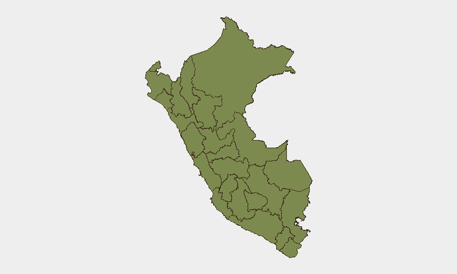
Ayacucho dominates sub-national risk at 31.3, reflecting historical gang and organized-crime dynamics and periodic unrest; Huánuco (14.8) and Ancash/Junín (both 9.3) follow, with Junín now amplified by the active earthquake emergency. Lima ranks significantly lower at 3.2 despite high urban crime, indicating that extortion and gang violence, while persistent, remain geographically fragmented rather than destabilizing. The concentration of risk in Andean and jungle regions reflects supply-chain vulnerabilities, weak state presence, and cartel-linked activity rather than imminent nationwide instability.
How GeoBit Would Assist
Security teams in Peru should employ AOI Monitoring & Early Warning to track Junín earthquake relief operations and detect secondary risks (aftershocks, landslides, supply-chain disruption); OSINT Fusion & Corroboration (social media, local news, civil defense bulletins) to validate emerging crime patterns in Lima–Callao and assess extortion escalation; and Risk & Threat Assessment linked to GIS & Spatial Analysis to map safe transit corridors for staff and assets in high-extortion zones. Early Warning & Prediction capabilities can flag emerging unrest or criminal activity shifts in Ayacucho and other high-risk regions before they broaden.
7-Day Outlook
Junín earthquake response will dominate immediate operational and media attention through late July; no immediate secondary political or civil-order crisis is forecast. Organized crime and extortion in Lima–Callao will continue at current baseline, with periodic localized incidents; standing emergency measures are expected to remain in effect. Risk trajectory remains stable without indicators of nationwide escalation, though cumulative effects of natural disaster and chronic crime warrant sustained monitoring in affected and transit zones.
Highest-Risk Areas — Ranked
| # | State / Region | Risk |
|---|---|---|
| 1 | Ayacucho | 31.3 |
| 2 | Huánuco | 14.8 |
| 3 | Ancash | 9.3 |
| 4 | Junín | 9.3 |
| 5 | Lambayeque | 8.7 |
| 6 | Lima | 3.2 |
| 7 | Apurímac | 1.9 |
| 8 | Tacna | 1.9 |
| 9 | Loreto | 1.3 |
| 10 | Tumbes | 1.3 |
| 11 | Piura | 1.3 |
| 12 | Amazonas | 1.3 |
Sources
Previous Daily Briefs
A new Peru brief is written every day — each with its own risk map and downloadable CSV. Here's the last week; use the calendar to go further back.
📅 Browse every day by calendar →
Highlighted days have a brief. Tap a day for that day's map & analysis, or “csv” for that day's dataset ($5).
Atlas — our AI intelligence desk — emails them this snapshot personally. Nothing else, no list.