Situation Summary
Somalia remains a high-consequence operating environment (global rank #9, composite threat score 96), with civil conflict and Al-Shabaab insurgency as primary drivers. As of 23 July 2026, no major kinetic incidents have been reliably corroborated in the last 24–48 hours; however, a cascade of secondary risks—fuel-price volatility, Puntland armed clashes, maritime crime, and critical infrastructure damage—are eroding stability and creating downstream humanitarian and commercial pressure. The threat landscape is characterised by underlying insurgent and criminal activity punctuated by periodic armed clashes, rather than sustained high-tempo conflict in this reporting window.
Key Developments
- Bakara Market fire, Mogadishu (21 July, early morning). Massive fire destroyed multiple businesses in the Abdalla Shideeye section of Mogadishu's largest commercial hub, causing extensive property damage and disrupting livelihoods and supply chains.
- Nationwide fuel-price spike (last 72 hours). Fuel prices doubled from ~$0.60 to $1.50 per litre, attributed to regional Middle East escalation. Secondary impacts include sharp increases in food and water prices, elevating humanitarian and social-stability risk.
- Puntland armed clashes, Bari region (20–21 July). Dervish forces and Puntland Security Force (PSF) engaged in armed clashes around Bosaso and Laag; Puntland authorities characterised these as a "planned security operation" to dismantle armed groups and assert territorial control in a key commercial hub.
- Hotel attack and vehicle hijacking, Qardho, Bari (21 July evening). Hotel Safari came under attack and a vehicle hijacking was reported the same evening; casualty and incident details remain incomplete but indicate elevated local security tensions.
- Maritime seizure/hijacking, Gulf of Aden–Somali waters (last 48 hours). A vessel transiting the Gulf of Aden was seized and moved into Somali territorial waters, classified as a hijacking and underscoring persistent piracy and maritime-crime risk.
- Somalia MFA condemnation of Houthi threats (22 July). Mogadishu issued an official statement condemning Houthi maritime threats against Saudi Arabia and actions undermining freedom of navigation and international trade, signalling concern over Red Sea/Gulf of Aden security implications for Somali shipping.
Highest-Risk Areas
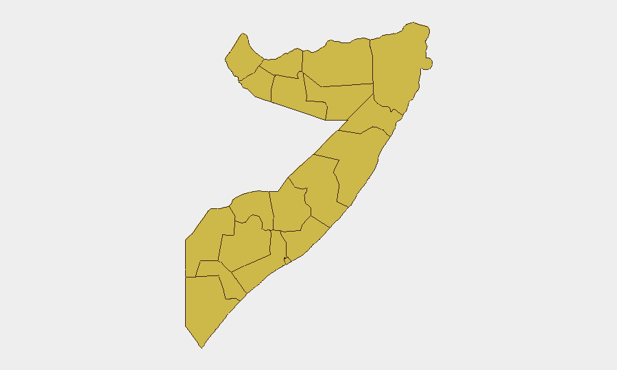
All twelve sub-national regions are ranked at identical composite risk (66.9), reflecting the nationwide diffusion of civil conflict, insurgency, and armed-group presence. Bari region (Puntland) is operationally the most volatile in this reporting window, with confirmed armed clashes, hotel attacks, and vehicle hijackings indicating active security deterioration in Bosaso and surrounding areas. Southern and central regions (Lower Shabelle, Middle Shebelle, Hiiraan, Bay, Bakool) remain chronically destabilised by Al-Shabaab presence and periodic clashes; northern regions (Awdal, Woqooyi Galbeed) face border tensions and resource competition. The identical ranking indicates systemic threat across all administrative boundaries rather than geographic clustering.
How GeoBit Would Assist
Security teams would employ AOI Monitoring & Early Warning on Mogadishu, Bosaso, and port zones to detect emerging clashes, maritime incidents, and infrastructure threats in near-real-time. Conflict & Military intelligence (force-structure tracking, armed-group positioning) combined with Network & Actor Analysis would map Puntland faction movements and Al-Shabaab operational zones. Routing & Network Analysis would provide alternative journey and supply-chain planning around fuel-price volatility hotspots and Bari region clashes, while Maritime & Aviation tracking would monitor vessel movements and Red Sea/Gulf of Aden shipping risk.
7-Day Outlook
Bari region clashes are likely to remain a focal point; Puntland's assertion of control may provoke further armed confrontations. Fuel-price pressure and Bakara Market disruption will amplify food-security and social-stability risks across urban centres. Maritime crime and Houthi-related shipping threats will persist, with no near-term de-escalation signalled.
Highest-Risk Areas — Ranked
| # | State / Region | Risk |
|---|---|---|
| 1 | Awdal | 66.9 |
| 2 | Woqooyi Galbeed | 66.9 |
| 3 | Gedo | 66.9 |
| 4 | Bakool | 66.9 |
| 5 | Bay | 66.9 |
| 6 | Middle Juba | 66.9 |
| 7 | Lower Shabelle | 66.9 |
| 8 | Sahil | 66.9 |
| 9 | Togdheer | 66.9 |
| 10 | Hiiraan | 66.9 |
| 11 | Middle Shebelle | 66.9 |
| 12 | Lower Juba | 66.9 |
Sources
Previous Daily Briefs
A new Somalia brief is written every day — each with its own risk map and downloadable CSV. Here's the last week; use the calendar to go further back.
📅 Browse every day by calendar →
Highlighted days have a brief. Tap a day for that day's map & analysis, or “csv” for that day's dataset ($5).
Atlas — our AI intelligence desk — emails them this snapshot personally. Nothing else, no list.