Situation Summary
Tonga remains a low-threat environment globally (rank #193, composite score 2) with no tracked security incidents this week. A magnitude-5.0 earthquake on 5 October caused no reported casualties or structural damage, and routine law-enforcement activity—drug and firearms arrests—reflects normal policing operations rather than systemic instability. The country's security trajectory remains stable, though Tongatapu continues to concentrate the largest share of measurable risk factors.
Key Developments
- Nukunuku, 15 October 2026: Tonga Police arrested and charged a 27-year-old male on suspicion of cannabis possession, cultivation, and possession of drug-processing equipment.
- ʻUtulau, 15 October 2026: Police arrested and charged a 34-year-old male for alleged unlicensed possession of firearms and ammunition.
- Tonga / Pacific Regional Policing, 14 October 2026: At the Pacific Islands Chiefs of Police conference held in the Commonwealth of the Northern Mariana Islands, Tonga formally endorsed the constitution of the Pacific Community of Policing (PACPOL), a new framework for inter-agency and regional police cooperation across the Pacific.
Highest-Risk Areas
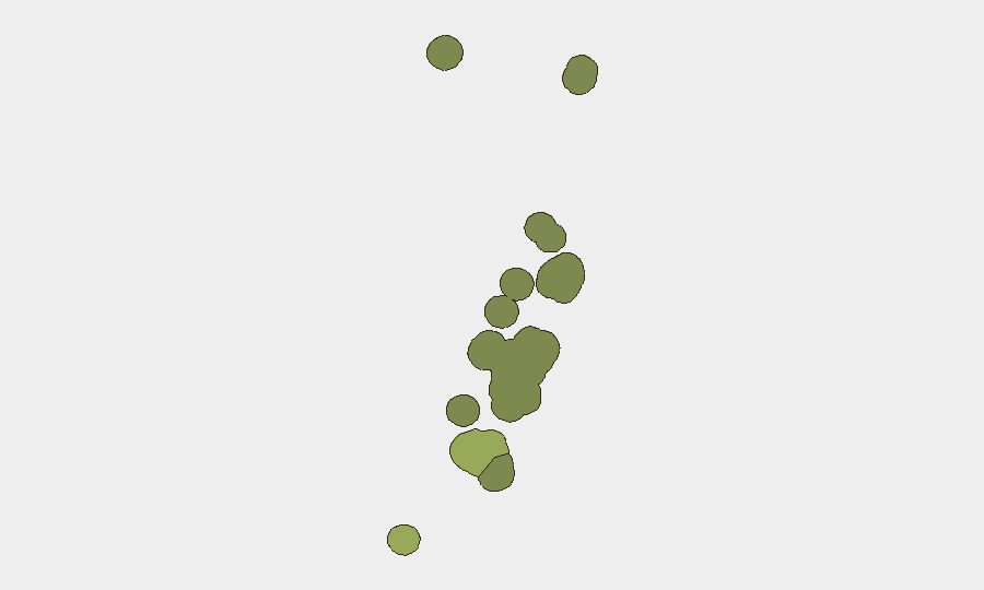
Tongatapu (risk score 45) accounts for the plurality of Tonga's measured risk and remains the operational center of government, commerce, and population density; elevated scores reflect typical urban-concentration factors rather than acute crisis indicators. Vavaʻu (28) and Haʻapai (22) follow at significantly lower scores, suggesting risk is heavily concentrated in the capital region. The outer islands—ʻEua (18) and Ongo Niua (12)—present minimal tracked risk. The absence of current security events across all regions indicates that sub-national risk rankings reflect structural and demographic factors rather than active conflict or instability.
How GeoBit Would Assist
Security teams monitoring personnel or assets in Tonga would deploy AOI Monitoring & Early Warning capabilities to watch Tongatapu and secondary islands for emerging civil unrest, infrastructure disruption, or natural hazards; OSINT and multi-language search to track local media, police announcements, and social sentiment across X/Twitter and Telegram; and Environmental & Health monitoring to integrate seismic, weather, and disease signals with security alerting, given the archipelago's exposure to earthquakes and cyclone risk. GIS & Spatial Analysis would support contingency route planning for personnel movement between islands and evacuation staging.
7-Day Outlook
No material escalation in security conditions is anticipated over the next seven days. Routine law-enforcement activity is likely to continue. Monitoring should remain calibrated to natural-hazard signals (seismic activity, tropical weather systems) and any shifts in regional policing coordination under the newly endorsed PACPOL framework, which may affect incident reporting visibility and inter-agency responsiveness in coming weeks.
Highest-Risk Areas — Ranked
| # | State / Region | Risk |
|---|---|---|
| 1 | Tongatapu | 45 |
| 2 | Vavaʻu | 28 |
| 3 | Haʻapai | 22 |
| 4 | ʻEua | 18 |
| 5 | Ongo Niua | 12 |
Sources
Previous Weekly Briefs
A new Tonga brief is written every Monday, covering the week — each with its own risk map and downloadable CSV. Use the calendar to go further back.
- October 12, 2026
- October 5, 2026
- September 28, 2026
- September 21, 2026
- September 14, 2026
- September 7, 2026
- August 31, 2026
📅 Browse past briefs by calendar →
Highlighted days have a brief. Tap a day for that day's map & analysis, or “csv” for that day's dataset ($5).
Atlas — our AI intelligence desk — emails them this snapshot personally. Nothing else, no list.