Situation Summary
Vietnam remains a relatively low-threat environment globally (rank #126, composite score 6) with no major security incidents, civil unrest, or political instability reported in the last 24–48 hours. Open media and social signals indicate routine crime, environmental response operations (forest fires in Quang Tri and Nghe An provinces in late July), and ongoing forensic/UXO-clearance work tied to a nationwide DNA campaign launched in June 2026. The security posture is stable, though localized property crime and persistent UXO hazards in non-urban areas remain baseline duty-of-care concerns.
Key Developments
- No major security incidents detected in last 24–48 hours. Cross-checked Vietnamese and international media, X/Twitter, and credible open sources show no new attacks, civil unrest, terrorism activity, or infrastructure failures within the 24–48 hour window.
- Quang Tri Province forest fire (late July 2026). Large coastal forest fire required multi-day firefighting response involving hundreds of personnel; operations concluded before August 1. Localized impact on nearby communities and transport; no ongoing acute threat indicated.
- Nghe An Province forest fires contained (late July 2026). Forest fires brought under control after two-day response effort. Temporary air quality and local infrastructure risk; situation resolved.
- Lam Dong Province / Da Lat tourism crime. Six suspects arrested for repeated theft of electrical equipment at Tuyen Lam National Tourist Area (late July). Reflects ongoing property crime risk targeting public utilities and tourist infrastructure in south-central Vietnam.
- Ho Chi Minh City forensic recovery operation (late July 2026). Search teams recovered 11 sets of human remains suspected to be war-dead from mass grave at Le Thi Rieng Park. Operation completed without associated violence or unrest.
- Nationwide DNA and remains-recovery campaign (ongoing since June 24, 2026). Over 1,300 remains recovered and tens of thousands of DNA samples collected across country; campaign explicitly continuing as of late July. Field work involves UXO-clearance operations, carrying localized hazard risk in non-urban areas.
Highest-Risk Areas
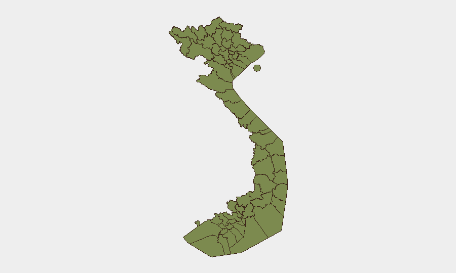
Hà Nội dominates Vietnam's sub-national risk profile (score 32.5), driven by political-administrative concentration, large-scale state operations (forensic campaign, security-force directives), and routine urban crime. Ho Chi Minh City ranks second (8.1), reflecting property crime and petty theft in crowded commercial and tourist districts. Northern border provinces (Lai Châu, Lào Cai, Hà Giang, Cao Bằng, Điện Biên, and others) each register uniform low scores (2.5), indicating baseline border-region and UXO-hazard concerns rather than active conflict or political instability.
How GeoBit Would Assist
Corporate security and risk teams should deploy GeoBit's Intel Sweep and multi-language OSINT fusion capabilities to monitor routine crime patterns, UXO-risk zones, and any sudden escalation in political or security messaging from Vietnamese authorities. AOI Monitoring & Early Warning on Hà Nội and Ho Chi Minh City, combined with X/Twitter and Telegram OSINT, enables real-time detection of civil unrest, labor action, or cyber incidents affecting operations or personnel. GIS & Spatial Analysis linked to Economic & Trade data supports route planning and supply-chain resilience around active forensic and UXO-clearance zones, reducing exposure to unplanned delays or localized hazards.
7-Day Outlook
No acute escalation is anticipated in the next seven days. Authorities' ongoing DNA campaign and security modernization directives will continue at current operational tempo. Standard monitoring for petty crime, localized environmental hazards (wet season weather), and routine administrative actions should remain in place; no elevation in national threat posture is expected unless major political or conflict signals emerge in social media or official channels.
Highest-Risk Areas — Ranked
| # | State / Region | Risk |
|---|---|---|
| 1 | Hà Nội | 32.5 |
| 2 | Ho Chi Minh City | 8.1 |
| 3 | Hải Phòng | 3.2 |
| 4 | Lai Châu Province | 2.5 |
| 5 | Lào Cai Province | 2.5 |
| 6 | Hà Giang Province | 2.5 |
| 7 | Tuyên Quang Province | 2.5 |
| 8 | Cao Bằng Province | 2.5 |
| 9 | Bắc Kạn Province | 2.5 |
| 10 | Điện Biên Province | 2.5 |
| 11 | Yên Bái Province | 2.5 |
| 12 | Sơn La Province | 2.5 |
Sources
Previous Daily Briefs
A new Vietnam brief is written every day — each with its own risk map and downloadable CSV. Here's the last week; use the calendar to go further back.
📅 Browse every day by calendar →
Highlighted days have a brief. Tap a day for that day's map & analysis, or “csv” for that day's dataset ($5).
Atlas — our AI intelligence desk — emails them this snapshot personally. Nothing else, no list.