Situation Summary
Saint Lucia remains a lower-tier global security risk (rank 171; composite threat score 6) with no confirmed tracked events in the past seven days. The island faces persistent urban crime concentration in Castries and Gros Islet, compounded by seasonal weather hazards. Overall trajectory is stable, though localized flooding from tropical systems presents recurring infrastructure disruption risk, particularly in Dennery and Cul de Sac.
Key Developments
No security events meeting the criteria for inclusion (occurrence within 14–20 October 2026) could be verified from available open sources. A fatal shooting incident in La Pointe, Dennery on 10 October resulting in one death and three injuries occurred outside the requested reporting window and is therefore not included in this week's development list. Web and social-media search coverage for Saint Lucia remained limited; no corroborating posts via X/Twitter or other platforms were recovered to support additional event identification.
Highest-Risk Areas
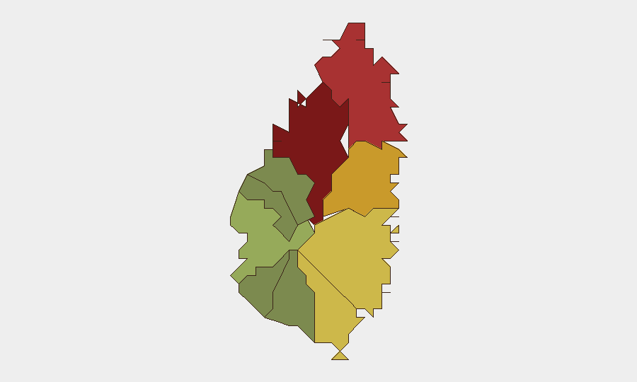
Castries (risk 95) and Gros Islet (risk 78) account for the majority of national security risk and should remain the primary focus of corporate security operations. Both districts are urban centers with documented histories of gang activity and street crime; Castries additionally serves as the capital and primary commercial hub, concentrating personnel and asset exposure. Dennery (risk 72) and Vieux Fort (risk 68) represent secondary risk zones, with Dennery notably vulnerable to both crime and weather-related disruption owing to its coastal geography and rainfall exposure. Southern and western parishes (Laborie, Choiseul, Anse La Raye) exhibit substantially lower risk profiles and are suitable for lower-vigilance posturing.
How GeoBit Would Assist
Corporate security teams operating in Saint Lucia should leverage GeoBit's AOI (Area of Interest) Monitoring & Early Warning capability to establish persistent watch over high-risk districts (Castries, Gros Islet, Dennery) with automated alerting on crime, civil unrest, or weather hazards. Intel Sweep and multi-language OSINT searches, combined with X/Twitter & Telegram OSINT, enable continuous horizon-scanning for emerging threats and incident validation that local reporting may not immediately surface. Environmental & Health monitoring and GIS & Spatial Analysis will track seasonal tropical weather patterns and flood risk in coastal and low-lying zones, supporting contingency planning and personnel routing adjustments.
7-Day Outlook
The absence of reported security incidents in the past week suggests a quiet operational window; however, limited open-source reporting on Saint Lucia reduces confidence in the completeness of this assessment. Tropical weather patterns remain the most foreseeable near-term hazard, with October–November representing peak rainfall season; organizations should maintain infrastructure and travel contingency plans. Continued monitoring of Castries and Gros Islet for crime-trend signals is advisable; any uptick in gang activity or violence in these zones would warrant elevated alerting protocols for personnel in those areas.
Highest-Risk Areas — Ranked
| # | State / Region | Risk |
|---|---|---|
| 1 | Castries | 95 |
| 2 | Gros Islet | 78 |
| 3 | Dennery | 72 |
| 4 | Vieux Fort | 68 |
| 5 | Micoud | 65 |
| 6 | Soufrière | 42 |
| 7 | Laborie | 38 |
| 8 | Choiseul | 35 |
| 9 | Anse La Raye | 28 |
| 10 | Canaries | 12 |
Sources
Previous Weekly Briefs
A new Saint Lucia brief is written every Monday, covering the week — each with its own risk map and downloadable CSV. Use the calendar to go further back.
- October 13, 2026
- October 6, 2026
- September 29, 2026
- September 22, 2026
- September 15, 2026
- September 9, 2026
- September 3, 2026
📅 Browse past briefs by calendar →
Highlighted days have a brief. Tap a day for that day's map & analysis, or “csv” for that day's dataset ($5).
Atlas — our AI intelligence desk — emails them this snapshot personally. Nothing else, no list.