Situation Summary
Bahrain faces an active, sustained threat environment following a wave of Iranian missile and drone attacks spanning late July into early August 2026. Multiple interception events by Bahrain Defence Force air defenses have prevented direct strikes on military and civilian targets, but incoming fire has damaged residential buildings and triggered kingdom-wide air-raid alerts. The conflict remains dynamic, with continued Iranian strikes reported as recently as August 1–2, elevated defensive readiness across all BDF units, and internal security measures (including citizenship revocation and speech restrictions) tightening in response to regional escalation.
Key Developments
- Multiple Iranian drone and missile strikes on Bahrain (kingdom-wide, including Manama, Sakhir, and Riffa areas) – pre-dawn Saturday, August 1, 2026. Bahrain's Foreign Ministry condemned several unmanned aerial vehicles and missiles targeting Bahraini territory; U.S. officials confirmed Iran launched a coordinated strike wave on both Bahrain and Kuwait the same night, elevating air-raid alert status and debris risk across populated zones.
- Residential building damage from Iranian attack (urban area, likely Manama vicinity) – late July / August 1–2 window. Bahrain's Interior Ministry confirmed a residential structure sustained damage in the latest Iranian strike, indicating civilian infrastructure is within the targeting pattern and not confined to military facilities.
- BDF interception and air-defense activation (multiple locations, including areas near Sheikh Isa Air Base and civilian neighborhoods) – ongoing through August 1–2. Bahrain Defence Force General Command announced repeated interception and destruction of Iranian aerial threats; the BDF remains at "highest levels of readiness and full defensive preparedness," with public advisories to avoid suspicious debris from intercepted munitions.
- Claimed Iranian strike on U.S. Navy assets at Sheikh Isa Air Base (Riffa, central Bahrain) – reported August 1–2, 2026. Iranian state media alleged successful targeting of Fifth Fleet facilities at the airbase; U.S. and Bahraini authorities have not independently confirmed the claim, but the allegation reflects sustained focus on major military infrastructure proximate to residential areas.
- Cabinet-level damage assessment and home-repair review (government offices, Manama) – within the last 48 hours. Bahrain's Cabinet committee initiated formal review of repair and financial assistance for properties damaged in recent Iranian attacks, indicating ongoing infrastructure recovery and potential disruption to local services and utilities.
- Renewed domestic security controls tied to Iran conflict (kingdom-wide) – August 1–2, 2026. Bahrain banned public mourning for Iran's Supreme Leader and stripped 69 individuals of citizenship for "glorifying" Iranian attacks, signaling tightened political-security enforcement and heightened protest/civil-unrest risk, particularly among Shia communities.
Highest-Risk Areas
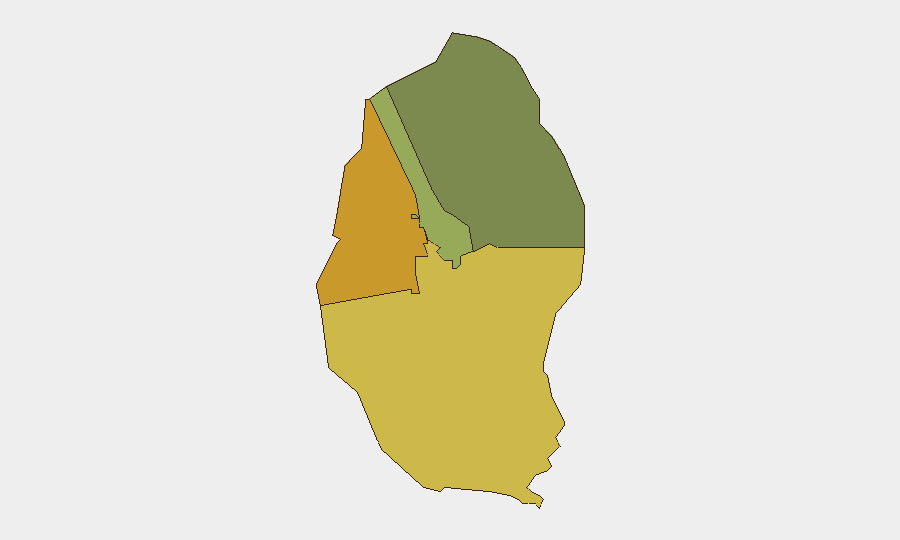
Northern Governorate (composite risk 72) and Southern Governorate (risk 68) are the primary drivers of sub-national threat elevation, likely reflecting proximity to maritime approaches for Iranian air and naval strike vectors, as well as concentration of critical military and energy infrastructure. Capital Governorate (risk 45), which encompasses Manama and includes Sheikh Isa Air Base and U.S. facilities in the Riffa district, remains elevated due to direct exposure to drone and missile attack patterns confirmed in the past 48 hours. Muharraq Governorate (risk 38), though lower-ranked, is not immune, given its position in central Bahrain and potential for debris or secondary effects from air-defense intercepts.
How GeoBit Would Assist
Teams should deploy AOI Monitoring & Early Warning on Sheikh Isa Air Base, U.S. facilities in Sakhir, and residential zones in Manama and Riffa to detect incoming strike alerts and coordinate movement restrictions in real time. Satellite & Imagery analysis of damage patterns and infrastructure repair activity will validate recovery timelines and identify neighborhoods with sustained service disruption. Conflict & Military force-structure and weapons-capability tracking, combined with OSINT fusion of Iranian state claims and U.S. CENTCOM posture, will clarify targeting intent and likelihood of follow-on strikes.
7-Day Outlook
Iranian strike activity is expected to continue at intervals matching the broader U.S.–Iran escalation cycle, with Bahrain remaining a priority target due to hosting U.S. Fifth Fleet assets. Air-defense interceptions will likely prevent mass casualties, but civilian infrastructure damage, service disruption, and internal security restrictions will persist. Travel within the Kingdom should anticipate periodic air-raid alerts, debris hazards, and potential localized road closures near military and critical facilities.
Highest-Risk Areas — Ranked
| # | State / Region | Risk |
|---|---|---|
| 1 | Northern Governorate | 72 |
| 2 | Southern Governorate | 68 |
| 3 | Capital Governorate | 45 |
| 4 | Muharraq Governorate | 38 |
Sources
Previous Daily Briefs
A new Bahrain brief is written every day — each with its own risk map and downloadable CSV. Here's the last week; use the calendar to go further back.
📅 Browse every day by calendar →
Highlighted days have a brief. Tap a day for that day's map & analysis, or “csv” for that day's dataset ($5).
Atlas — our AI intelligence desk — emails them this snapshot personally. Nothing else, no list.