Situation Summary
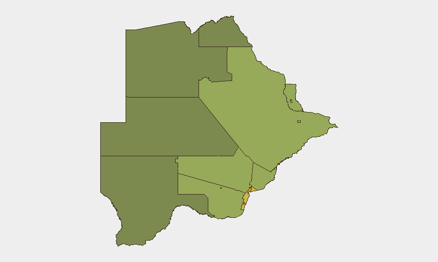
Botswana remains a low-threat environment with a composite threat score of 7 (ranked #151 globally) and no tracked discrete security events in the current assessment window. Urban centers—particularly Gaborone, South-East District, and Lobatse—carry elevated risk scores (65–72) reflecting crime, economic pressures, and population density, but no acute conflict, political instability, or organized violence has been reported. The security baseline remains stable with no indicators of imminent deterioration.
Key Developments
No discrete security, conflict, crime, political instability, or infrastructure events meeting multi-source corroboration thresholds were identified in the last 24–48 hours. Web and social-media research returned administrative and non-security items (military exercise announcements, school projects, embassy housing quotations) but no validated incident reporting. This absence of event signals is consistent with Botswana's sustained low-threat profile.
Highest-Risk Areas
Urban and mining-dependent regions drive the sub-national risk hierarchy. Gaborone (risk 72) and South-East District (68) represent the highest-risk zones, followed by the mining towns of Lobatse, Francistown, Jwaneng, and Selebi Phikwe (scores 61–65). Risk in these areas stems primarily from crime rates, unemployment, and economic volatility in the diamond and mineral sectors rather than political or conflict drivers. Rural and northern regions (North-West, Central, North-East districts) score substantially lower (38–45), indicating that risk concentrates in populated commercial hubs. Organizations with personnel or assets in Gaborone and the southeastern industrial corridor should maintain standard urban crime awareness and duty-of-care protocols.
How GeoBit Would Assist
Security teams monitoring Botswana operations can employ AOI Monitoring & Early Warning (persistent watch on Gaborone, mining towns, and border areas with alerting thresholds) to detect emerging incidents or shifts in crime or unrest before they impact operations. Intel Sweep and multi-language OSINT (including X/Twitter, Telegram, and local news aggregation) provide real-time situational awareness and early signals of labor disputes, economic crises, or cross-border activity that might elevate risk. Routing & Network Analysis enables security and logistics teams to identify safer travel corridors within high-risk urban areas and plan contingency movements if conditions deteriorate.
7-Day Outlook
No imminent escalation is anticipated. Botswana's institutional stability, low conflict risk, and absence of recent triggering events suggest the security environment will remain within normal parameters over the next week. Standard monitoring for urban crime, labor unrest in the mining sector, and border-region activity should continue; no heightened alert posture is warranted at this time.
Highest-Risk Areas — Ranked
| # | State / Region | Risk |
|---|---|---|
| 1 | Gaborone | 72 |
| 2 | South-East District | 68 |
| 3 | Lobatse | 65 |
| 4 | Francistown | 62 |
| 5 | Jwaneng | 61 |
| 6 | Selebi Phikwe | 58 |
| 7 | Southern District | 55 |
| 8 | Kgatleng District | 50 |
| 9 | Kweneng District | 48 |
| 10 | North-East District | 45 |
| 11 | Central District | 42 |
| 12 | North-West District | 38 |
Sources
Previous Daily Briefs
A new Botswana brief is written every day — each with its own risk map and downloadable CSV. Here's the last week; use the calendar to go further back.
- August 18, 2026
- August 16, 2026
- August 14, 2026
- August 12, 2026
- August 10, 2026
- August 8, 2026
- August 6, 2026
📅 Browse every day by calendar →
Highlighted days have a brief. Tap a day for that day's map & analysis, or “csv” for that day's dataset ($5).
Atlas — our AI intelligence desk — emails them this snapshot personally. Nothing else, no list.