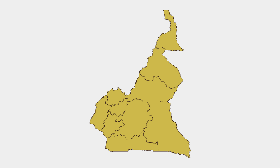
Situation Summary
Cameroon remains at composite threat level 22 globally (score 91) with uniform elevated risk across all ten administrative regions, indicating systemic rather than localized instability. The Anglophone crisis, inter-communal tensions, and organized crime continue to drive broad insecurity, though no major escalation was detected in the last 24–48 hours. Web-sourced incident reporting for the immediate period remains limited, suggesting either operational quiet or reporting gaps in available open sources. The security environment remains volatile but not acutely destabilized as of 9 July 2026.
Key Developments
- Limited incident corroboration (24–48h window). Available web and social media sources did not yield verified recent Cameroon incidents with specific location, time, or incident type. A 8 July 2026 Mimi Mefo Info Facebook post flagged as a news summary but contained no actionable incident detail in indexed snippets.
- Uniform regional risk profile. All ten regions—from Northwest and Southwest (Anglophone strongholds) through Far-North and Adamawa (Boko Haram-affected zones)—register identical composite risk scores of 63.6, indicating either synchronized threat drivers or analytical limitations in sub-regional differentiation as of this reporting cycle.
- Background: Anglophone unrest (ongoing since 2016). Northwest and Southwest regions continue to experience armed-group activity, kidnappings, and road-movement restrictions; no new escalation was reported in the last two days.
- Background: Far-North instability (ongoing since ~2012). Boko Haram and splinter groups conduct intermittent attacks, roadside incidents, and extortion in Adamawa and Far-North; no new incident confirmed in the last 48 hours.
- Background: Urban crime and organized criminal networks. Douala, Yaoundé, and Littoral region experience theft, armed robbery, and gang activity; no acute surge reported in the past day.
Highest-Risk Areas
All ten administrative regions carry identical composite risk scores (63.6), reflecting broad exposure rather than clear geographic differentiation. The Northwest, Southwest, and West cluster remains most operationally significant due to Anglophone separatist-group presence, roadblocks, and kidnapping risk; Adamawa and Far-North are elevated by Boko Haram activity and criminal banditry. The uniform scoring suggests either that GeoBit's regional model is converging on a "general Cameroon risk baseline" or that critical differentiation data (incident frequency, actor presence, or temporal trends) are not yet disaggregated in the current cycle. Security teams should treat all regions as requiring active monitoring and not assume lower-risk areas are genuinely safer.
How GeoBit Would Assist
Teams with personnel or assets in Cameroon should deploy Intel Sweep and AOI Monitoring & Early Warning on key facilities, transit routes, and personnel residences in Douala, Yaoundé, and Bamenda to capture real-time incident signals and protest activity. Multi-language OSINT fusion (French, English, Pidgin) on regional media, Telegram, and X will improve corroboration of open-source reporting and close current information gaps. Routing & Network Analysis can identify alternative mobility corridors if primary roads (e.g., Douala–Yaoundé highway, Northwest corridors) become interdicted by armed groups or checkpoints.
7-Day Outlook
No major escalation is forecast for the immediate week; however, the uniform regional risk profile and limited granular incident visibility indicate that emerging threats may not be rapidly detected through standard reporting channels. Teams should maintain heightened vigilance on staff movements, supply chains, and facility security posture, with contingency plans for rapid lockdown or evacuation if localized unrest occurs.
Highest-Risk Areas — Ranked
| # | State / Region | Risk |
|---|---|---|
| 1 | Northwest | 63.6 |
| 2 | Southwest | 63.6 |
| 3 | West | 63.6 |
| 4 | Littoral | 63.6 |
| 5 | Adamawa | 63.6 |
| 6 | Centre | 63.6 |
| 7 | South | 63.6 |
| 8 | Far-North | 63.6 |
| 9 | North | 63.6 |
| 10 | East | 63.6 |
Sources
Previous Daily Briefs
A new Cameroon brief is written every day — each with its own risk map and downloadable CSV. Here's the last week; use the calendar to go further back.
📅 Browse every day by calendar →
Highlighted days have a brief. Tap a day for that day's map & analysis, or “csv” for that day's dataset ($5).
Atlas — our AI intelligence desk — emails them this snapshot personally. Nothing else, no list.