Situation Summary
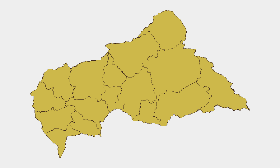
Central African Republic remains a complex operating environment with a composite threat score of 96 (global rank #23) and zero confirmed tracked events in the last 24–48 hours. Regional instability—particularly involving Congo, Rwanda, and external state actors—is generating diplomatic friction and military posturing that may create secondary effects for CAR's borders and commercial corridors. All 12 sub-national regions carry elevated and uniform risk profiles (67.3), indicating broad-based vulnerability across the country rather than localized hotspots.
Key Developments
No specific, multi-sourced security incidents within Central African Republic were confirmed for the 24–48 hour reporting window. Live web research identified no reliable corroboration of new armed clashes, civil unrest, infrastructure disruption, or travel impediments in CAR proper.
Regional context (last 48–72 hours) affecting CAR's threat environment:
- 2026-06-28 · Congo–Uzbekistan military engagement: Conventional military activity involving Congo signals potential for broader sub-regional instability and cross-border spillover into CAR's northern and eastern regions.
- 2026-06-27 · Congo–Rwanda diplomatic deterioration: Disapproval statements between Congo and Rwanda, coupled with similar DRC–Rwanda friction, indicate regional polarization that may draw CAR into competing spheres of influence or supply networks.
- 2026-06-26 · Domestic armed clash (location unspecified): Small-arms combat between Ukrainian national(s) and city mayor, plus a separate Central Bank incident, suggests localized law-enforcement or commercial security tension; geographic specificity unclear.
- 2026-06-26–28 · Banking sector stress: Administrative sanctions issued against unspecified bank(s) relative to CAR's Central Bank. May indicate financial instability, sanctions evasion scrutiny, or currency/remittance disruption.
Note: All events lack precise CAR location confirmation; several likely originate in neighboring Congo or DRC. Cross-border spillover monitoring is warranted.
Highest-Risk Areas
All 12 sub-national regions carry identical composite risk scores (67.3), indicating systemic rather than focal vulnerability. The eastern and northern prefectures—Bamingui-Bangoran, Vakaga, Haute-Kotto, Haut-Mbomou, and Mbomou—border or lie proximate to Congo and Sudan, amplifying exposure to refugee flows, armed group infiltration, and regional conflict contagion. Ouham, Ouham-Pendé, Nana-Mambéré, and Mambéré-Kadéï in the northwest carry similar risk weights, reflecting CAR's porous borders and limited state capacity for border security. The uniform risk distribution suggests that threat drivers—institutional fragility, non-state armed groups, and regional conflict—are nationwide rather than concentrated; duty-of-care protocols should not assume safer zones within CAR.
How GeoBit Would Assist
A security team managing personnel or assets in CAR should deploy AOI (Area-of-Interest) Monitoring & Early Warning on key operational locations and border regions to capture cross-border military or armed-group movement before escalation. Conflict & Military mapping and force-structure tracking would clarify which external actors (Congo, Rwanda, Sudan, Uganda proxies) pose direct or indirect risk to CAR operations. Network & Actor Analysis combined with OSINT fusion across Telegram, X, and radio SIGINT would detect emerging armed-group recruitment, supply-line disruption, or checkpoint establishment in real time—critical for Routing & Network Analysis and alternative journey planning around active threat nodes.
7-Day Outlook
Congo–Rwanda tensions and Uzbekistan military involvement in the sub-region are likely to generate diplomatic posturing and armed repositioning over 7–14 days rather than immediate CAR-wide escalation. However, any major conflict surge in Congo or Sudan would rapidly pressurize CAR's borders and humanitarian corridors. Security teams should assume current threat conditions (elevated, nationwide) will persist; significant downside risk exists if regional militaries mobilize or armed-group activity spikes.
Highest-Risk Areas — Ranked
| # | State / Region | Risk |
|---|---|---|
| 1 | Bamingui-Bangoran | 67.3 |
| 2 | Vakaga | 67.3 |
| 3 | Haute-Kotto | 67.3 |
| 4 | Haut-Mbomou | 67.3 |
| 5 | Mbomou | 67.3 |
| 6 | Nana-Mambéré | 67.3 |
| 7 | Ouham-Pendé | 67.3 |
| 8 | Mambéré-Kadéï | 67.3 |
| 9 | Sangha-Mbaéré | 67.3 |
| 10 | Ouham | 67.3 |
| 11 | Nana-Grébizi | 67.3 |
| 12 | Kémo | 67.3 |
Sources
Previous Daily Briefs
A new Central African Republic brief is written every day — each with its own risk map and downloadable CSV. Here's the last week; use the calendar to go further back.
📅 Browse every day by calendar →
Highlighted days have a brief. Tap a day for that day's map & analysis, or “csv” for that day's dataset ($5).