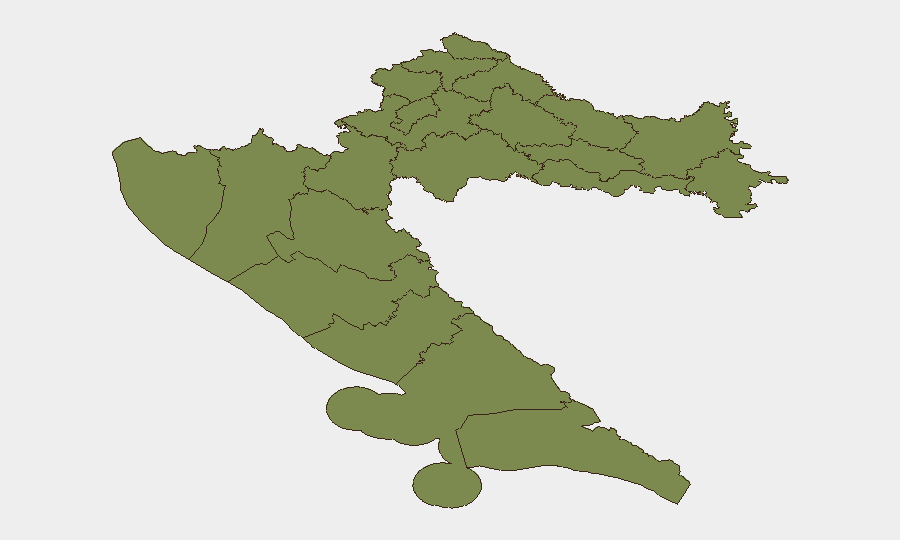
Situation Summary
Croatia remains a stable, low-threat environment with a composite national threat score of 14 and no active conflict, terrorism, or mass civil unrest. The past 24–48 hours have been marked by localized public-safety incidents—infrastructure accidents, water-safety fatalities, and enforcement actions—rather than security threats. Risk remains concentrated in Zagreb and Vukovar-Srijem County (both scoring 31.3), driven by historical factors and ongoing event activity, while most regional areas score below 1.5.
Key Developments
- Štinjan, Pula (Istria), 29 July ~14:00 local time: Roof collapse in an abandoned military bunker injured six foreign youths. Emergency services responded; incident classified as accidental infrastructure failure. Highlights localized safety risk from derelict military structures in coastal areas.
- Sava River near Zagreb, within last 48 hours: Police recovered bodies of three Egyptian nationals who drowned due to dangerous currents while swimming. Water-safety incident with no criminal element; underscores hazards for river swimmers and water-activity participants.
- Coastal zones, Croatia (last 7 days, enforcement ongoing): Maritime police recorded over 50 speeding violations by boats operating dangerously within 300 m of shore, issuing fines €400–€7,000. Indicates heightened enforcement and genuine maritime safety risks in popular tourist areas.
- Dubrovnik city area, within last 72 hours: Police seized three illegal e-scooters and fined 36 riders, including enforcement against underage riders. Reflects active micro-mobility policing in a major tourist destination; expect compliance expectations and substantial fines for violations.
- Eastern Croatia villages (exact locations unnamed), last 48–72 hours: Two new African swine fever outbreaks confirmed on pig farms; authorities expanded protection and surveillance zones, implementing movement controls on pigs and pork products. Agricultural-biosecurity issue; may affect rural logistics and impose veterinary checkpoints near affected holdings.
- Zagreb and Vukovar-Srijem County (ongoing): Both regions remain the nation's highest-risk areas, with composite scores of 31.3 driven by historical political tensions, minority-community dynamics, and event density. No acute crisis reported in the last 24–48 hours.
Highest-Risk Areas
Zagreb and Vukovar-Srijem County together drive national risk, each scoring 31.3. Both areas carry legacy tensions from the 1990s Balkans conflict and host ethnically diverse populations; Vukovar-Srijem, in particular, remains demographically Serb-majority and politically sensitive. While no violent incidents are reported in the current 24–48-hour window, the elevated risk scores reflect persistent underlying political fragmentation, minority-rights issues, and regular low-level civil-society activity. Dubrovnik-Neretva County (8.8) is notably elevated relative to most other regions, likely reflecting tourism density, enforcement activity, and coastal-zone complexity. All other counties score 1.3, indicating minimal acute threat.
How GeoBit Would Assist
A security team protecting personnel or assets in Croatia would employ Intel Sweep and global event feeds to monitor Zagreb and Vukovar-Srijem for emerging political activity or civil unrest; OSINT fusion and sentiment analysis on local media, social platforms, and Telegram channels to detect early signals of protests or community tension; AOI Monitoring & Early Warning on high-risk zones (especially Zagreb, coastal tourism centers, and eastern counties) to alert to sudden changes in event frequency or character; and Routing & Network Analysis to plan safe transit corridors avoiding areas of gathering or enforcement activity. These capabilities enable proactive duty-of-care monitoring without relying on delayed news feeds.
7-Day Outlook
No major escalation is anticipated in the near term. Water-safety, infrastructure-accident, and enforcement-action patterns will likely persist as seasonal and routine phenomena. Risk will remain below regional conflict thresholds, with Zagreb and Vukovar-Srijem maintaining elevated but stable scores absent fresh triggering events.
Highest-Risk Areas — Ranked
| # | State / Region | Risk |
|---|---|---|
| 1 | City of Zagreb | 31.3 |
| 2 | Vukovar-Srijem County | 31.3 |
| 3 | Dubrovnik-Neretva County | 8.8 |
| 4 | Krapina-Zagorje County | 1.3 |
| 5 | Međimurje County | 1.3 |
| 6 | Varaždin County | 1.3 |
| 7 | Koprivnica-Križevci County | 1.3 |
| 8 | Zagreb County | 1.3 |
| 9 | Karlovac County | 1.3 |
| 10 | Sisak-Moslavina County | 1.3 |
| 11 | Istria | 1.3 |
| 12 | Primorje-Gorski Kotar County | 1.3 |
Sources
Previous Daily Briefs
A new Croatia brief is written every day — each with its own risk map and downloadable CSV. Here's the last week; use the calendar to go further back.
📅 Browse every day by calendar →
Highlighted days have a brief. Tap a day for that day's map & analysis, or “csv” for that day's dataset ($5).
Atlas — our AI intelligence desk — emails them this snapshot personally. Nothing else, no list.