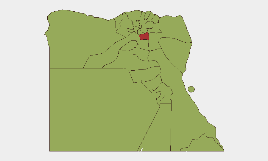
Situation Summary
Egypt remains a moderate-to-elevated security environment (Global Rank #24, composite threat score 71) with risk heavily concentrated in Cairo and the northeastern border regions. Current dynamics reflect Egypt's role as a critical regional mediator amid broader Middle East tensions, combined with elevated military posture along the Gaza border and intensified security enforcement in the southern frontier. The security picture is stable but reactive, with potential for rapid escalation if regional conflicts intensify or border incidents occur.
Key Developments
- Cairo – Regional mediation hub activity (27 July 2026). AP sources confirm Qatar and Pakistan-led mediation efforts, with Iranian and Omani involvement, are progressing in negotiations to restore a US–Iran ceasefire and manage Hormuz shipping access. While reflecting elevated geopolitical activity rather than direct violence on Egyptian soil, this signals Cairo's exposure to regional instability and potential for secondary effects on commercial and diplomatic operations.
- Gaza–Egypt border, Rafah area – Military reinforcement and policy stance (24–27 July 2026). Egypt has dispatched additional military reinforcements to its northern Sinai border near Rafah and formally rejected Israel's proposed humanitarian zone in Tel Al-Sultan, citing concerns over displaced-population mass movement and security risks. This signals elevated border military readiness and potential for new movement restrictions affecting humanitarian access, fuel transit, and personnel crossing.
- Egypt–Sudan border, southern frontier – Large-scale detention operation (current reporting cycle, operation ongoing). Egyptian security forces have detained 223 individuals (87 Egyptian nationals, 136 foreign nationals of unspecified origin) in a sweeping anti-smuggling and illegal mining operation. The scope and scale indicate heightened enforcement risk for any unauthorized cross-border movement, commercial activity, or personnel transit in southern governorates.
- National travel-risk advisory update (within 48 hours). Australian Smartraveller and comparable advisories maintain "high degree of caution" recommendations for Egypt overall, citing terrorism threat and unpredictable regional military developments that could trigger sudden transit disruptions. Advisories note risk levels may escalate at short notice if regional conditions deteriorate.
- Regional military and political statements (25–27 July 2026). Military, scientific, and diplomatic figures across Egypt have issued public statements and rejection statements; these correlate with broader regional tensions (Israel–Africa relations, West Bank settler violence, Egypt–Libya military dynamics, Egypt–Iran military relations) and suggest domestic institutional attention to border and alliance issues.
Highest-Risk Areas
Cairo dominates sub-national risk (79.6), driven by its role as the political and diplomatic capital exposed to regional shocks, protest activity, and security-force operations. The northeast border zone—Ad Dakahliya (54.8), Alexandria (54.2), North Sinai (50.2), and Giza (50.2)—reflects Gaza-border military presence, smuggling routes, and residual militant activity since 2013. Southern and Red Sea governorates (Qena, South Sinai, Red Sea, Matruh, and others at 49.6) indicate enforcement risk and maritime/border security concerns. Risk clustering in border and urban-capital zones is typical of Egypt's profile; provincial interiors remain lower-risk.
How GeoBit Would Assist
Teams should deploy AOI Monitoring & Early Warning on Cairo (diplomatic district), Rafah border crossing, and southern Sudan frontier to detect movement shifts or incident escalation. OSINT fusion across X/Twitter, Telegram, and Arabic-language news would track military-posture changes, detention announcements, and border-closure signals in real time. Routing & Network Analysis and satellite imagery would enable alternative-route planning for Egypt transit and border-crossing contingency if Rafah or southern crossings face sudden closure.
7-Day Outlook
Mediation activity and military posturing are likely to continue without immediate escalation. However, any deterioration in US–Iran negotiations or a major Gaza-border incident could trigger rapid Egyptian policy shifts, border closures, or mass-casualty events affecting Cairo and the northeast. Risk elevation is probable if regional conflict intensity increases; teams should monitor diplomatic statements and cross-border incident rates as leading indicators.
Highest-Risk Areas — Ranked
| # | State / Region | Risk |
|---|---|---|
| 1 | Cairo | 79.6 |
| 2 | Ad Dakahliya | 54.8 |
| 3 | Alexandria | 54.2 |
| 4 | North Sinai | 50.2 |
| 5 | Giza | 50.2 |
| 6 | Qena | 49.6 |
| 7 | South Sinai | 49.6 |
| 8 | Red Sea | 49.6 |
| 9 | Halaib Triangle | 49.6 |
| 10 | Matruh | 49.6 |
| 11 | Kafr El Sheikh | 49.6 |
| 12 | The Lake | 49.6 |
Sources
Previous Daily Briefs
A new Egypt brief is written every day — each with its own risk map and downloadable CSV. Here's the last week; use the calendar to go further back.
📅 Browse every day by calendar →
Highlighted days have a brief. Tap a day for that day's map & analysis, or “csv” for that day's dataset ($5).
Atlas — our AI intelligence desk — emails them this snapshot personally. Nothing else, no list.