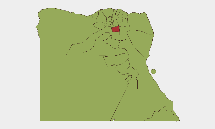
Situation Summary
Egypt's composite threat score of 67 reflects a security environment that remains relatively stable in major urban centers but faces persistent terrorism risk in border and desert regions, particularly North Sinai. Over the past 24–48 hours, no large-scale terrorist attacks or civil unrest have been publicly reported; however, intensified law-enforcement and counter-smuggling operations—especially along the Sudan border and in southern criminal hubs—signal elevated security activity. Regional tensions tied to the broader US–Iran conflict continue to elevate background terrorism risk, particularly around critical infrastructure in Cairo and other major cities.
Key Developments
- Kerdasa, Giza (28 July 2026): A misdemeanor court sentenced a 35-year-old man to three years in prison after he injured six people during a confrontation over an Israeli flag sticker on his vehicle. The incident underscores heightened social and political sensitivity around Israel-related symbols in urban areas.
- Egypt–Sudan border region (late July, ongoing): Egyptian security forces detained hundreds of people—87 Egyptians and 136 foreign nationals—in a sweeping operation targeting illegal gold mining and smuggling. This indicates elevated detention and enforcement risk for travelers and workers near border areas and mining zones.
- Nationwide counter-narcotics operations (reported 28 July 2026): Border guard forces, in coordination with other armed branches, announced seizure of drugs and weapons valued at EGP 40 billion and arrested 223 suspects in criminal hubs, primarily in southern regions. Operations signal increased checkpoints, raids, and movement controls across vulnerable areas.
- Northern Sinai travel advisories (reconfirmed late July 2026): Canada and Australia maintain "avoid all travel" warnings for North Sinai, the Egypt–Israel border (except Taba), and Western Desert zones. Advisories cite persistent terrorist activity, armed-group presence, military operations, and a 5 p.m.–7 a.m. curfew in parts of the governorate.
- Egypt–Gaza border militarization (reported late July 2026): Egypt is constructing new military facilities and towers near the Rafah border to support potential international stabilization efforts while quietly increasing humanitarian flows. This reflects ongoing militarization, restricted access, and potential for sudden movement restrictions.
- Political climate assessment (late July 2026): German foreign ministry notes political tensions remain "tense but stable," with a background risk of terrorist attacks linked to US–Iran conflict escalation and potential for sudden security deterioration.
Highest-Risk Areas
Cairo (76.8) drives the national risk score, reflecting its status as the capital, primary economic hub, and historic target for terrorism. Ad Dakahliya (55), Alexandria (53.2), Giza (47.7), and the Sinai Peninsula (North Sinai, South Sinai, both 47.7) follow. North Sinai's risk is rooted in active terrorist presence, military operations, and curfews; the Egypt–Sudan border zones are elevated due to smuggling, illegal mining, and enforcement intensity; and Cairo and major urban centers face diffuse terrorism risk despite relative stability. Western Desert border regions (Matruh, 46.8) remain vulnerable to smuggling and cross-border militant activity.
How GeoBit Would Assist
Security teams would use OSINT Fusion & Corroboration to monitor real-time law-enforcement and border operations, cross-checking official announcements with social media and local reporting. AOI Monitoring & Early Warning with persistent watch on Cairo, North Sinai, and the Sudan border would alert to sudden escalations, military mobilizations, or detention sweeps. Conflict & Military tracking combined with Routing & Network Analysis would enable identification of alternative travel routes and safe corridors around active enforcement zones and curfewed areas.
7-Day Outlook
No imminent large-scale security event is indicated, but the intensified border and counter-smuggling operations suggest continued enforcement activity and checkpoint density over the next week. Regional US–Iran tensions and political sensitivities will sustain a baseline terrorism threat, particularly around critical infrastructure and public gatherings. North Sinai and border areas remain high-consequence zones; Cairo and major cities require standard vigilance protocols but are not under acute threat.
Highest-Risk Areas — Ranked
| # | State / Region | Risk |
|---|---|---|
| 1 | Cairo | 76.8 |
| 2 | Ad Dakahliya | 55 |
| 3 | Alexandria | 53.2 |
| 4 | North Sinai | 47.7 |
| 5 | Giza | 47.7 |
| 6 | Qena | 46.8 |
| 7 | South Sinai | 46.8 |
| 8 | Red Sea | 46.8 |
| 9 | Halaib Triangle | 46.8 |
| 10 | Matruh | 46.8 |
| 11 | Kafr El Sheikh | 46.8 |
| 12 | The Lake | 46.8 |
Sources
Previous Daily Briefs
A new Egypt brief is written every day — each with its own risk map and downloadable CSV. Here's the last week; use the calendar to go further back.
📅 Browse every day by calendar →
Highlighted days have a brief. Tap a day for that day's map & analysis, or “csv” for that day's dataset ($5).
Atlas — our AI intelligence desk — emails them this snapshot personally. Nothing else, no list.