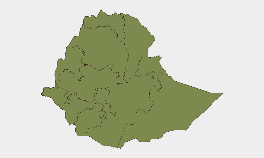
Situation Summary
Ethiopia remains a moderate-risk operating environment (global rank #50) with composite threat score 44 across 33 tracked events. Amhara Region dominates the risk profile at 2.6× the national average, driven by ongoing civil-security tensions and administrative disputes; Central Ethiopia follows at significantly lower risk (19). Recent signal activity—including public statements by government officials, population rejection events, and cross-border demands toward Somalia—suggests elevated political friction rather than imminent large-scale instability. Concurrent natural hazards (seismic activity near Awash, wildfire, and reported Marburg virus disease cases) compound operational complexity in select zones.
Key Developments
- 2026-07-09 · Demand event · Ethiopia–Somalia border: Ethiopia issued formal demand toward Somalia; context and specifics require urgent clarification via OSINT to assess border-security implications for expatriate and asset presence in border regions.
- 2026-07-07–08 · Multiple public statements · Government and PM-level activity: Statements by Prime Minister and Deputy officials, alongside anti-government demonstration in Addis Ababa (2026-07-07), signal high-level political messaging; no violence reported but tone warrants monitoring for escalation.
- 2026-07-08 · Population rejection event: Unspecified mass-rejection activity indicates public dissent; geographic and sectoral scope require clarification to assess impact on businesses and personnel.
- Recent · Marburg virus disease outbreak · Ethiopia (unspecified locations): Confirmed case(s) of high-fatality viral disease; public-health protocols and travel restrictions may affect operations; containment status unknown.
- Recent · M 4.4 seismic event · 9 km ESE of Awash: Moderate earthquake in geologically active zone; no immediate tsunami or secondary-hazard risk but highlights infrastructure vulnerability in transport and energy corridors.
- Recent · Wildfire · Ethiopia (unspecified extent): Active fire event(s); potential impact on air quality, transportation, and supply chains depending on location and containment trajectory.
Highest-Risk Areas
Amhara Region's elevated risk (32.6) reflects unresolved civil-administrative governance disputes and historical communal tensions that resurface periodically; organizations with personnel or logistics operations in Amhara (including in or transiting to/from the region) face elevated background risk of protest, roadblocks, or administrative interference. Central Ethiopia Regional State (risk 19) ranks second but at substantially lower severity, suggesting localized friction rather than widespread instability. All other tracked regions cluster at 2.6, indicating either effective containment, lower population density, or fewer current trigger events; however, Addis Ababa's presence in this group should not be read as zero-risk—capital cities remain vulnerable to political demonstrations and cross-border policy shocks (e.g., Somalia tensions).
How GeoBit Would Assist
Corporate security and duty-of-care teams should deploy Intel Sweep and global event feeds to establish real-time baseline on the Ethiopia–Somalia demand and political statements; multi-language OSINT and X/Twitter/Telegram monitoring will clarify population-rejection scope and sectoral impact. AOI Monitoring & Early Warning on Amhara Region, Addis Ababa, and border zones provides persistent alerting; GIS & spatial analysis combined with satellite imagery can track wildfire extent and seismic aftershock zones. Conflict & military force-structure tracking and regime-stability assessment will contextualize government messaging and prevent miscalibration of threat level.
7-Day Outlook
Political friction is likely to persist or intensify modestly as government–opposition communication cycles continue; no near-term armed-conflict escalation is signaled. Natural hazards (Marburg, seismic aftershocks, wildfire) will remain localized but may disrupt transport and healthcare. Organizations should expect 5–10 days of elevated administrative scrutiny and possible communication campaigns affecting operations in Amhara and Addis Ababa; routine security protocols remain adequate if actively maintained.
Highest-Risk Areas — Ranked
| # | State / Region | Risk |
|---|---|---|
| 1 | Amhara Region | 32.6 |
| 2 | Central Ethiopia Regional State | 19 |
| 3 | Tigray | 2.6 |
| 4 | Afar Region | 2.6 |
| 5 | Benishangul-Gumuz Region | 2.6 |
| 6 | Somali Region | 2.6 |
| 7 | Gambela Region | 2.6 |
| 8 | South West Ethiopia Peoples | 2.6 |
| 9 | Addis Ababa | 2.6 |
| 10 | South Ethiopia Regional State | 2.6 |
| 11 | Oromia Region | 2.6 |
| 12 | Sidama | 2.6 |
Previous Daily Briefs
A new Ethiopia brief is written every day — each with its own risk map and downloadable CSV. Here's the last week; use the calendar to go further back.
📅 Browse every day by calendar →
Highlighted days have a brief. Tap a day for that day's map & analysis, or “csv” for that day's dataset ($5).
Atlas — our AI intelligence desk — emails them this snapshot personally. Nothing else, no list.