Situation Summary
Ghana faces a complex near-term security environment marked by localized civil unrest, active transnational border threats, and organized cybercrime. While the country ranks #102 globally (composite threat score 9), risk is highly concentrated in Greater Accra Region and Northern border zones, with recent police-involved fatalities and diplomatic tension adding volatility. The security picture shows no immediate systemic collapse but reflects friction points across law enforcement, inter-party violence, and transnational criminal activity that require sustained monitoring.
Key Developments
- Sefwi Sayerano, Western North Region (11–12 July): Police shootings during a resident confrontation killed at least three people; protesters burned two police posts and blocked roads in response. Ghana Police Service interdicted eight officers and initiated an active investigation; authorities report the situation is now under control.
- Bantama Constituency, Kumasi, Ashanti Region (11 July): Violence disrupted NPP constituency executive elections, resulting in three detentions and at least one injury. Electoral authorities announced a re-run of the Bantama elections.
- Accra–Pretoria Diplomatic Channel (up to 12 July): Ghana postponed and rejected bilateral engagements and a proposed South African state visit in response to anti-migrant violence against Ghanaian nationals in South Africa, elevating expatriate-safety concerns and diplomatic strain.
- Ghana Cyber Security Authority, National (11–12 July): Authorities identified multiple locations involved in suspected social-engineering and digital fraud operations, indicating organized cybercrime targeting public and financial systems.
- Tema Station Market & Adabraka Polyclinic, Greater Accra (10–11 July): Ghana Health Service conducted disinfection operations as part of post-flood cleanup; localized disruption expected to ease as operations conclude.
- Northern Border Regions (advisory current as of 8 July, ongoing): Travel advisories against border zones with Burkina Faso, Togo, and Côte d'Ivoire remain in effect, particularly around Bawku, Garu, Zebilla, Tempane, Nalerigu, and Walewale, due to Bawku conflict–related violent clashes.
Highest-Risk Areas
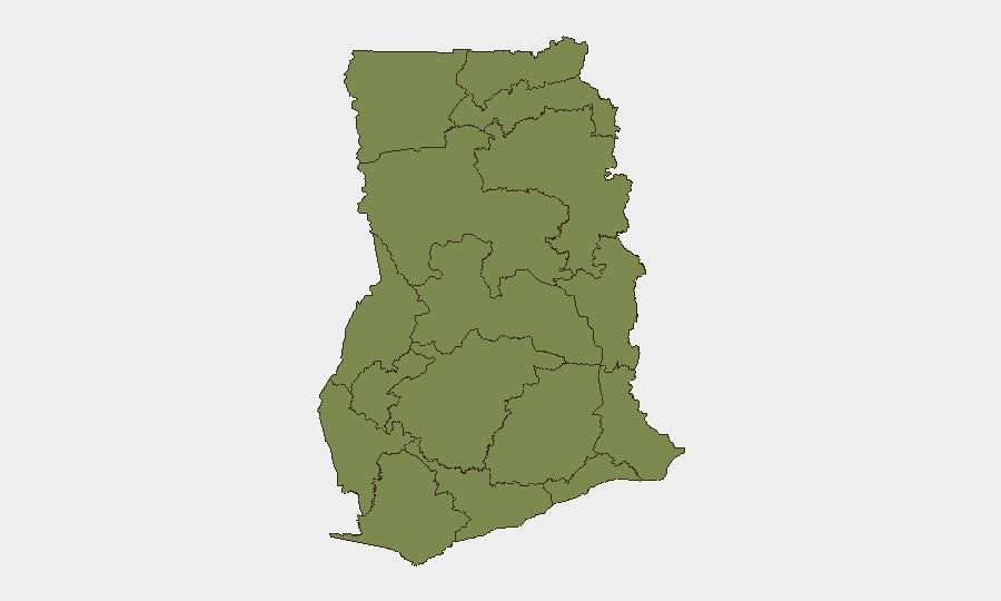
Greater Accra Region (risk 32.4) dominates Ghana's threat profile, reflecting concentration of diplomatic incidents, cybercrime operations, and post-flood infrastructure vulnerability in the capital. Bono East Region (19.0) and Northern Region (15.7) follow, driven by organized crime networks, border instability linked to the Bawku conflict, and spillover from Burkina Faso–linked security pressures. Western Region (4.0) has seen recent civil unrest but remains lower-risk; remaining regions cluster at baseline (2.4), indicating a three-tier risk structure anchored in the capital and northern corridor.
How GeoBit Would Assist
Security teams monitoring Ghana would employ OSINT fusion and entity extraction across social media and local sources to track emerging unrest signals ahead of incidents like Sefwi Sayerano or Bantama; AOI monitoring and early-warning capabilities for persistent watch on Greater Accra, Bono East, and Northern border regions; and alternative route and network analysis for staff mobility planning in high-risk zones. Cyber threat and cybercrime actor tracking would provide early visibility into organized fraud networks ahead of financial-sector impact.
7-Day Outlook
The immediate 7-day period is likely to see continued police investigation and possible charges in the Sefwi Sayerano incident, with some risk of secondary protests or civil-society backlash. Northern border zones will remain volatile; diplomatic tension with South Africa may persist, affecting Ghanaian expatriate communities. No systemic national instability is indicated, but localized flash points and organized cybercrime demand active monitoring.
Highest-Risk Areas — Ranked
| # | State / Region | Risk |
|---|---|---|
| 1 | Greater Accra Region | 32.4 |
| 2 | Bono East Region | 19 |
| 3 | Northern Region | 15.7 |
| 4 | Western Region | 4 |
| 5 | Upper East Region | 2.4 |
| 6 | Upper West Region | 2.4 |
| 7 | Savannah Region | 2.4 |
| 8 | North East Region | 2.4 |
| 9 | Eastern Region | 2.4 |
| 10 | Oti Region | 2.4 |
| 11 | Volta Region | 2.4 |
| 12 | Bono Region | 2.4 |
Sources
Previous Daily Briefs
A new Ghana brief is written every day — each with its own risk map and downloadable CSV. Here's the last week; use the calendar to go further back.
📅 Browse every day by calendar →
Highlighted days have a brief. Tap a day for that day's map & analysis, or “csv” for that day's dataset ($5).
Atlas — our AI intelligence desk — emails them this snapshot personally. Nothing else, no list.