Situation Summary
Greece faces an acute crisis driven by concurrent wildfires, industrial incidents, and emergency response strain across multiple regions on 30 July 2026. At least five major fires—including a metal-recycling explosion in Aspropyrgos (Attica) injuring 11 people and a large industrial fire in Thessaloniki generating a 20 km toxic smoke plume—have triggered state-of-emergency declarations and overwhelmed civil protection resources. An F-16 emergency landing at Zakynthos and a violent assault incident in Crete add secondary security dimensions, though the fire-and-explosion cluster represents the primary immediate threat to personnel safety, air quality, and business continuity.
Key Developments
- Aspropyrgos, Attica (30 July): Major fire and explosion at a metal recycling facility injured at least 11 people; 3 remain intubated in critical condition. Significant disruption to surrounding industrial zone; emergency services deployed for extended response.
- Thessaloniki industrial area near Kalochori (30 July): Large factory/warehouse fire produced toxic smoke cloud extending ~20 km, prompting civil protection warnings and air quality alerts across the region.
- Oraiokastro & Pavlos Melas municipalities, Thessaloniki region (30 July): State of emergency declared due to active wildfire with smoke affecting populated areas; civil protection services remain mobilized.
- Sismanogleio General Hospital, Marousi, Athens (30 July): Fire incident triggered precautionary evacuation of facility sections; temporary operational disruption while safety checks and smoke clearance conducted.
- Argyromylos, Larisa (Central Greece) (30 July): Expanding wildfire led authorities to deploy seven aerial firefighting assets and reinforce ground crews to protect nearby settlements and infrastructure.
- Kilkis regional unit (Northern Greece) (30 July): Brush fire prompted helicopter deployment and additional firefighting units; civil protection issued local smoke and spread advisories.
- Zakynthos Airport (30 July): Hellenic Air Force F-16 conducted emergency landing during training exercise; aircraft unharmed, pilot safe, but airport temporarily closed for technical inspections and runway safety checks.
- Malia, Crete (30 July): German tourist reported violent assault in nightclub; three arrests made by local police. Case attracting national media attention.
Highest-Risk Areas
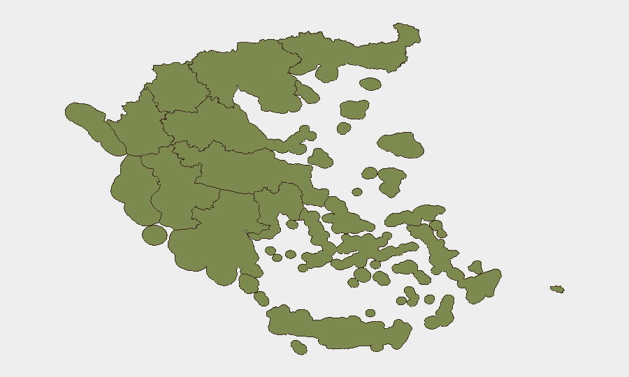
Crete (31.3) and Thessaly (26.4) dominate the sub-national ranking, reflecting persistent wildfire activity, industrial incident clustering, and response capacity constraints. The 30 July fire surge has concentrated acute risk in Attica (16) due to the Aspropyrgos industrial explosion and hospital fire, and in Thessaloniki-adjacent zones within Central Macedonia (11.9). Peloponnese Region (20.9) shows elevated baseline risk likely tied to seasonal fire conditions. Regions with lower risk scores (South Aegean, Eastern Macedonia and Thrace, Western Greece, Epirus, Western Macedonia) remain relatively stable but should be monitored for secondary cascading effects (air quality, supply-chain disruption).
How GeoBit Would Assist
Security teams should deploy AOI Monitoring & Early Warning capabilities on Crete, Thessaly, Attica, and Central Macedonia to detect fire ignition and fire-service mobilization signals in real time. Environmental & Health intelligence (air quality, toxic plume tracking, hospital resource status) combined with multi-language OSINT (local media, Telegram emergency channels, X updates) provides situational awareness of smoke impact and evacuation zones. Routing & Network Analysis enables rapid identification of alternate supply-chain and personnel-transit corridors around affected industrial zones and roadways.
7-Day Outlook
Continued hot, dry conditions and wind patterns will sustain wildfire risk across Crete and Thessaly through early August; industrial fire incidents may recur if hazardous-goods facilities remain under stress or poorly secured. Airport and hospital disruptions are likely to resolve within 48–72 hours pending technical clearance and smoke dissipation, but tourism and supply-chain disruptions may persist. Monitoring for secondary incidents (infrastructure damage, power outages, water disruption) and civil unrest around emergency response coordination is warranted.
Highest-Risk Areas — Ranked
| # | State / Region | Risk |
|---|---|---|
| 1 | Crete | 31.3 |
| 2 | Thessaly | 26.4 |
| 3 | Peloponnese Region | 20.9 |
| 4 | Attica | 16 |
| 5 | Central Macedonia | 11.9 |
| 6 | Northern Aegean | 11.4 |
| 7 | Ioanian Islands | 9.9 |
| 8 | South Aegean | 4.7 |
| 9 | Eastern Macedonia and Thrace | 2.1 |
| 10 | Western Greece | 1.5 |
| 11 | Epirus | 1.5 |
| 12 | Western Macedonia | 1.3 |
Sources
Previous Daily Briefs
A new Greece brief is written every day — each with its own risk map and downloadable CSV. Here's the last week; use the calendar to go further back.
📅 Browse every day by calendar →
Highlighted days have a brief. Tap a day for that day's map & analysis, or “csv” for that day's dataset ($5).
Atlas — our AI intelligence desk — emails them this snapshot personally. Nothing else, no list.